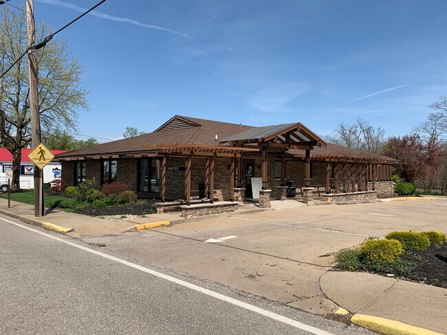
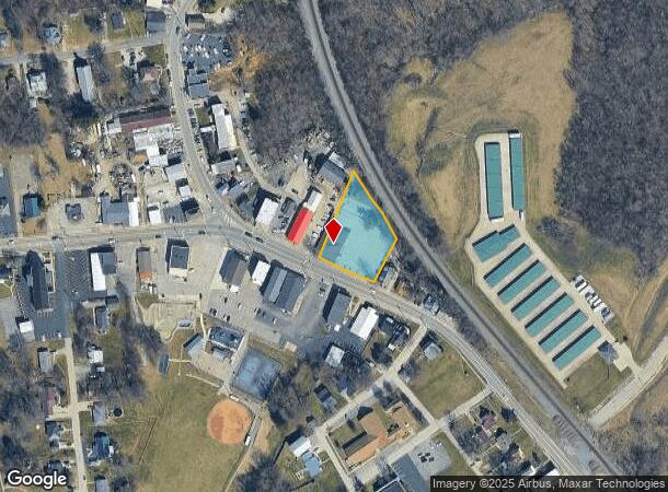
Property Record
19 S Main St, Dry Ridge, KY 41035
NEARBY LISTINGS FOR SALE OR LEASE
Property Detail
19 S Main St
046-01-00-161.00
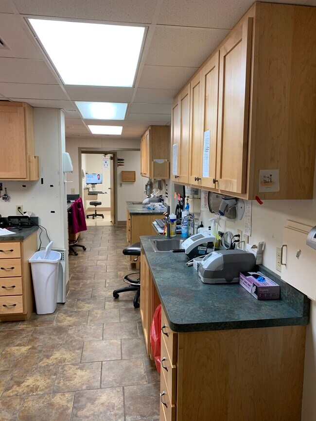
DENTIST OFFICE & 0.8087 AC
Medicalclinic
Grant
X
Kentucky
21191C0125E
0.81 AC
2025
Grant County
2025
Cincinnati/Dayton
920202
Cincinnati, OH-KY-IN
1,760 SF
DEMOGRAPHICS near 19 S Main St
1 Mile
3 Mile
5 Mile
2024 Total Population
1,613
6,831
12,579
2029 Population
1,693
7,256
13,391
Pop Growth 2024-2029
+ 4.96%
+ 6.22%
+ 6.46%
Average Age
36
38
38
2024 Total Households
605
2,511
4,503
HH Growth 2024-2029
+ 5.12%
+ 6.17%
+ 6.48%
Median Household Inc
$28,947
$57,642
$59,696
Avg Household Size
2.60
2.70
2.70
2024 Avg HH Vehicles
2.00
2.00
2.00
Median Home Value
$149,650
$179,277
$174,242
Median Year Built
1981
1986
1987
Nearby Places
Map Layers
Map Styles
 Street
 Aerial
- Restaurants
- Banks
- Shops
- Fitness
- Groceries
PUBLIC TRANSPORTATION
AIRPORT
Cincinnati/Northern Kentucky International
DRIVE
WALK
Distance
Cincinnati/Northern Kentucky International
39 min
28.3 mi
Freight Ports
Port of Toledo
DRIVE
WALK
Distance
Port of Toledo
281 min
240.4 mi
SALE & LEASE HISTORY
LISTING DATE
SALE/LEASE

Aug 26, 2021
For Sale
Apr 13, 2021
For Lease
Nearby Properties
Address
Land Use
TOTAL SIZE
Lot Size
Zoning
Address
Land Use
TOTAL SIZE
Lot Size
Zoning
321,300 SF
28.87 AC
Address
Land Use
TOTAL SIZE
Lot Size
Zoning
154,743 SF
16.19 AC
COM
Address
Land Use
TOTAL SIZE
Lot Size
Zoning
Address
Land Use
TOTAL SIZE
Lot Size
Zoning
29,364 SF
9.94 AC
Address
Land Use
TOTAL SIZE
Lot Size
Zoning
2,400 SF
0.70 AC
COM
Address
Land Use
TOTAL SIZE
Lot Size
Zoning
Address
Land Use
TOTAL SIZE
Lot Size
Zoning
7.62 AC
Address
Land Use
TOTAL SIZE
Lot Size
Zoning
31.95 AC
Address
Land Use
TOTAL SIZE
Lot Size
Zoning
39,548 SF
1.29 AC
COM
Address
Land Use
TOTAL SIZE
Lot Size
Zoning
10.81 AC
Address
Land Use
TOTAL SIZE
Lot Size
Zoning
21,420 SF
4.83 AC
Address
Land Use
TOTAL SIZE
Lot Size
Zoning
3,350 SF
1 AC
COM
Address
Land Use
TOTAL SIZE
Lot Size
Zoning
6,272 SF
5.75 AC
Address
Land Use
TOTAL SIZE
Lot Size
Zoning
Address
Land Use
TOTAL SIZE
Lot Size
Zoning
4,230 SF
0.84 AC
COM
Address
Land Use
TOTAL SIZE
Lot Size
Zoning
35,685 SF
1.32 AC
COM
Address
Land Use
TOTAL SIZE
Lot Size
Zoning
14,142 SF
3 AC
Address
Land Use
TOTAL SIZE
Lot Size
Zoning
5,100 SF
0.85 AC
Address
Land Use
TOTAL SIZE
Lot Size
Zoning
15.35 AC
Address
Land Use
TOTAL SIZE
Lot Size
Zoning
16,545 SF
3.34 AC
Address
Land Use
TOTAL SIZE
Lot Size
Zoning
33.67 AC
Address
Land Use
TOTAL SIZE
Lot Size
Zoning
22,152 SF
1.13 AC
COM
Address
Land Use
TOTAL SIZE
Lot Size
Zoning
38 AC
Address
Land Use
TOTAL SIZE
Lot Size
Zoning
127,735 SF
11.10 AC
Address
Land Use
TOTAL SIZE
Lot Size
Zoning
Address
Land Use
TOTAL SIZE
Lot Size
Zoning
11.20 AC
Address
Land Use
TOTAL SIZE
Lot Size
Zoning
1.40 AC
Address
Land Use
TOTAL SIZE
Lot Size
Zoning
1.43 AC
Address
Land Use
TOTAL SIZE
Lot Size
Zoning
5,850 SF
0.83 AC
Address
Land Use
TOTAL SIZE
Lot Size
Zoning
5,232 SF
2.50 AC
The World's #1 Commercial Real Estate Marketplace
Connect with us
© 2026 CoStar Group
The information above has been obtained from sources believed reliable. While we do not doubt its accuracy we have not verified it and make no guarantee, warranty or representation about it. It is your responsibility to independently confirm its accuracy and completeness. Any projections, opinions, assumptions, or estimates used are for example only and do not represent the current or future performance of the property. The value of this transaction to you depends on tax and other factors which should be evaluated by your tax, financial, and legal advisors. You and your advisors should conduct a careful, independent investigation of the property to determine to your satisfaction the suitability of the property for your needs.