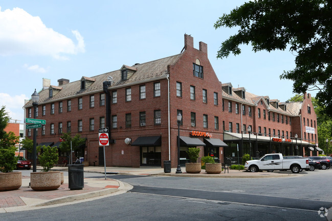
Property Record
19 Shipping Pl, Dundalk, MD 21222

Property Detail
19 Shipping Pl
12-1204075770
ADJNS TO LT 2&3 DUNDALK
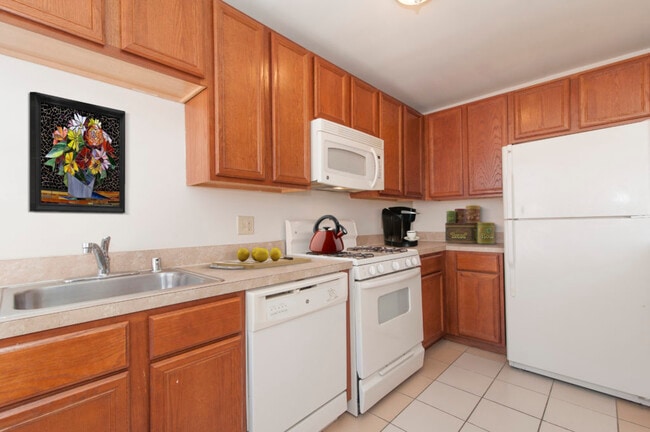
Storebuilding
Baltimore
BM
Maryland
B and X Area of moderate flood hazard, usually the area between the limits of the 100-year and 500-year floods.
2,3
2024
0.83 AC
2025
Baltimore County East
420900
Baltimore
30,641 SF
Baltimore-Columbia-Towson, MD
NEARBY LISTINGS FOR SALE OR LEASE
DEMOGRAPHICS near 19 Shipping Pl
1 mile
3 mile
5 mile
2025 Total Population
16,898
83,789
235,287
2030 Population
16,980
83,498
233,737
Pop Growth 2025-2030
+ 0.49%
(0.35%)
(0.66%)
Average Age
40
38
38
2025 Total Households
6,719
31,828
95,710
HH Growth 2025-2030
+ 0.51%
(0.35%)
(0.76%)
Median Household Inc
$57,810
$63,783
$68,115
Avg Household Size
2.40
2.60
2.40
2025 Avg HH Vehicles
1.00
2.00
1.00
Median Home Value
$216,015
$216,030
$251,385
Median Year Built
1951
1953
1952
Nearby Places
Map Layers
Map Styles
 Street
 Aerial
Layers
 Traffic
 Biking
Places
Listings with unknown addresses are not visible on the map
- Restaurants
- Banks
- Shops
- Fitness
- Groceries
PUBLIC TRANSPORTATION
COMMUTER RAIL
Camden Station (Camden Line - Maryland Area Regional Commuter Trains (The MARC))
Drive
Walk
Distance
Camden Station (Camden Line - Maryland Area Regional Commuter Trains (The MARC))
16 min
9.0 mi
AIRPORT
Baltimore/Washington International Thurgood Marshall
Drive
Walk
Distance
Baltimore/Washington International Thurgood Marshall
24 min
16.3 mi
Freight Ports
Port of Baltimore
Drive
Walk
Distance
Port of Baltimore
1 min
4.1 mi
SALE & LEASE HISTORY
LISTING DATE
SALE/LEASE

Sep 25, 2025
For Lease
May 30, 2018
For Sale
Feb 01, 2024
For Sale
Nearby Properties
Address
Land Use
TOTAL SIZE
Lot Size
Zoning
Address
Land Use
TOTAL SIZE
Lot Size
Zoning
608,666 SF
8.42 AC
H
Address
Land Use
TOTAL SIZE
Lot Size
Zoning
268,543 SF
84.93 AC
H
Address
Land Use
TOTAL SIZE
Lot Size
Zoning
1,015,550 SF
64.95 AC
I-2
Address
Land Use
TOTAL SIZE
Lot Size
Zoning
831,350 SF
5.56 AC
C-2
Address
Land Use
TOTAL SIZE
Lot Size
Zoning
598,638 SF
3.75 AC
C-2
Address
Land Use
TOTAL SIZE
Lot Size
Zoning
728,691 SF
3.95 AC
C-2
Address
Land Use
TOTAL SIZE
Lot Size
Zoning
979,200 SF
49.24 AC
Address
Land Use
TOTAL SIZE
Lot Size
Zoning
263 AC
0M030
Address
Land Use
TOTAL SIZE
Lot Size
Zoning
475,525 SF
4.22 AC
C-3
Address
Land Use
TOTAL SIZE
Lot Size
Zoning
347,000 SF
42.73 AC
DR
Address
Land Use
TOTAL SIZE
Lot Size
Zoning
522,274 SF
1.23 AC
C-3
Address
Land Use
TOTAL SIZE
Lot Size
Zoning
291,062 SF
47.39 AC
Address
Land Use
TOTAL SIZE
Lot Size
Zoning
619,700 SF
34.98 AC
I-2
Address
Land Use
TOTAL SIZE
Lot Size
Zoning
735,681 SF
44.98 AC
Address
Land Use
TOTAL SIZE
Lot Size
Zoning
449,920 SF
26.42 AC
Address
Land Use
TOTAL SIZE
Lot Size
Zoning
278,006 SF
49.85 AC
DR
Address
Land Use
TOTAL SIZE
Lot Size
Zoning
210,873 SF
12.28 AC
C-3
Address
Land Use
TOTAL SIZE
Lot Size
Zoning
413,345 SF
46.90 AC
I-2
Address
Land Use
TOTAL SIZE
Lot Size
Zoning
49,950 SF
28.31 AC
I-2
Address
Land Use
TOTAL SIZE
Lot Size
Zoning
33.65 AC
DR16
Address
Land Use
TOTAL SIZE
Lot Size
Zoning
249,000 SF
1.40 AC
R-8
Address
Land Use
TOTAL SIZE
Lot Size
Zoning
126,507 SF
1.05 AC
H
Address
Land Use
TOTAL SIZE
Lot Size
Zoning
135,548 SF
13 AC
DR5.5
Address
Land Use
TOTAL SIZE
Lot Size
Zoning
279,062 SF
13.40 AC
I-2
Address
Land Use
TOTAL SIZE
Lot Size
Zoning
132,038 SF
5.38 AC
OIC
Address
Land Use
TOTAL SIZE
Lot Size
Zoning
346,408 SF
18.50 AC
I-2
Address
Land Use
TOTAL SIZE
Lot Size
Zoning
139.18 AC
MI
Address
Land Use
TOTAL SIZE
Lot Size
Zoning
97,784 SF
1.35 AC
DR10.
Address
Land Use
TOTAL SIZE
Lot Size
Zoning
342,500 SF
52.40 AC
I-2
Address
Land Use
TOTAL SIZE
Lot Size
Zoning
666,800 SF
17.50 AC
OIC
The World's #1 Commercial Real Estate Marketplace
Connect with us
© 2026 CoStar Group
The information above has been obtained from sources believed reliable. While we do not doubt its accuracy we have not verified it and make no guarantee, warranty or representation about it. It is your responsibility to independently confirm its accuracy and completeness. Any projections, opinions, assumptions, or estimates used are for example only and do not represent the current or future performance of the property. The value of this transaction to you depends on tax and other factors which should be evaluated by your tax, financial, and legal advisors. You and your advisors should conduct a careful, independent investigation of the property to determine to your satisfaction the suitability of the property for your needs.