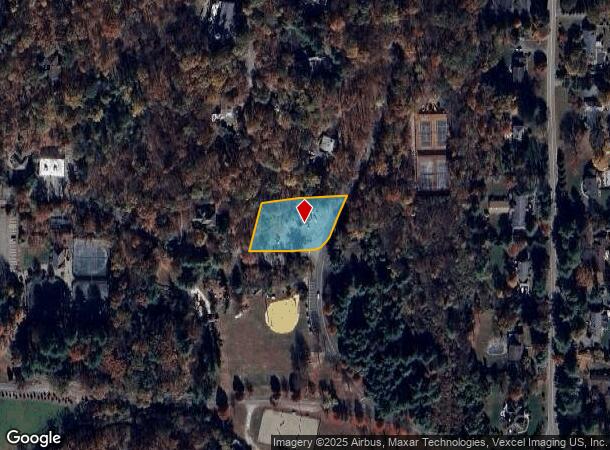
Property Record
19 Sleepy Hollow Rd, Butler, NJ 07405

NEARBY LISTINGS FOR SALE OR LEASE
Property Detail
19 Sleepy Hollow Rd
Newark, NJ-PA
Smoke Rise Sec 2
15-11105-0000-00115
Morris
Commercialnec
New Jersey
2024
115
2025
0.89 AC
040701
Eastern Morris
1,260 SF
Northern New Jersey
DEMOGRAPHICS near 19 Sleepy Hollow Rd
1 Mile
3 Mile
5 Mile
2024 Total Population
1,500
16,048
45,134
2029 Population
1,505
15,936
45,053
Pop Growth 2024-2029
+ 0.33%
(0.70%)
(0.18%)
Average Age
42
42
44
2024 Total Households
511
5,922
17,776
HH Growth 2024-2029
+ 0.39%
(0.86%)
(0.37%)
Median Household Inc
$192,241
$123,236
$117,714
Avg Household Size
2.90
2.70
2.50
2024 Avg HH Vehicles
2.00
2.00
2.00
Median Home Value
$771,404
$522,062
$470,962
Median Year Built
1974
1968
1972
Nearby Places
Map Layers
Map Styles
 Street
 Aerial
- Restaurants
- Banks
- Shops
- Fitness
- Groceries
PUBLIC TRANSPORTATION
COMMUTER RAIL
Boonton (Montclair-Boonton Line - NJ Transit Commuter Rail (NJ Transit))
DRIVE
WALK
Distance
Boonton (Montclair-Boonton Line - NJ Transit Commuter Rail (NJ Transit))
17 min
8.6 mi
AIRPORT
Newark Liberty International
DRIVE
WALK
Distance
Newark Liberty International
44 min
34.7 mi
Freight Ports
Port Newark Container Terminal
DRIVE
WALK
Distance
Port Newark Container Terminal
50 min
34.0 mi
SALE & LEASE HISTORY
LISTING DATE
SALE/LEASE

Sep 24, 2016
For Sale
Nearby Properties
Address
Land Use
TOTAL SIZE
Lot Size
Zoning
Address
Land Use
TOTAL SIZE
Lot Size
Zoning
15.36 AC
AH
Address
Land Use
TOTAL SIZE
Lot Size
Zoning
9,360 SF
13.58 AC
R-7
Address
Land Use
TOTAL SIZE
Lot Size
Zoning
41,791 SF
4.82 AC
HC
Address
Land Use
TOTAL SIZE
Lot Size
Zoning
31.46 AC
R
Address
Land Use
TOTAL SIZE
Lot Size
Zoning
82,022 SF
6.09 AC
RC
Address
Land Use
TOTAL SIZE
Lot Size
Zoning
9.13 AC
R-G
Address
Land Use
TOTAL SIZE
Lot Size
Zoning
23.15 AC
R
Address
Land Use
TOTAL SIZE
Lot Size
Zoning
105,263 SF
15.60 AC
RC
Address
Land Use
TOTAL SIZE
Lot Size
Zoning
11.51 AC
R
Address
Land Use
TOTAL SIZE
Lot Size
Zoning
493.70 AC
R
Address
Land Use
TOTAL SIZE
Lot Size
Zoning
65,723 SF
12.85 AC
R-4
Address
Land Use
TOTAL SIZE
Lot Size
Zoning
35,111 SF
1.48 AC
HC
Address
Land Use
TOTAL SIZE
Lot Size
Zoning
26.36 AC
R
Address
Land Use
TOTAL SIZE
Lot Size
Zoning
395.63 AC
SC
Address
Land Use
TOTAL SIZE
Lot Size
Zoning
4,320 SF
58.73 AC
R
Address
Land Use
TOTAL SIZE
Lot Size
Zoning
44,981 SF
6.11 AC
R-4
Address
Land Use
TOTAL SIZE
Lot Size
Zoning
5,436 SF
108.30 AC
R-88
Address
Land Use
TOTAL SIZE
Lot Size
Zoning
3.96 AC
HC-2
Address
Land Use
TOTAL SIZE
Lot Size
Zoning
7,921 SF
1 AC
R
Address
Land Use
TOTAL SIZE
Lot Size
Zoning
26,158 SF
10.99 AC
HC
Address
Land Use
TOTAL SIZE
Lot Size
Zoning
15.80 AC
Address
Land Use
TOTAL SIZE
Lot Size
Zoning
879.26 AC
R
Address
Land Use
TOTAL SIZE
Lot Size
Zoning
1.94 AC
RC
Address
Land Use
TOTAL SIZE
Lot Size
Zoning
466.93 AC
Address
Land Use
TOTAL SIZE
Lot Size
Zoning
1,200 SF
22.70 AC
R-1
Address
Land Use
TOTAL SIZE
Lot Size
Zoning
18,666 SF
3 AC
HC
Address
Land Use
TOTAL SIZE
Lot Size
Zoning
4,525 SF
258.45 AC
R
Address
Land Use
TOTAL SIZE
Lot Size
Zoning
4,680 SF
151 AC
R20A
Address
Land Use
TOTAL SIZE
Lot Size
Zoning
2.60 AC
HC
Address
Land Use
TOTAL SIZE
Lot Size
Zoning
20,222 SF
2.60 AC
HC
The World's #1 Commercial Real Estate Marketplace
Connect with us
© 2025 CoStar Group
The information above has been obtained from sources believed reliable. While we do not doubt its accuracy we have not verified it and make no guarantee, warranty or representation about it. It is your responsibility to independently confirm its accuracy and completeness. Any projections, opinions, assumptions, or estimates used are for example only and do not represent the current or future performance of the property. The value of this transaction to you depends on tax and other factors which should be evaluated by your tax, financial, and legal advisors. You and your advisors should conduct a careful, independent investigation of the property to determine to your satisfaction the suitability of the property for your needs.