Property Record
19 Stoney Brook Dr, Wilton, NH 03086
NEARBY LISTINGS FOR SALE OR LEASE
-
-
View all Wilton listings for lease on LoopNet.com
Property Detail
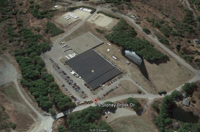
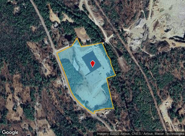
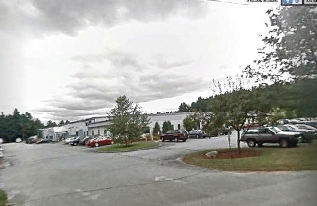
19 Stoney Brook Dr
WLTN-000000-B000110
Hillsborough
Warehouse
New Hampshire
AE
110
33011C0432D
23.87 AC
2024
Hillsborough
2024
Boston
019000
Manchester-Nashua, NH
127,722 SF
DEMOGRAPHICS near 19 Stoney Brook Dr
1 Mile
3 Mile
5 Mile
2024 Total Population
296
4,012
9,648
2029 Population
300
4,021
9,762
Pop Growth 2024-2029
+ 1.35%
+ 0.22%
+ 1.18%
Average Age
44
43
43
2024 Total Households
115
1,603
3,730
HH Growth 2024-2029
+ 1.74%
+ 0.12%
+ 1.10%
Median Household Inc
$110,000
$100,090
$109,198
Avg Household Size
2.50
2.50
2.60
2024 Avg HH Vehicles
3.00
2.00
2.00
Median Home Value
$401,471
$363,165
$378,241
Median Year Built
1983
1968
1980
Nearby Places
Map Layers
Map Styles
 Street
 Aerial
- Restaurants
- Banks
- Shops
- Fitness
- Groceries
PUBLIC TRANSPORTATION
AIRPORT
Manchester Boston Regional
DRIVE
WALK
Distance
Manchester Boston Regional
50 min
26.3 mi
Freight Ports
Port of Boston
DRIVE
WALK
Distance
Port of Boston
102 min
67.2 mi
SALE & LEASE HISTORY
LISTING DATE
SALE/LEASE

Sep 25, 2016
For Lease
Sep 24, 2016
For Sale
Nearby Properties
Address
Land Use
TOTAL SIZE
Lot Size
Zoning
Address
Land Use
TOTAL SIZE
Lot Size
Zoning
87,438 SF
55.60 AC
SZ
Address
Land Use
TOTAL SIZE
Lot Size
Zoning
45,690 SF
5.50 AC
Address
Land Use
TOTAL SIZE
Lot Size
Zoning
37,157 SF
1.60 AC
RA
Address
Land Use
TOTAL SIZE
Lot Size
Zoning
6,000 SF
6.38 AC
ICI
Address
Land Use
TOTAL SIZE
Lot Size
Zoning
112,299 SF
3.50 AC
I
Address
Land Use
TOTAL SIZE
Lot Size
Zoning
10.10 AC
I
Address
Land Use
TOTAL SIZE
Lot Size
Zoning
29,404 SF
1.40 AC
I
Address
Land Use
TOTAL SIZE
Lot Size
Zoning
15,426 SF
6.40 AC
RA
Address
Land Use
TOTAL SIZE
Lot Size
Zoning
8,940 SF
1.22 AC
ICI
Address
Land Use
TOTAL SIZE
Lot Size
Zoning
6.50 AC
I
Address
Land Use
TOTAL SIZE
Lot Size
Zoning
3,925 SF
262 AC
RURAL
Address
Land Use
TOTAL SIZE
Lot Size
Zoning
4,702 SF
136.50 AC
RA
Address
Land Use
TOTAL SIZE
Lot Size
Zoning
Address
Land Use
TOTAL SIZE
Lot Size
Zoning
6,000 SF
5.10 AC
I
Address
Land Use
TOTAL SIZE
Lot Size
Zoning
2,992 SF
2.12 AC
ICI
Address
Land Use
TOTAL SIZE
Lot Size
Zoning
20.30 AC
RA
Address
Land Use
TOTAL SIZE
Lot Size
Zoning
7,341 SF
16.50 AC
RURAL
Address
Land Use
TOTAL SIZE
Lot Size
Zoning
13,916 SF
8.20 AC
VILLAG
Address
Land Use
TOTAL SIZE
Lot Size
Zoning
23,232 SF
Address
Land Use
TOTAL SIZE
Lot Size
Zoning
6.33 AC
I
Address
Land Use
TOTAL SIZE
Lot Size
Zoning
15,702 SF
0.90 AC
SZ
Address
Land Use
TOTAL SIZE
Lot Size
Zoning
Address
Land Use
TOTAL SIZE
Lot Size
Zoning
9,266 SF
0.88 AC
RD
Address
Land Use
TOTAL SIZE
Lot Size
Zoning
44,774 SF
1.33 AC
I
Address
Land Use
TOTAL SIZE
Lot Size
Zoning
2.10 AC
RD
Address
Land Use
TOTAL SIZE
Lot Size
Zoning
10,364 SF
0.30 AC
RD
Address
Land Use
TOTAL SIZE
Lot Size
Zoning
46,146 SF
2.30 AC
I
Address
Land Use
TOTAL SIZE
Lot Size
Zoning
8,520 SF
0.80 AC
RD
Address
Land Use
TOTAL SIZE
Lot Size
Zoning
2.41 AC
C
The World's #1 Commercial Real Estate Marketplace
Connect with us
© 2025 CoStar Group
The information above has been obtained from sources believed reliable. While we do not doubt its accuracy we have not verified it and make no guarantee, warranty or representation about it. It is your responsibility to independently confirm its accuracy and completeness. Any projections, opinions, assumptions, or estimates used are for example only and do not represent the current or future performance of the property. The value of this transaction to you depends on tax and other factors which should be evaluated by your tax, financial, and legal advisors. You and your advisors should conduct a careful, independent investigation of the property to determine to your satisfaction the suitability of the property for your needs.