Property Record
19 Texas Station Ct, Lutherville Timonium, MD 21093


NEARBY LISTINGS FOR SALE OR LEASE
Property Detail
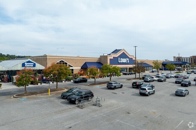
19 Texas Station Ct
Baltimore-Columbia-Towson, MD
Texas Station East
08-2300008149
14.5333 AC TEXAS STATION EAST
Storebuilding
Baltimore
X
Maryland
2400100235G
2
2024
14.53 AC
2025
Route 83 Corridor North
408900
Baltimore
138,368 SF
DEMOGRAPHICS near 19 Texas Station Ct
1 Mile
3 Mile
5 Mile
2024 Total Population
10,130
57,063
108,151
2029 Population
9,954
56,352
107,202
Pop Growth 2024-2029
(1.74%)
(1.25%)
(0.88%)
Average Age
38
43
42
2024 Total Households
4,291
23,628
43,543
HH Growth 2024-2029
(1.82%)
(1.29%)
(0.79%)
Median Household Inc
$80,073
$98,960
$100,535
Avg Household Size
2.30
2.30
2.30
2024 Avg HH Vehicles
2.00
2.00
2.00
Median Home Value
$352,110
$419,371
$450,286
Median Year Built
1976
1977
1977
Nearby Places
Map Layers
Map Styles
 Street
 Aerial
- Restaurants
- Banks
- Shops
- Fitness
- Groceries
PUBLIC TRANSPORTATION
AIRPORT
Baltimore/Washington International Thurgood Marshall
DRIVE
WALK
Distance
Baltimore/Washington International Thurgood Marshall
41 min
26.0 mi
Freight Ports
Port of Baltimore
DRIVE
WALK
Distance
Port of Baltimore
28 min
15.5 mi
Nearby Properties
Address
Land Use
TOTAL SIZE
Lot Size
Zoning
Address
Land Use
TOTAL SIZE
Lot Size
Zoning
217,147 SF
5.08 AC
MLIM
Address
Land Use
TOTAL SIZE
Lot Size
Zoning
513,056 SF
55.49 AC
BM
Address
Land Use
TOTAL SIZE
Lot Size
Zoning
343,606 SF
19.65 AC
Address
Land Use
TOTAL SIZE
Lot Size
Zoning
720,989 SF
32.65 AC
Address
Land Use
TOTAL SIZE
Lot Size
Zoning
595,100 SF
5.73 AC
Address
Land Use
TOTAL SIZE
Lot Size
Zoning
38.89 AC
DR16
Address
Land Use
TOTAL SIZE
Lot Size
Zoning
512,317 SF
2.76 AC
BM
Address
Land Use
TOTAL SIZE
Lot Size
Zoning
13,468 SF
32.08 AC
DR16
Address
Land Use
TOTAL SIZE
Lot Size
Zoning
28.74 AC
DR16
Address
Land Use
TOTAL SIZE
Lot Size
Zoning
362,686 SF
88.84 AC
MR
Address
Land Use
TOTAL SIZE
Lot Size
Zoning
489,483 SF
84.32 AC
RC4
Address
Land Use
TOTAL SIZE
Lot Size
Zoning
237,800 SF
1.28 AC
BM
Address
Land Use
TOTAL SIZE
Lot Size
Zoning
330,145 SF
16.20 AC
Address
Land Use
TOTAL SIZE
Lot Size
Zoning
26.73 AC
DR16
Address
Land Use
TOTAL SIZE
Lot Size
Zoning
330,802 SF
14.81 AC
ML-IM
Address
Land Use
TOTAL SIZE
Lot Size
Zoning
176,584 SF
31 AC
Address
Land Use
TOTAL SIZE
Lot Size
Zoning
125,398 SF
15.13 AC
BM
Address
Land Use
TOTAL SIZE
Lot Size
Zoning
73,186 SF
34 AC
Address
Land Use
TOTAL SIZE
Lot Size
Zoning
44.76 AC
DR3.5
Address
Land Use
TOTAL SIZE
Lot Size
Zoning
138,000 SF
3.09 AC
Address
Land Use
TOTAL SIZE
Lot Size
Zoning
172,782 SF
5.35 AC
ML-IM
Address
Land Use
TOTAL SIZE
Lot Size
Zoning
14.49 AC
DR16
Address
Land Use
TOTAL SIZE
Lot Size
Zoning
94,534 SF
15.68 AC
BLCCC
Address
Land Use
TOTAL SIZE
Lot Size
Zoning
18.07 AC
DR3.5
Address
Land Use
TOTAL SIZE
Lot Size
Zoning
13.46 AC
DR16
Address
Land Use
TOTAL SIZE
Lot Size
Zoning
326,069 SF
9.28 AC
ML-IM
Address
Land Use
TOTAL SIZE
Lot Size
Zoning
18.68 AC
DR3.5
Address
Land Use
TOTAL SIZE
Lot Size
Zoning
204,329 SF
25.45 AC
ML
Address
Land Use
TOTAL SIZE
Lot Size
Zoning
143,260 SF
7.31 AC
ML
Address
Land Use
TOTAL SIZE
Lot Size
Zoning
4,000 SF
23.97 AC
DR3.5
The World's #1 Commercial Real Estate Marketplace
Connect with us
© 2026 CoStar Group
The information above has been obtained from sources believed reliable. While we do not doubt its accuracy we have not verified it and make no guarantee, warranty or representation about it. It is your responsibility to independently confirm its accuracy and completeness. Any projections, opinions, assumptions, or estimates used are for example only and do not represent the current or future performance of the property. The value of this transaction to you depends on tax and other factors which should be evaluated by your tax, financial, and legal advisors. You and your advisors should conduct a careful, independent investigation of the property to determine to your satisfaction the suitability of the property for your needs.