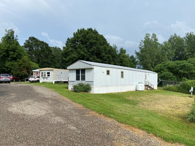
Property Record
19 Waterview Rd, Oswego, NY 13126

NEARBY LISTINGS FOR SALE OR LEASE
Property Detail
19 Waterview Rd
Syracuse, NY
Oswego
354200-127-018-0001-002-000-0000
New York
Mobilehomepark
10.22 AC
X
Oswego County
36075C0258H
Syracuse
780 SF
DEMOGRAPHICS near 19 Waterview Rd
1 Mile
3 Mile
5 Mile
2024 Total Population
4,419
20,845
28,496
2029 Population
4,455
21,041
28,685
Pop Growth 2024-2029
+ 0.81%
+ 0.94%
+ 0.66%
Average Age
26
38
39
2024 Total Households
479
7,268
10,451
HH Growth 2024-2029
+ 1.67%
+ 1.00%
+ 0.66%
Median Household Inc
$64,195
$49,866
$54,993
Avg Household Size
2.40
2.20
2.20
2024 Avg HH Vehicles
2.00
2.00
2.00
Median Home Value
$145,913
$121,954
$130,076
Median Year Built
1973
1949
1958
Nearby Places
Map Layers
Map Styles
 Street
 Aerial
- Restaurants
- Banks
- Shops
- Fitness
- Groceries
SALE & LEASE HISTORY
LISTING DATE
SALE/LEASE

Jun 03, 2021
For Sale
Jul 11, 2022
For Sale
Feb 02, 2021
For Sale
Nearby Properties
Address
Land Use
TOTAL SIZE
Lot Size
Zoning
Address
Land Use
TOTAL SIZE
Lot Size
Zoning
178,730 SF
114.65 AC
IN
Address
Land Use
TOTAL SIZE
Lot Size
Zoning
15.85 AC
IN
Address
Land Use
TOTAL SIZE
Lot Size
Zoning
600 SF
27.36 AC
IN
Address
Land Use
TOTAL SIZE
Lot Size
Zoning
44,918 SF
6.30 AC
SR
Address
Land Use
TOTAL SIZE
Lot Size
Zoning
166,923 SF
3.27 AC
TD
Address
Land Use
TOTAL SIZE
Lot Size
Zoning
904 SF
146.72 AC
01 - NOT Z
Address
Land Use
TOTAL SIZE
Lot Size
Zoning
53,632 SF
59.72 AC
TB
Address
Land Use
TOTAL SIZE
Lot Size
Zoning
225,081 SF
13.84 AC
TN2
Address
Land Use
TOTAL SIZE
Lot Size
Zoning
128,922 SF
39.72 AC
SR
Address
Land Use
TOTAL SIZE
Lot Size
Zoning
42,320 SF
4.88 AC
TB
Address
Land Use
TOTAL SIZE
Lot Size
Zoning
72,159 SF
3.50 AC
Address
Land Use
TOTAL SIZE
Lot Size
Zoning
69,091 SF
5.38 AC
SR
Address
Land Use
TOTAL SIZE
Lot Size
Zoning
91,452 SF
1.54 AC
TB
Address
Land Use
TOTAL SIZE
Lot Size
Zoning
459 SF
3.63 AC
TN2
Address
Land Use
TOTAL SIZE
Lot Size
Zoning
87,469 SF
16.11 AC
TN2
Address
Land Use
TOTAL SIZE
Lot Size
Zoning
20,460 SF
3.47 AC
IN
Address
Land Use
TOTAL SIZE
Lot Size
Zoning
74,770 SF
2.25 AC
TB
Address
Land Use
TOTAL SIZE
Lot Size
Zoning
4,914 SF
23.95 AC
TN2
Address
Land Use
TOTAL SIZE
Lot Size
Zoning
2,380 SF
42.70 AC
TN2
Address
Land Use
TOTAL SIZE
Lot Size
Zoning
7,056 SF
6.51 AC
01
Address
Land Use
TOTAL SIZE
Lot Size
Zoning
33,140 SF
SR
Address
Land Use
TOTAL SIZE
Lot Size
Zoning
59,526 SF
10.37 AC
SR
Address
Land Use
TOTAL SIZE
Lot Size
Zoning
40,000 SF
TD
Address
Land Use
TOTAL SIZE
Lot Size
Zoning
780 SF
1 AC
MT
Address
Land Use
TOTAL SIZE
Lot Size
Zoning
44,009 SF
5.30 AC
TN1
Address
Land Use
TOTAL SIZE
Lot Size
Zoning
29,700 SF
0.14 AC
TD
Address
Land Use
TOTAL SIZE
Lot Size
Zoning
78,678 SF
TN1
Address
Land Use
TOTAL SIZE
Lot Size
Zoning
35,950 SF
2.25 AC
TN2
Address
Land Use
TOTAL SIZE
Lot Size
Zoning
76,328 SF
1.29 AC
WA
Address
Land Use
TOTAL SIZE
Lot Size
Zoning
52,323 SF
1.06 AC
TB
The World's #1 Commercial Real Estate Marketplace
Connect with us
© 2025 CoStar Group
The information above has been obtained from sources believed reliable. While we do not doubt its accuracy we have not verified it and make no guarantee, warranty or representation about it. It is your responsibility to independently confirm its accuracy and completeness. Any projections, opinions, assumptions, or estimates used are for example only and do not represent the current or future performance of the property. The value of this transaction to you depends on tax and other factors which should be evaluated by your tax, financial, and legal advisors. You and your advisors should conduct a careful, independent investigation of the property to determine to your satisfaction the suitability of the property for your needs.