Property Record
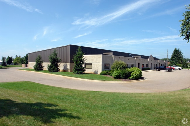
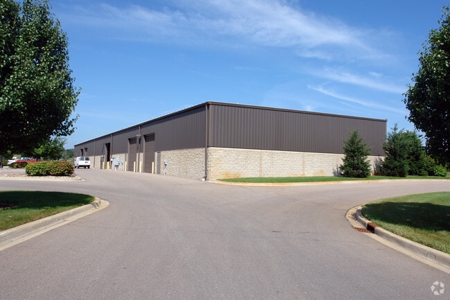
190 E Wardlow Rd, Highland, MI 48356

Property Detail
190 E Wardlow Rd
11-15-377-011
T3N, R7E, SEC 15 PART OF SW 1/4 BEG AT PT DIST N 89-15-00 E 1313.75 FT & N 88-47-30 E 443.69 FT & N 02-16-50 W 670.60 FT FROM SW SEC COR, TH N 02-16-50 W 661.20 FT, TH S 89-51-00 E 471.70 FT, TH S 00-10-00 W 337.59 FT, TH S 88-47-30 W 43.01 FT, TH S
Loftbuilding
Oakland
II
Michigan
B and X Area of moderate flood hazard, usually the area between the limits of the 100-year and 500-year floods.
5.30 AC
2025
Lakes Area
2025
Detroit
131100
Detroit-Warren-Dearborn, MI
24,925 SF
NEARBY LISTINGS FOR SALE OR LEASE
DEMOGRAPHICS near 190 E Wardlow Rd
1 mile
3 mile
5 mile
2025 Total Population
3,252
17,121
44,714
2030 Population
3,397
17,666
45,923
Pop Growth 2025-2030
+ 4.46%
+ 3.18%
+ 2.70%
Average Age
41
43
44
2025 Total Households
1,339
6,642
17,364
HH Growth 2025-2030
+ 4.71%
+ 3.25%
+ 2.79%
Median Household Inc
$78,756
$99,562
$96,952
Avg Household Size
2.40
2.60
2.50
2025 Avg HH Vehicles
2.00
2.00
2.00
Median Home Value
$219,061
$347,576
$345,242
Median Year Built
1982
1979
1985
Nearby Places
Map Layers
Map Styles
 Street
 Aerial
Layers
 Traffic
 Biking
Places
Listings with unknown addresses are not visible on the map
- Restaurants
- Banks
- Shops
- Fitness
- Groceries
PUBLIC TRANSPORTATION
AIRPORT
Bishop International
Drive
Walk
Distance
Bishop International
49 min
33.6 mi
Detroit Metro Wayne County
Drive
Walk
Distance
Detroit Metro Wayne County
65 min
46.2 mi
Nearby Properties
Address
Land Use
TOTAL SIZE
Lot Size
Zoning
Address
Land Use
TOTAL SIZE
Lot Size
Zoning
6,498 SF
77.52 AC
MM
Address
Land Use
TOTAL SIZE
Lot Size
Zoning
46,500 SF
5.86 AC
BI
Address
Land Use
TOTAL SIZE
Lot Size
Zoning
34,854 SF
5.28 AC
AI
Address
Land Use
TOTAL SIZE
Lot Size
Zoning
45,644 SF
7.74 AC
BI
Address
Land Use
TOTAL SIZE
Lot Size
Zoning
26,054 SF
7.90 AC
AV
Address
Land Use
TOTAL SIZE
Lot Size
Zoning
34,075 SF
14.06 AC
BI
Address
Land Use
TOTAL SIZE
Lot Size
Zoning
38,846 SF
6.78 AC
BI
Address
Land Use
TOTAL SIZE
Lot Size
Zoning
51,167 SF
11.08 AC
BI
Address
Land Use
TOTAL SIZE
Lot Size
Zoning
55,183 SF
Address
Land Use
TOTAL SIZE
Lot Size
Zoning
47,204 SF
10.77 AC
II
Address
Land Use
TOTAL SIZE
Lot Size
Zoning
24,370 SF
4.86 AC
BI
Address
Land Use
TOTAL SIZE
Lot Size
Zoning
67,936 SF
9.68 AC
BI
Address
Land Use
TOTAL SIZE
Lot Size
Zoning
27,756 SF
228.31 AC
Address
Land Use
TOTAL SIZE
Lot Size
Zoning
34,464 SF
7.45 AC
AI
Address
Land Use
TOTAL SIZE
Lot Size
Zoning
47,996 SF
8.99 AC
BI
Address
Land Use
TOTAL SIZE
Lot Size
Zoning
36,928 SF
5.16 AC
II
Address
Land Use
TOTAL SIZE
Lot Size
Zoning
58,721 SF
7.59 AC
BI
Address
Land Use
TOTAL SIZE
Lot Size
Zoning
68,340 SF
5.48 AC
II
Address
Land Use
TOTAL SIZE
Lot Size
Zoning
21,000 SF
3.12 AC
BI
Address
Land Use
TOTAL SIZE
Lot Size
Zoning
58,677 SF
16.70 AC
II
Address
Land Use
TOTAL SIZE
Lot Size
Zoning
25,432 SF
4.53 AC
AI
Address
Land Use
TOTAL SIZE
Lot Size
Zoning
59,200 SF
6 AC
II
Address
Land Use
TOTAL SIZE
Lot Size
Zoning
37,646 SF
7.53 AC
SI
Address
Land Use
TOTAL SIZE
Lot Size
Zoning
22,605 SF
3.79 AC
BI
Address
Land Use
TOTAL SIZE
Lot Size
Zoning
12,463 SF
4.73 AC
Address
Land Use
TOTAL SIZE
Lot Size
Zoning
50.93 AC
MM
Address
Land Use
TOTAL SIZE
Lot Size
Zoning
32,400 SF
2.67 AC
II
Address
Land Use
TOTAL SIZE
Lot Size
Zoning
38,449 SF
2.60 AC
IV
Address
Land Use
TOTAL SIZE
Lot Size
Zoning
44,893 SF
22.58 AC
MM
Address
Land Use
TOTAL SIZE
Lot Size
Zoning
20,700 SF
The World's #1 Commercial Real Estate Marketplace
Connect with us
© 2026 CoStar Group
The information above has been obtained from sources believed reliable. While we do not doubt its accuracy we have not verified it and make no guarantee, warranty or representation about it. It is your responsibility to independently confirm its accuracy and completeness. Any projections, opinions, assumptions, or estimates used are for example only and do not represent the current or future performance of the property. The value of this transaction to you depends on tax and other factors which should be evaluated by your tax, financial, and legal advisors. You and your advisors should conduct a careful, independent investigation of the property to determine to your satisfaction the suitability of the property for your needs.