Property Record
190 Main St, La Crescent, MN 55947
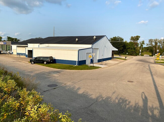
Property Detail
190 Main St
La Crosse-Onalaska, WI-MN
SECT-10 TWP-104 RANGE-004 MANTON LOT-999 BLOCK-005 LOTS 11 & 12 - BLK 5 & N 10 FT VAC MAIN ST ADJ SAME MANTON PLAT DOC #22933
R-25.0030.000
HOUSTON
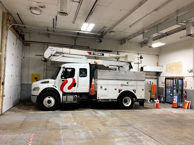
Warehouse
Minnesota
B and X Area of moderate flood hazard, usually the area between the limits of the 100-year and 500-year floods.
11-12
2025
0.33 AC
2025
Minnesota South Area
020100
Other Market Areas
3,600 SF
NEARBY LISTINGS FOR SALE OR LEASE
-
-
View all La Crescent listings for lease on LoopNet.com
DEMOGRAPHICS near 190 Main St
1 mile
3 mile
5 mile
2024 Total Population
3,825
16,018
56,653
2029 Population
3,851
16,265
57,397
Pop Growth 2024-2029
+ 0.68%
+ 1.54%
+ 1.31%
Average Age
43
41
38
2024 Total Households
1,616
7,561
24,108
HH Growth 2024-2029
+ 0.68%
+ 1.42%
+ 1.34%
Median Household Inc
$74,322
$52,451
$49,811
Avg Household Size
2.30
2.10
2.10
2024 Avg HH Vehicles
2.00
2.00
2.00
Median Home Value
$236,448
$207,574
$182,550
Median Year Built
1973
1973
1965
Nearby Places
Map Layers
Map Styles
 Street
 Aerial
Transit
 Traffic
 Biking
Places
Listings with unknown addresses are not visible on the map
- Restaurants
- Banks
- Shops
- Fitness
- Groceries
PUBLIC TRANSPORTATION
COMMUTER RAIL
La Crosse (Empire Builder - Amtrak)
Drive
Walk
Distance
La Crosse (Empire Builder - Amtrak)
14 min
8.1 mi
AIRPORT
La Crosse Regional
Drive
Walk
Distance
La Crosse Regional
11 min
6.5 mi
Freight Ports
Port Milwaukee
Drive
Walk
Distance
Port Milwaukee
236 min
213.5 mi
SALE & LEASE HISTORY
LISTING DATE
SALE/LEASE

Nov 04, 2021
For Lease
Nearby Properties
Address
Land Use
TOTAL SIZE
Lot Size
Zoning
Address
Land Use
TOTAL SIZE
Lot Size
Zoning
158,050 SF
44.85 AC
Address
Land Use
TOTAL SIZE
Lot Size
Zoning
131,552 SF
0.89 AC
Address
Land Use
TOTAL SIZE
Lot Size
Zoning
3.91 AC
Address
Land Use
TOTAL SIZE
Lot Size
Zoning
0.75 AC
MZA
Address
Land Use
TOTAL SIZE
Lot Size
Zoning
59,405 SF
5.64 AC
Address
Land Use
TOTAL SIZE
Lot Size
Zoning
5.29 AC
MZA
Address
Land Use
TOTAL SIZE
Lot Size
Zoning
0.12 AC
Address
Land Use
TOTAL SIZE
Lot Size
Zoning
5.79 AC
MZA
Address
Land Use
TOTAL SIZE
Lot Size
Zoning
2.43 AC
Address
Land Use
TOTAL SIZE
Lot Size
Zoning
73,056 SF
0.62 AC
Address
Land Use
TOTAL SIZE
Lot Size
Zoning
81,664 SF
1.06 AC
MZA
Address
Land Use
TOTAL SIZE
Lot Size
Zoning
162,355 SF
13.90 AC
MZA
Address
Land Use
TOTAL SIZE
Lot Size
Zoning
2.10 AC
MZA
Address
Land Use
TOTAL SIZE
Lot Size
Zoning
7.88 AC
IND
Address
Land Use
TOTAL SIZE
Lot Size
Zoning
64,480 SF
0.69 AC
MZA
Address
Land Use
TOTAL SIZE
Lot Size
Zoning
1.20 AC
MZA
Address
Land Use
TOTAL SIZE
Lot Size
Zoning
1.19 AC
Address
Land Use
TOTAL SIZE
Lot Size
Zoning
2.12 AC
MZA
Address
Land Use
TOTAL SIZE
Lot Size
Zoning
0.96 AC
MZA
Address
Land Use
TOTAL SIZE
Lot Size
Zoning
11,708 SF
5.70 AC
Address
Land Use
TOTAL SIZE
Lot Size
Zoning
0.78 AC
MZA
Address
Land Use
TOTAL SIZE
Lot Size
Zoning
9,330 SF
1.42 AC
MZA
Address
Land Use
TOTAL SIZE
Lot Size
Zoning
6.07 AC
MZA
Address
Land Use
TOTAL SIZE
Lot Size
Zoning
27,000 SF
0.22 AC
MZA
Address
Land Use
TOTAL SIZE
Lot Size
Zoning
1.79 AC
MZA
Address
Land Use
TOTAL SIZE
Lot Size
Zoning
2.12 AC
MZA
Address
Land Use
TOTAL SIZE
Lot Size
Zoning
1.95 AC
MZA
Address
Land Use
TOTAL SIZE
Lot Size
Zoning
1.58 AC
MZA
Address
Land Use
TOTAL SIZE
Lot Size
Zoning
0.87 AC
MZA
Address
Land Use
TOTAL SIZE
Lot Size
Zoning
5.82 AC
MZA
The World's #1 Commercial Real Estate Marketplace
Connect with us
© 2026 CoStar Group
The information above has been obtained from sources believed reliable. While we do not doubt its accuracy we have not verified it and make no guarantee, warranty or representation about it. It is your responsibility to independently confirm its accuracy and completeness. Any projections, opinions, assumptions, or estimates used are for example only and do not represent the current or future performance of the property. The value of this transaction to you depends on tax and other factors which should be evaluated by your tax, financial, and legal advisors. You and your advisors should conduct a careful, independent investigation of the property to determine to your satisfaction the suitability of the property for your needs.