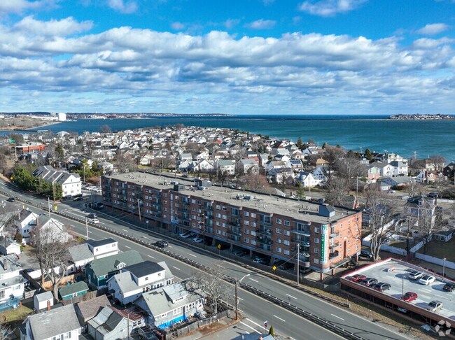
Property Record
190 N Shore Rd, Revere, MA 02151


NEARBY LISTINGS FOR SALE OR LEASE
-
-
-
-
-
No Photo
-
-
View all Revere listings for sale on LoopNet.com
Property Detail
190 N Shore Rd
REVE-000013-000192U-000001A
Suffolk
Apartment
Massachusetts
AE
1a
25025C0036J
0.89 AC
2025
Point of Pines
2025
Boston
170502
Boston-Cambridge-Newton, MA-NH
95,160 SF
DEMOGRAPHICS near 190 N Shore Rd
1 Mile
3 Mile
5 Mile
2024 Total Population
2,492
134,969
349,570
2029 Population
2,341
130,953
337,564
Pop Growth 2024-2029
(6.06%)
(2.98%)
(3.43%)
Average Age
46
39
39
2024 Total Households
1,142
49,637
127,317
HH Growth 2024-2029
(6.57%)
(3.03%)
(3.56%)
Median Household Inc
$58,775
$65,452
$76,007
Avg Household Size
2.20
2.60
2.60
2024 Avg HH Vehicles
1.00
1.00
1.00
Median Home Value
$559,122
$465,445
$520,030
Median Year Built
1970
1954
1949
Nearby Places
Map Layers
Map Styles
 Street
 Aerial
- Restaurants
- Banks
- Shops
- Fitness
- Groceries
PUBLIC TRANSPORTATION
COMMUTER RAIL
River Works (Newburyport/Rockport Line - Massachusetts Bay Transportation Authority Commuter Rail (Purple Line))
DRIVE
WALK
Distance
River Works (Newburyport/Rockport Line - Massachusetts Bay Transportation Authority Commuter Rail (Purple Line))
5 min
1.5 mi
Lynn (Newburyport/Rockport Line - Massachusetts Bay Transportation Authority Commuter Rail (Purple Line))
DRIVE
WALK
Distance
Lynn (Newburyport/Rockport Line - Massachusetts Bay Transportation Authority Commuter Rail (Purple Line))
4 min
2.4 mi
AIRPORT
General Edward Lawrence Logan International
DRIVE
WALK
Distance
General Edward Lawrence Logan International
14 min
7.5 mi
Nearby Properties
Address
Land Use
TOTAL SIZE
Lot Size
Zoning
Address
Land Use
TOTAL SIZE
Lot Size
Zoning
8 AC
HB
Address
Land Use
TOTAL SIZE
Lot Size
Zoning
247,013 SF
1.13 AC
RC2
Address
Land Use
TOTAL SIZE
Lot Size
Zoning
6.73 AC
HB
Address
Land Use
TOTAL SIZE
Lot Size
Zoning
195,446 SF
12.98 AC
R2
Address
Land Use
TOTAL SIZE
Lot Size
Zoning
9.73 AC
R5
Address
Land Use
TOTAL SIZE
Lot Size
Zoning
211,294 SF
1.66 AC
RC2
Address
Land Use
TOTAL SIZE
Lot Size
Zoning
224,840 SF
2.18 AC
RC1
Address
Land Use
TOTAL SIZE
Lot Size
Zoning
226,431 SF
4.31 AC
HB
Address
Land Use
TOTAL SIZE
Lot Size
Zoning
359,892 SF
9.06 AC
Address
Land Use
TOTAL SIZE
Lot Size
Zoning
277,750 SF
13.47 AC
LI
Address
Land Use
TOTAL SIZE
Lot Size
Zoning
1.65 AC
RC2
Address
Land Use
TOTAL SIZE
Lot Size
Zoning
6.02 AC
TED
Address
Land Use
TOTAL SIZE
Lot Size
Zoning
11,840 SF
0.67 AC
CBD
Address
Land Use
TOTAL SIZE
Lot Size
Zoning
4.51 AC
R5
Address
Land Use
TOTAL SIZE
Lot Size
Zoning
422,028 SF
16.10 AC
RB
Address
Land Use
TOTAL SIZE
Lot Size
Zoning
172,043 SF
1.13 AC
RC1
Address
Land Use
TOTAL SIZE
Lot Size
Zoning
345,298 SF
5.74 AC
WF1
Address
Land Use
TOTAL SIZE
Lot Size
Zoning
241,299 SF
10.26 AC
RB
Address
Land Use
TOTAL SIZE
Lot Size
Zoning
144,848 SF
13.85 AC
IP
Address
Land Use
TOTAL SIZE
Lot Size
Zoning
5.15 AC
Address
Land Use
TOTAL SIZE
Lot Size
Zoning
8.47 AC
PC
Address
Land Use
TOTAL SIZE
Lot Size
Zoning
303,568 SF
1.11 AC
LI
Address
Land Use
TOTAL SIZE
Lot Size
Zoning
196,356 SF
6.20 AC
RQ1
Address
Land Use
TOTAL SIZE
Lot Size
Zoning
130,120 SF
0.83 AC
RC2
Address
Land Use
TOTAL SIZE
Lot Size
Zoning
8.74 AC
WF1A
Address
Land Use
TOTAL SIZE
Lot Size
Zoning
151.89 AC
PC
Address
Land Use
TOTAL SIZE
Lot Size
Zoning
169,840 SF
16.70 AC
NA
Address
Land Use
TOTAL SIZE
Lot Size
Zoning
181,959 SF
1.38 AC
RC2
Address
Land Use
TOTAL SIZE
Lot Size
Zoning
3.99 AC
Address
Land Use
TOTAL SIZE
Lot Size
Zoning
514,553 SF
57.16 AC
R4
The World's #1 Commercial Real Estate Marketplace
Connect with us
© 2026 CoStar Group
The information above has been obtained from sources believed reliable. While we do not doubt its accuracy we have not verified it and make no guarantee, warranty or representation about it. It is your responsibility to independently confirm its accuracy and completeness. Any projections, opinions, assumptions, or estimates used are for example only and do not represent the current or future performance of the property. The value of this transaction to you depends on tax and other factors which should be evaluated by your tax, financial, and legal advisors. You and your advisors should conduct a careful, independent investigation of the property to determine to your satisfaction the suitability of the property for your needs.