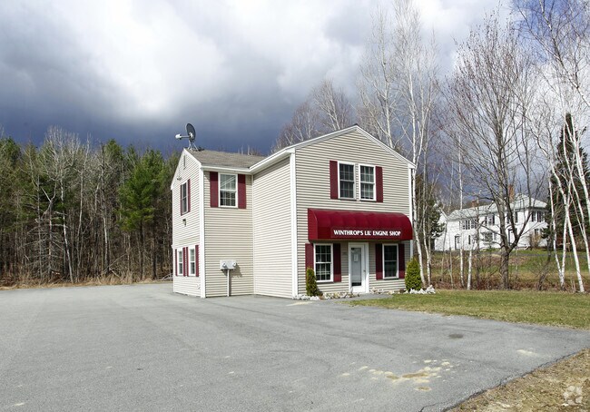
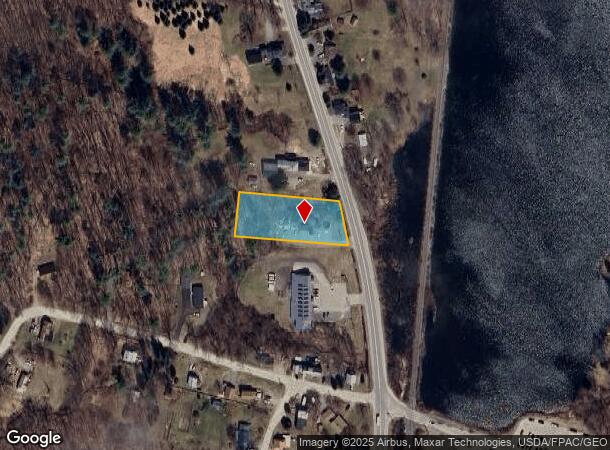
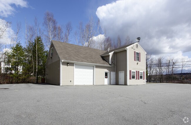
Property Record
190 Route 133, Winthrop, ME 04364
NEARBY LISTINGS FOR SALE OR LEASE
-
-
View all Winthrop listings for sale on LoopNet.com
Property Detail
190 Route 133
WINP-000030-000033-B000001
Kennebec
Officebuilding
Maine
X
33
23011C0486D
0.69 AC
2024
Maine South & Augusta
2024
Other Market Areas
014001
Augusta-Waterville, ME
1,856 SF
DEMOGRAPHICS near 190 Route 133
1 Mile
3 Mile
5 Mile
2024 Total Population
2,151
5,555
10,070
2029 Population
2,256
5,833
10,553
Pop Growth 2024-2029
+ 4.88%
+ 5.00%
+ 4.80%
Average Age
42
44
44
2024 Total Households
972
2,411
4,316
HH Growth 2024-2029
+ 4.94%
+ 5.10%
+ 4.94%
Median Household Inc
$57,313
$75,285
$75,915
Avg Household Size
2.20
2.30
2.30
2024 Avg HH Vehicles
2.00
2.00
2.00
Median Home Value
$219,028
$241,328
$251,257
Median Year Built
1970
1975
1977
Nearby Places
- Restaurants
- Banks
- Shops
- Fitness
- Groceries
Nearby Properties
Address
Land Use
TOTAL SIZE
Lot Size
Zoning
Address
Land Use
TOTAL SIZE
Lot Size
Zoning
72,274 SF
90.83 AC
MIX
Address
Land Use
TOTAL SIZE
Lot Size
Zoning
Address
Land Use
TOTAL SIZE
Lot Size
Zoning
232,995 SF
54.40 AC
MIX
Address
Land Use
TOTAL SIZE
Lot Size
Zoning
17.75 AC
V
Address
Land Use
TOTAL SIZE
Lot Size
Zoning
3.14 AC
V
Address
Land Use
TOTAL SIZE
Lot Size
Zoning
122,149 SF
18.97 AC
GC
Address
Land Use
TOTAL SIZE
Lot Size
Zoning
36,453 SF
3.94 AC
GC
Address
Land Use
TOTAL SIZE
Lot Size
Zoning
149.78 AC
MIX
Address
Land Use
TOTAL SIZE
Lot Size
Zoning
9,786 SF
2.32 AC
GC
Address
Land Use
TOTAL SIZE
Lot Size
Zoning
17.10 AC
GC
Address
Land Use
TOTAL SIZE
Lot Size
Zoning
124.99 AC
MIX
Address
Land Use
TOTAL SIZE
Lot Size
Zoning
14,360 SF
1.24 AC
GC
Address
Land Use
TOTAL SIZE
Lot Size
Zoning
13,718 SF
5.30 AC
RU
Address
Land Use
TOTAL SIZE
Lot Size
Zoning
3.67 AC
GR
Address
Land Use
TOTAL SIZE
Lot Size
Zoning
3.19 AC
V
Address
Land Use
TOTAL SIZE
Lot Size
Zoning
3,168 SF
1.97 AC
GC
Address
Land Use
TOTAL SIZE
Lot Size
Zoning
10,902 SF
3.20 AC
GC
Address
Land Use
TOTAL SIZE
Lot Size
Zoning
1,176 SF
RP
Address
Land Use
TOTAL SIZE
Lot Size
Zoning
2.15 AC
GR
Address
Land Use
TOTAL SIZE
Lot Size
Zoning
8.50 AC
RU
Address
Land Use
TOTAL SIZE
Lot Size
Zoning
3.50 AC
MIX
Address
Land Use
TOTAL SIZE
Lot Size
Zoning
99.66 AC
MIX
Address
Land Use
TOTAL SIZE
Lot Size
Zoning
2,788 SF
19.53 AC
MIX
Address
Land Use
TOTAL SIZE
Lot Size
Zoning
5,835 SF
18.95 AC
MIX
Address
Land Use
TOTAL SIZE
Lot Size
Zoning
8,400 SF
1.47 AC
GC
Address
Land Use
TOTAL SIZE
Lot Size
Zoning
20,400 SF
3.10 AC
GC
Address
Land Use
TOTAL SIZE
Lot Size
Zoning
4,457 SF
1.84 AC
PW
Address
Land Use
TOTAL SIZE
Lot Size
Zoning
5,708 SF
2.97 AC
MIX
Address
Land Use
TOTAL SIZE
Lot Size
Zoning
188.04 AC
RU
Address
Land Use
TOTAL SIZE
Lot Size
Zoning
11,036 SF
3.14 AC
MIX
The World's #1 Commercial Real Estate Marketplace
Connect with us
© 2025 CoStar Group
The information above has been obtained from sources believed reliable. While we do not doubt its accuracy we have not verified it and make no guarantee, warranty or representation about it. It is your responsibility to independently confirm its accuracy and completeness. Any projections, opinions, assumptions, or estimates used are for example only and do not represent the current or future performance of the property. The value of this transaction to you depends on tax and other factors which should be evaluated by your tax, financial, and legal advisors. You and your advisors should conduct a careful, independent investigation of the property to determine to your satisfaction the suitability of the property for your needs.