Property Record
190 S 500 W, Bountiful, UT 84010

Save to a Folder
{{folder.Name}}
{{folder.ListingIds.length}} Properties
{{folder.ListingIds.length}} Property
Create a New Folder
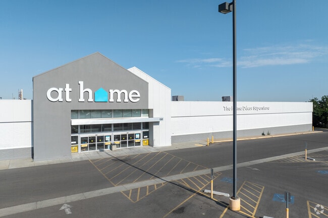
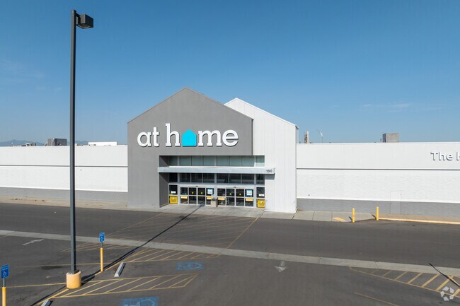
Property Detail
190 S 500 W
06-039-0213
BEG ON THE W LINE OF A HWY AT A PT N 89^59'16" W 171.98 FT ALG THE SEC LINE & N 0^12'25" W 617.50 FT ALG SD HWY LINE & S 89^47'35" W 292.0 FT FR THE NE COR OF SEC 25-T2N-R1W, SLM; & RUN TH N 0^12'25"
Wholesaleoutletdiscountstore
DAVIS
CG
Utah
B and X Area of moderate flood hazard, usually the area between the limits of the 100-year and 500-year floods.
6.70 AC
2025
Davis/Weber Counties
2025
Salt Lake City
126700
Ogden, UT
100,999 SF
NEARBY LISTINGS FOR SALE OR LEASE
DEMOGRAPHICS near 190 S 500 W
1 mile
3 mile
5 mile
2025 Total Population
11,547
76,587
104,136
2030 Population
11,785
78,064
106,530
Pop Growth 2025-2030
+ 2.06%
+ 1.93%
+ 2.30%
Average Age
37
37
37
2025 Total Households
4,319
25,629
34,208
HH Growth 2025-2030
+ 2.27%
+ 2.07%
+ 2.45%
Median Household Inc
$89,710
$107,687
$112,236
Avg Household Size
2.60
3.00
3.00
2025 Avg HH Vehicles
2.00
2.00
2.00
Median Home Value
$474,699
$566,348
$594,319
Median Year Built
1975
1978
1984
Nearby Places
Map Layers
Map Styles
 Street
 Aerial
Layers
 Traffic
 Biking
Places
Listings with unknown addresses are not visible on the map
- Restaurants
- Banks
- Shops
- Fitness
- Groceries
PUBLIC TRANSPORTATION
COMMUTER RAIL
Woods Cross (FrontRunner North - Utah Transit Authority (UTA))
Drive
Walk
Distance
Woods Cross (FrontRunner North - Utah Transit Authority (UTA))
3 min
1.1 mi
Warm Springs Relief Point (FrontRunner - Utah Transit Authority (UTA))
Drive
Walk
Distance
Warm Springs Relief Point (FrontRunner - Utah Transit Authority (UTA))
14 min
8.2 mi
AIRPORT
Salt Lake City International
Drive
Walk
Distance
Salt Lake City International
19 min
13.4 mi
Freight Ports
Port of Stockton
Drive
Walk
Distance
Port of Stockton
719 min
703.7 mi
Nearby Properties
Address
Land Use
TOTAL SIZE
Lot Size
Zoning
Address
Land Use
TOTAL SIZE
Lot Size
Zoning
123,416 SF
14.85 AC
R4
Address
Land Use
TOTAL SIZE
Lot Size
Zoning
181,804 SF
24.72 AC
Address
Land Use
TOTAL SIZE
Lot Size
Zoning
83,092 SF
9.07 AC
R3
Address
Land Use
TOTAL SIZE
Lot Size
Zoning
240,104 SF
37.03 AC
C2
Address
Land Use
TOTAL SIZE
Lot Size
Zoning
657,526 SF
35.95 AC
MD
Address
Land Use
TOTAL SIZE
Lot Size
Zoning
13,126 SF
7.83 AC
P
Address
Land Use
TOTAL SIZE
Lot Size
Zoning
168,369 SF
10.14 AC
H
Address
Land Use
TOTAL SIZE
Lot Size
Zoning
113,419 SF
16.45 AC
R4
Address
Land Use
TOTAL SIZE
Lot Size
Zoning
92,796 SF
2.22 AC
DN
Address
Land Use
TOTAL SIZE
Lot Size
Zoning
67,712 SF
4.98 AC
CVH
Address
Land Use
TOTAL SIZE
Lot Size
Zoning
219,598 SF
19.99 AC
CVH
Address
Land Use
TOTAL SIZE
Lot Size
Zoning
113,265 SF
0.55 AC
CG
Address
Land Use
TOTAL SIZE
Lot Size
Zoning
45,956 SF
8.44 AC
Address
Land Use
TOTAL SIZE
Lot Size
Zoning
230,020 SF
27.33 AC
MD
Address
Land Use
TOTAL SIZE
Lot Size
Zoning
156,694 SF
7.67 AC
Address
Land Use
TOTAL SIZE
Lot Size
Zoning
167,410 SF
12.89 AC
CG
Address
Land Use
TOTAL SIZE
Lot Size
Zoning
155,896 SF
8.96 AC
Address
Land Use
TOTAL SIZE
Lot Size
Zoning
58,273 SF
3.80 AC
I1
Address
Land Use
TOTAL SIZE
Lot Size
Zoning
532 SF
144.31 AC
A1
Address
Land Use
TOTAL SIZE
Lot Size
Zoning
280,221 SF
30.36 AC
R4
Address
Land Use
TOTAL SIZE
Lot Size
Zoning
167,405 SF
13.81 AC
CVH
Address
Land Use
TOTAL SIZE
Lot Size
Zoning
19,299 SF
3.06 AC
Address
Land Use
TOTAL SIZE
Lot Size
Zoning
3,986 SF
13 AC
CG
Address
Land Use
TOTAL SIZE
Lot Size
Zoning
119,710 SF
13.15 AC
R4
Address
Land Use
TOTAL SIZE
Lot Size
Zoning
6,050 SF
59.94 AC
Address
Land Use
TOTAL SIZE
Lot Size
Zoning
90,104 SF
9.62 AC
CVH
Address
Land Use
TOTAL SIZE
Lot Size
Zoning
66,855 SF
5.84 AC
CVH
Address
Land Use
TOTAL SIZE
Lot Size
Zoning
81,147 SF
4.10 AC
CVH
Address
Land Use
TOTAL SIZE
Lot Size
Zoning
146,381 SF
18.50 AC
PFL
Address
Land Use
TOTAL SIZE
Lot Size
Zoning
72,560 SF
2.32 AC
The World's #1 Commercial Real Estate Marketplace
Connect with us
© 2026 CoStar Group
The information above has been obtained from sources believed reliable. While we do not doubt its accuracy we have not verified it and make no guarantee, warranty or representation about it. It is your responsibility to independently confirm its accuracy and completeness. Any projections, opinions, assumptions, or estimates used are for example only and do not represent the current or future performance of the property. The value of this transaction to you depends on tax and other factors which should be evaluated by your tax, financial, and legal advisors. You and your advisors should conduct a careful, independent investigation of the property to determine to your satisfaction the suitability of the property for your needs.