Property Record
190 Willie Colvin Rd, Robbinsville, NC 28771


NEARBY LISTINGS FOR SALE OR LEASE
-
-
View all Robbinsville listings for sale on LoopNet.com
Property Detail
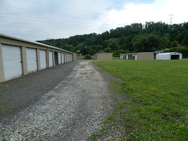
190 Willie Colvin Rd
5661-00-00-1999-0
Survey For Slickrock Development
Publicstorage
FR GLADYS JORDAN
X
Graham
3700566100J
North Carolina
2025
2.61 AC
2025
North Carolina West/Cherokee Area
920200
Other Market Areas
648 SF
DEMOGRAPHICS near 190 Willie Colvin Rd
1 Mile
3 Mile
5 Mile
2024 Total Population
634
2,921
4,888
2029 Population
613
2,864
4,827
Pop Growth 2024-2029
(3.31%)
(1.95%)
(1.25%)
Average Age
41
42
43
2024 Total Households
254
1,175
1,973
HH Growth 2024-2029
(3.54%)
(2.13%)
(1.37%)
Median Household Inc
$33,833
$36,538
$40,181
Avg Household Size
2.50
2.40
2.40
2024 Avg HH Vehicles
2.00
2.00
2.00
Median Home Value
$131,507
$121,988
$123,322
Median Year Built
1988
1985
1985
Nearby Places
Map Layers
Map Styles
 Street
 Aerial
- Restaurants
- Banks
- Shops
- Fitness
- Groceries
Nearby Properties
Address
Land Use
TOTAL SIZE
Lot Size
Zoning
Address
Land Use
TOTAL SIZE
Lot Size
Zoning
3,082 SF
1,151 AC
Address
Land Use
TOTAL SIZE
Lot Size
Zoning
7,200 SF
30.93 AC
Address
Land Use
TOTAL SIZE
Lot Size
Zoning
15,030 SF
11.20 AC
Address
Land Use
TOTAL SIZE
Lot Size
Zoning
169 SF
359.25 AC
Address
Land Use
TOTAL SIZE
Lot Size
Zoning
992 SF
9.90 AC
Address
Land Use
TOTAL SIZE
Lot Size
Zoning
35,722 SF
5.24 AC
Address
Land Use
TOTAL SIZE
Lot Size
Zoning
10,496 SF
1.21 AC
Address
Land Use
TOTAL SIZE
Lot Size
Zoning
3,381 SF
10.94 AC
Address
Land Use
TOTAL SIZE
Lot Size
Zoning
6,592 SF
55.01 AC
Address
Land Use
TOTAL SIZE
Lot Size
Zoning
Address
Land Use
TOTAL SIZE
Lot Size
Zoning
12,352 SF
3 AC
Address
Land Use
TOTAL SIZE
Lot Size
Zoning
25,740 SF
0.42 AC
Address
Land Use
TOTAL SIZE
Lot Size
Zoning
50,452 SF
3.86 AC
Address
Land Use
TOTAL SIZE
Lot Size
Zoning
48,259 SF
6.27 AC
Address
Land Use
TOTAL SIZE
Lot Size
Zoning
1,920 SF
4.53 AC
Address
Land Use
TOTAL SIZE
Lot Size
Zoning
1,920 SF
3.43 AC
Address
Land Use
TOTAL SIZE
Lot Size
Zoning
35,938 SF
5.24 AC
Address
Land Use
TOTAL SIZE
Lot Size
Zoning
11,740 SF
Address
Land Use
TOTAL SIZE
Lot Size
Zoning
1,976 SF
4.08 AC
Address
Land Use
TOTAL SIZE
Lot Size
Zoning
13,064 SF
7.44 AC
Address
Land Use
TOTAL SIZE
Lot Size
Zoning
7,557 SF
3.12 AC
Address
Land Use
TOTAL SIZE
Lot Size
Zoning
4,462 SF
10.96 AC
Address
Land Use
TOTAL SIZE
Lot Size
Zoning
9,967 SF
2.19 AC
Address
Land Use
TOTAL SIZE
Lot Size
Zoning
7,692 SF
2.10 AC
Address
Land Use
TOTAL SIZE
Lot Size
Zoning
5,250 SF
4 AC
Address
Land Use
TOTAL SIZE
Lot Size
Zoning
4,462 SF
2.07 AC
Address
Land Use
TOTAL SIZE
Lot Size
Zoning
18,750 SF
5.94 AC
Address
Land Use
TOTAL SIZE
Lot Size
Zoning
14,076 SF
0.83 AC
Address
Land Use
TOTAL SIZE
Lot Size
Zoning
32.49 AC
Address
Land Use
TOTAL SIZE
Lot Size
Zoning
864 SF
0.90 AC
The World's #1 Commercial Real Estate Marketplace
Connect with us
© 2026 CoStar Group
The information above has been obtained from sources believed reliable. While we do not doubt its accuracy we have not verified it and make no guarantee, warranty or representation about it. It is your responsibility to independently confirm its accuracy and completeness. Any projections, opinions, assumptions, or estimates used are for example only and do not represent the current or future performance of the property. The value of this transaction to you depends on tax and other factors which should be evaluated by your tax, financial, and legal advisors. You and your advisors should conduct a careful, independent investigation of the property to determine to your satisfaction the suitability of the property for your needs.