Property Record
1900 Anderson Rd, Davis, CA 95616
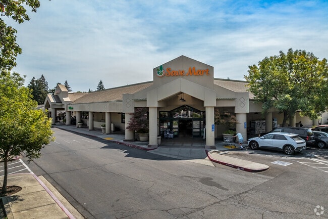

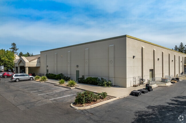
Property Detail
1900 Anderson Rd
034-093-008-000
LEGAL VERIFIED 2015-0036262
Supermarket
Yolo
C-N
California
C and X Area of minimal flood hazard, usually depicted on FIRMs as above the 500-year flood level.
1
2024
3.09 AC
2025
Davis
010704
Sacramento
37,946 SF
Sacramento-Roseville-Folsom, CA
NEARBY LISTINGS FOR SALE OR LEASE
DEMOGRAPHICS near 1900 Anderson Rd
1 mile
3 mile
5 mile
2025 Total Population
27,750
77,641
85,857
2030 Population
28,623
79,846
88,171
Pop Growth 2025-2030
+ 3.15%
+ 2.84%
+ 2.70%
Average Age
34
34
34
2025 Total Households
10,142
26,618
29,756
HH Growth 2025-2030
+ 3.14%
+ 2.79%
+ 2.67%
Median Household Inc
$82,407
$83,508
$89,202
Avg Household Size
2.40
2.50
2.50
2025 Avg HH Vehicles
2.00
2.00
2.00
Median Home Value
$854,175
$806,070
$837,726
Median Year Built
1978
1983
1983
Nearby Places
Map Layers
Map Styles
 Street
 Aerial
Layers
 Traffic
 Biking
Places
Listings with unknown addresses are not visible on the map
- Restaurants
- Banks
- Shops
- Fitness
- Groceries
PUBLIC TRANSPORTATION
COMMUTER RAIL
Drive
Walk
Distance
7 min
2.2 mi
AIRPORT
Sacramento International
Drive
Walk
Distance
Sacramento International
28 min
19.2 mi
Freight Ports
Port of Stockton
Drive
Walk
Distance
Port of Stockton
72 min
60.0 mi
Nearby Properties
Address
Land Use
TOTAL SIZE
Lot Size
Zoning
Address
Land Use
TOTAL SIZE
Lot Size
Zoning
11.18 AC
P-D
Address
Land Use
TOTAL SIZE
Lot Size
Zoning
40,000 SF
16.56 AC
A1
Address
Land Use
TOTAL SIZE
Lot Size
Zoning
5.92 AC
P-D
Address
Land Use
TOTAL SIZE
Lot Size
Zoning
29,376 SF
0.14 AC
PD
Address
Land Use
TOTAL SIZE
Lot Size
Zoning
225,000 SF
7.43 AC
PD
Address
Land Use
TOTAL SIZE
Lot Size
Zoning
185,271 SF
1.01 AC
RHD
Address
Land Use
TOTAL SIZE
Lot Size
Zoning
0.20 AC
I
Address
Land Use
TOTAL SIZE
Lot Size
Zoning
209,988 SF
0.11 AC
PD
Address
Land Use
TOTAL SIZE
Lot Size
Zoning
168,279 SF
0.09 AC
R-M
Address
Land Use
TOTAL SIZE
Lot Size
Zoning
110,839 SF
0.26 AC
R3M
Address
Land Use
TOTAL SIZE
Lot Size
Zoning
134,214 SF
5.99 AC
PD
Address
Land Use
TOTAL SIZE
Lot Size
Zoning
174,228 SF
0.16 AC
PD
Address
Land Use
TOTAL SIZE
Lot Size
Zoning
4.40 AC
PD
Address
Land Use
TOTAL SIZE
Lot Size
Zoning
107,817 SF
6.44 AC
PD
Address
Land Use
TOTAL SIZE
Lot Size
Zoning
1.37 AC
PD
Address
Land Use
TOTAL SIZE
Lot Size
Zoning
2.52 AC
I
Address
Land Use
TOTAL SIZE
Lot Size
Zoning
99,399 SF
5.83 AC
I
Address
Land Use
TOTAL SIZE
Lot Size
Zoning
152,916 SF
0.17 AC
PD
Address
Land Use
TOTAL SIZE
Lot Size
Zoning
13,068 SF
8.25 AC
PD
Address
Land Use
TOTAL SIZE
Lot Size
Zoning
1.74 AC
CH
Address
Land Use
TOTAL SIZE
Lot Size
Zoning
68,428 SF
0.29 AC
PD
Address
Land Use
TOTAL SIZE
Lot Size
Zoning
213,692 SF
8.07 AC
03
Address
Land Use
TOTAL SIZE
Lot Size
Zoning
1.93 AC
PD
Address
Land Use
TOTAL SIZE
Lot Size
Zoning
61,829 SF
1.31 AC
CC
Address
Land Use
TOTAL SIZE
Lot Size
Zoning
12,361 SF
0.59 AC
PD
Address
Land Use
TOTAL SIZE
Lot Size
Zoning
70,954 SF
3.73 AC
PD
Address
Land Use
TOTAL SIZE
Lot Size
Zoning
79,719 SF
3.50 AC
PD
Address
Land Use
TOTAL SIZE
Lot Size
Zoning
59,200 SF
2.34 AC
R3M
Address
Land Use
TOTAL SIZE
Lot Size
Zoning
2.03 AC
I-R
Address
Land Use
TOTAL SIZE
Lot Size
Zoning
158,000 SF
0.13 AC
PD
The World's #1 Commercial Real Estate Marketplace
Connect with us
© 2026 CoStar Group
The information above has been obtained from sources believed reliable. While we do not doubt its accuracy we have not verified it and make no guarantee, warranty or representation about it. It is your responsibility to independently confirm its accuracy and completeness. Any projections, opinions, assumptions, or estimates used are for example only and do not represent the current or future performance of the property. The value of this transaction to you depends on tax and other factors which should be evaluated by your tax, financial, and legal advisors. You and your advisors should conduct a careful, independent investigation of the property to determine to your satisfaction the suitability of the property for your needs.