Property Record
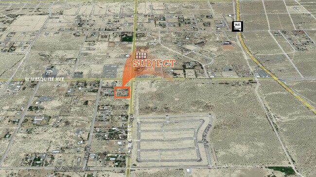
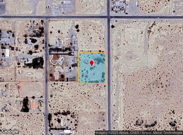
1900 N Blagg Rd, Pahrump, NV 89060
NEARBY LISTINGS FOR SALE OR LEASE
Property Detail
1900 N Blagg Rd
Pahrump, NV
Nye
35-051-02
Nevada
Sfr
2.50 AC
X
Carson City/Nevada Area
32023C8825F
Other Market Areas
DEMOGRAPHICS near 1900 N Blagg Rd
1 Mile
3 Mile
5 Mile
2024 Total Population
959
10,458
26,379
2029 Population
1,125
12,146
30,810
Pop Growth 2024-2029
+ 17.31%
+ 16.14%
+ 16.80%
Average Age
48
50
49
2024 Total Households
374
4,269
11,213
HH Growth 2024-2029
+ 17.65%
+ 16.51%
+ 17.01%
Median Household Inc
$65,332
$49,976
$52,075
Avg Household Size
2.30
2.20
2.30
2024 Avg HH Vehicles
2.00
2.00
2.00
Median Home Value
$164,814
$193,566
$228,015
Median Year Built
1994
1996
1996
Nearby Places
- Restaurants
- Banks
- Shops
- Fitness
- Groceries
SALE & LEASE HISTORY
LISTING DATE
SALE/LEASE

Nov 02, 2021
For Sale
Aug 04, 2022
For Sale
Nearby Properties
Address
Land Use
TOTAL SIZE
Lot Size
Zoning
Address
Land Use
TOTAL SIZE
Lot Size
Zoning
191,653 SF
118.11 AC
CF
Address
Land Use
TOTAL SIZE
Lot Size
Zoning
76,885 SF
12.53 AC
LI
Address
Land Use
TOTAL SIZE
Lot Size
Zoning
128,429 SF
19.39 AC
CF
Address
Land Use
TOTAL SIZE
Lot Size
Zoning
51,128 SF
24.15 AC
M
Address
Land Use
TOTAL SIZE
Lot Size
Zoning
156,375 SF
13.60 AC
GC
Address
Land Use
TOTAL SIZE
Lot Size
Zoning
106,309 SF
12.24 AC
GC
Address
Land Use
TOTAL SIZE
Lot Size
Zoning
62,279 SF
7.09 AC
GC
Address
Land Use
TOTAL SIZE
Lot Size
Zoning
56,409 SF
5.44 AC
GC
Address
Land Use
TOTAL SIZE
Lot Size
Zoning
6.91 AC
LI
Address
Land Use
TOTAL SIZE
Lot Size
Zoning
12,000 SF
9.54 AC
CF
Address
Land Use
TOTAL SIZE
Lot Size
Zoning
48,436 SF
5 AC
M
Address
Land Use
TOTAL SIZE
Lot Size
Zoning
560 SF
5.30 AC
LI
Address
Land Use
TOTAL SIZE
Lot Size
Zoning
10,280 SF
6.73 AC
Address
Land Use
TOTAL SIZE
Lot Size
Zoning
20,053 SF
4.61 AC
CF
Address
Land Use
TOTAL SIZE
Lot Size
Zoning
10,282 SF
34.27 AC
OS
Address
Land Use
TOTAL SIZE
Lot Size
Zoning
13,885 SF
2.01 AC
M
Address
Land Use
TOTAL SIZE
Lot Size
Zoning
18,746 SF
5.08 AC
NC
Address
Land Use
TOTAL SIZE
Lot Size
Zoning
12,160 SF
1.26 AC
M
Address
Land Use
TOTAL SIZE
Lot Size
Zoning
12,000 SF
5 AC
CM
Address
Land Use
TOTAL SIZE
Lot Size
Zoning
7,656 SF
5.75 AC
CF
Address
Land Use
TOTAL SIZE
Lot Size
Zoning
24,400 SF
1.10 AC
GC
Address
Land Use
TOTAL SIZE
Lot Size
Zoning
8,400 SF
2.17 AC
GC
Address
Land Use
TOTAL SIZE
Lot Size
Zoning
9,306 SF
4.69 AC
MU
Address
Land Use
TOTAL SIZE
Lot Size
Zoning
9,292 SF
1.06 AC
GC
Address
Land Use
TOTAL SIZE
Lot Size
Zoning
20,575 SF
1.63 AC
GC
Address
Land Use
TOTAL SIZE
Lot Size
Zoning
17,070 SF
2.11 AC
GC
Address
Land Use
TOTAL SIZE
Lot Size
Zoning
4,931 SF
1.21 AC
GC
Address
Land Use
TOTAL SIZE
Lot Size
Zoning
1,200 SF
10.02 AC
CF
Address
Land Use
TOTAL SIZE
Lot Size
Zoning
0.46 AC
AO
Address
Land Use
TOTAL SIZE
Lot Size
Zoning
11,368 SF
4.71 AC
HI
The World's #1 Commercial Real Estate Marketplace
Connect with us
© 2025 CoStar Group
The information above has been obtained from sources believed reliable. While we do not doubt its accuracy we have not verified it and make no guarantee, warranty or representation about it. It is your responsibility to independently confirm its accuracy and completeness. Any projections, opinions, assumptions, or estimates used are for example only and do not represent the current or future performance of the property. The value of this transaction to you depends on tax and other factors which should be evaluated by your tax, financial, and legal advisors. You and your advisors should conduct a careful, independent investigation of the property to determine to your satisfaction the suitability of the property for your needs.