Property Record
1900 Carlton Rd, Cleveland, OH 44134

NEARBY LISTINGS FOR SALE OR LEASE
Property Detail
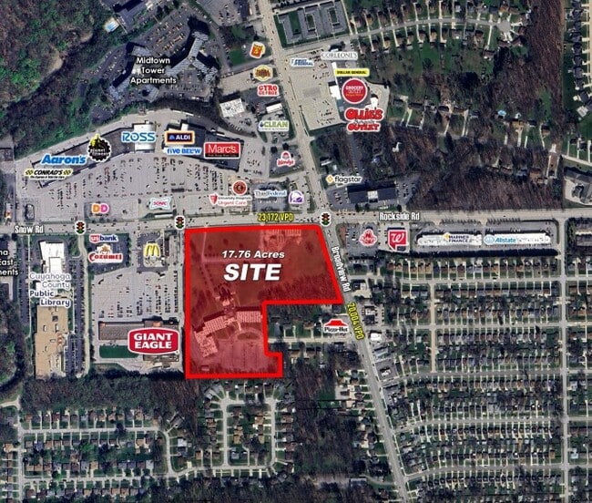
1900 Carlton Rd
Cleveland-Elyria, OH
Byzantine Catholic Diocese Of Parma Lot
445-28-009
9 000B
Commercialnec
Cuyahoga
X
Ohio
39035C0189E
b
2024
17.68 AC
2024
Southwest
177302
Cleveland
68,709 SF
DEMOGRAPHICS near 1900 Carlton Rd
1 Mile
3 Mile
5 Mile
2024 Total Population
14,627
94,523
232,126
2029 Population
14,025
90,918
223,065
Pop Growth 2024-2029
(4.12%)
(3.81%)
(3.90%)
Average Age
42
42
41
2024 Total Households
6,393
40,699
98,668
HH Growth 2024-2029
(4.40%)
(4.10%)
(4.17%)
Median Household Inc
$57,451
$58,957
$52,929
Avg Household Size
2.20
2.20
2.30
2024 Avg HH Vehicles
2.00
2.00
2.00
Median Home Value
$149,910
$142,819
$142,137
Median Year Built
1957
1954
1954
Nearby Places
Map Layers
Map Styles
 Street
 Aerial
- Restaurants
- Banks
- Shops
- Fitness
- Groceries
PUBLIC TRANSPORTATION
COMMUTER RAIL
Rockside (National Park Scenic Railway - Cuyahoga Valley Scenic Railroad)
DRIVE
WALK
Distance
Rockside (National Park Scenic Railway - Cuyahoga Valley Scenic Railroad)
9 min
4.2 mi
Canal Exploration Center (National Park Scenic Railway - Cuyahoga Valley Scenic Railroad)
DRIVE
WALK
Distance
Canal Exploration Center (National Park Scenic Railway - Cuyahoga Valley Scenic Railroad)
11 min
5.7 mi
AIRPORT
Cleveland-Hopkins International
DRIVE
WALK
Distance
Cleveland-Hopkins International
21 min
10.2 mi
Freight Ports
Port of Toledo
DRIVE
WALK
Distance
Port of Toledo
135 min
111.4 mi
SALE & LEASE HISTORY
LISTING DATE
SALE/LEASE

Jan 09, 2025
For Sale
Nearby Properties
Address
Land Use
TOTAL SIZE
Lot Size
Zoning
Address
Land Use
TOTAL SIZE
Lot Size
Zoning
162,711 SF
192.04 AC
IG
Address
Land Use
TOTAL SIZE
Lot Size
Zoning
477,641 SF
14.07 AC
MF-1
Address
Land Use
TOTAL SIZE
Lot Size
Zoning
436,164 SF
20.01 AC
U-5
Address
Land Use
TOTAL SIZE
Lot Size
Zoning
245,255 SF
14 AC
Address
Land Use
TOTAL SIZE
Lot Size
Zoning
384,714 SF
4.75 AC
U-5-HR
Address
Land Use
TOTAL SIZE
Lot Size
Zoning
238,500 SF
20.31 AC
SC
Address
Land Use
TOTAL SIZE
Lot Size
Zoning
379,061 SF
42.68 AC
Address
Land Use
TOTAL SIZE
Lot Size
Zoning
632,686 SF
16.44 AC
MF-3
Address
Land Use
TOTAL SIZE
Lot Size
Zoning
102,219 SF
14.01 AC
RB
Address
Land Use
TOTAL SIZE
Lot Size
Zoning
281,600 SF
18.73 AC
SF-A
Address
Land Use
TOTAL SIZE
Lot Size
Zoning
475,286 SF
5.81 AC
U-5-HR
Address
Land Use
TOTAL SIZE
Lot Size
Zoning
46,250 SF
16.36 AC
U-5
Address
Land Use
TOTAL SIZE
Lot Size
Zoning
239,000 SF
6.29 AC
U-6A
Address
Land Use
TOTAL SIZE
Lot Size
Zoning
372,486 SF
3.98 AC
GR
Address
Land Use
TOTAL SIZE
Lot Size
Zoning
60,989 SF
9.31 AC
U-4
Address
Land Use
TOTAL SIZE
Lot Size
Zoning
225,593 SF
4.79 AC
U-6A
Address
Land Use
TOTAL SIZE
Lot Size
Zoning
78,622 SF
11.78 AC
CB
Address
Land Use
TOTAL SIZE
Lot Size
Zoning
168,322 SF
14.44 AC
Address
Land Use
TOTAL SIZE
Lot Size
Zoning
49,998 SF
19.72 AC
U-6
Address
Land Use
TOTAL SIZE
Lot Size
Zoning
440,765 SF
44.35 AC
2F
Address
Land Use
TOTAL SIZE
Lot Size
Zoning
209,068 SF
23.10 AC
IG
Address
Land Use
TOTAL SIZE
Lot Size
Zoning
245,255 SF
13.34 AC
Address
Land Use
TOTAL SIZE
Lot Size
Zoning
19.48 AC
U5-A
Address
Land Use
TOTAL SIZE
Lot Size
Zoning
83,375 SF
9.29 AC
MF-1
Address
Land Use
TOTAL SIZE
Lot Size
Zoning
87,489 SF
8.01 AC
Address
Land Use
TOTAL SIZE
Lot Size
Zoning
86,900 SF
18.01 AC
U-5
Address
Land Use
TOTAL SIZE
Lot Size
Zoning
239,222 SF
22.87 AC
G-B
Address
Land Use
TOTAL SIZE
Lot Size
Zoning
208,675 SF
17.33 AC
G-B
Address
Land Use
TOTAL SIZE
Lot Size
Zoning
116,373 SF
13.28 AC
U-3
Address
Land Use
TOTAL SIZE
Lot Size
Zoning
54,055 SF
3.11 AC
U-4
The World's #1 Commercial Real Estate Marketplace
Connect with us
© 2025 CoStar Group
The information above has been obtained from sources believed reliable. While we do not doubt its accuracy we have not verified it and make no guarantee, warranty or representation about it. It is your responsibility to independently confirm its accuracy and completeness. Any projections, opinions, assumptions, or estimates used are for example only and do not represent the current or future performance of the property. The value of this transaction to you depends on tax and other factors which should be evaluated by your tax, financial, and legal advisors. You and your advisors should conduct a careful, independent investigation of the property to determine to your satisfaction the suitability of the property for your needs.