Property Record
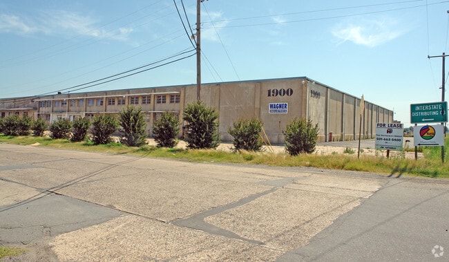
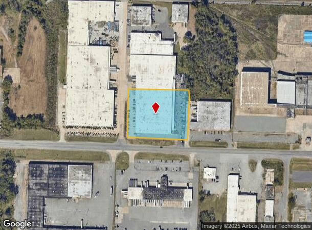
1900 E Roosevelt Rd, Little Rock, AR 72206
NEARBY LISTINGS FOR SALE OR LEASE
Property Detail
1900 E Roosevelt Rd
34L-233-00-044-01
Shilcotts Commercial Annax
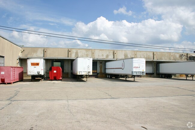
Warehouse
PT N1/2 NW BG 970 5W OF NW CR S357 E369 N357 TH W TO POB 13 1N 12W C/O 37135
X
Pulaski
05119C0457G
Arkansas
2025
2.72 AC
2025
Airport
980400
Little Rock/N Little Rock
117,830 SF
Little Rock-North Little Rock-Conway, AR
DEMOGRAPHICS near 1900 E Roosevelt Rd
1 mile
3 mile
5 mile
2024 Total Population
1,279
23,770
77,026
2029 Population
1,327
24,477
78,882
Pop Growth 2024-2029
+ 3.75%
+ 2.97%
+ 2.41%
Average Age
39
41
40
2024 Total Households
550
11,639
35,570
HH Growth 2024-2029
+ 3.82%
+ 2.90%
+ 2.47%
Median Household Inc
$19,912
$34,243
$39,104
Avg Household Size
2.20
1.90
2.00
2024 Avg HH Vehicles
1.00
1.00
1.00
Median Home Value
$79,220
$129,328
$127,117
Median Year Built
1966
1964
1965
Nearby Places
Map Layers
Map Styles
 Street
 Aerial
Transit
 Traffic
 Biking
Places
Listings with unknown addresses are not visible on the map
- Restaurants
- Banks
- Shops
- Fitness
- Groceries
PUBLIC TRANSPORTATION
COMMUTER RAIL
Little Rock Union Station (Texas Eagle - Amtrak)
Drive
Walk
Distance
Little Rock Union Station (Texas Eagle - Amtrak)
7 min
4.0 mi
AIRPORT
Bill and Hillary Clinton Ntl/Adams Field
Drive
Walk
Distance
Bill and Hillary Clinton Ntl/Adams Field
4 min
2.1 mi
Freight Ports
Port of Shreveport
Drive
Walk
Distance
Port of Shreveport
250 min
233.0 mi
Nearby Properties
Address
Land Use
TOTAL SIZE
Lot Size
Zoning
Address
Land Use
TOTAL SIZE
Lot Size
Zoning
1,000,000 SF
9.38 AC
Address
Land Use
TOTAL SIZE
Lot Size
Zoning
333,096 SF
11.62 AC
Address
Land Use
TOTAL SIZE
Lot Size
Zoning
237,144 SF
1.26 AC
Address
Land Use
TOTAL SIZE
Lot Size
Zoning
180,616 SF
0.91 AC
Address
Land Use
TOTAL SIZE
Lot Size
Zoning
12,562 SF
2.26 AC
Address
Land Use
TOTAL SIZE
Lot Size
Zoning
412,597 SF
Address
Land Use
TOTAL SIZE
Lot Size
Zoning
22,017 SF
2.06 AC
Address
Land Use
TOTAL SIZE
Lot Size
Zoning
761,810 SF
75.61 AC
Address
Land Use
TOTAL SIZE
Lot Size
Zoning
2,636 SF
0.67 AC
Address
Land Use
TOTAL SIZE
Lot Size
Zoning
267,152 SF
Address
Land Use
TOTAL SIZE
Lot Size
Zoning
260,000 SF
5.80 AC
Address
Land Use
TOTAL SIZE
Lot Size
Zoning
143,553 SF
12.76 AC
Address
Land Use
TOTAL SIZE
Lot Size
Zoning
130,742 SF
15.71 AC
Address
Land Use
TOTAL SIZE
Lot Size
Zoning
95,719 SF
32.76 AC
Address
Land Use
TOTAL SIZE
Lot Size
Zoning
346,974 SF
Address
Land Use
TOTAL SIZE
Lot Size
Zoning
138,352 SF
2.95 AC
Address
Land Use
TOTAL SIZE
Lot Size
Zoning
61,225 SF
5.66 AC
Address
Land Use
TOTAL SIZE
Lot Size
Zoning
269,624 SF
3.40 AC
Address
Land Use
TOTAL SIZE
Lot Size
Zoning
361,910 SF
Address
Land Use
TOTAL SIZE
Lot Size
Zoning
83,652 SF
12.55 AC
Address
Land Use
TOTAL SIZE
Lot Size
Zoning
220,800 SF
2.92 AC
Address
Land Use
TOTAL SIZE
Lot Size
Zoning
9,272 SF
0.58 AC
Address
Land Use
TOTAL SIZE
Lot Size
Zoning
57,701 SF
1.93 AC
Address
Land Use
TOTAL SIZE
Lot Size
Zoning
83,506 SF
Address
Land Use
TOTAL SIZE
Lot Size
Zoning
142,944 SF
Address
Land Use
TOTAL SIZE
Lot Size
Zoning
244,722 SF
1.31 AC
Address
Land Use
TOTAL SIZE
Lot Size
Zoning
153,264 SF
2.45 AC
Address
Land Use
TOTAL SIZE
Lot Size
Zoning
146,636 SF
1.17 AC
Address
Land Use
TOTAL SIZE
Lot Size
Zoning
178,019 SF
Address
Land Use
TOTAL SIZE
Lot Size
Zoning
67,914 SF
3.24 AC
The World's #1 Commercial Real Estate Marketplace
Connect with us
© 2026 CoStar Group
The information above has been obtained from sources believed reliable. While we do not doubt its accuracy we have not verified it and make no guarantee, warranty or representation about it. It is your responsibility to independently confirm its accuracy and completeness. Any projections, opinions, assumptions, or estimates used are for example only and do not represent the current or future performance of the property. The value of this transaction to you depends on tax and other factors which should be evaluated by your tax, financial, and legal advisors. You and your advisors should conduct a careful, independent investigation of the property to determine to your satisfaction the suitability of the property for your needs.