Property Record
1900 E Southport Pkwy, Wilmer, TX 75172
NEARBY LISTINGS FOR SALE OR LEASE
Property Detail
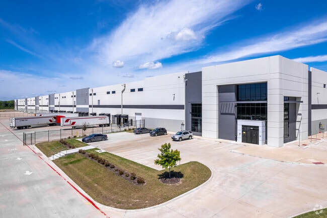
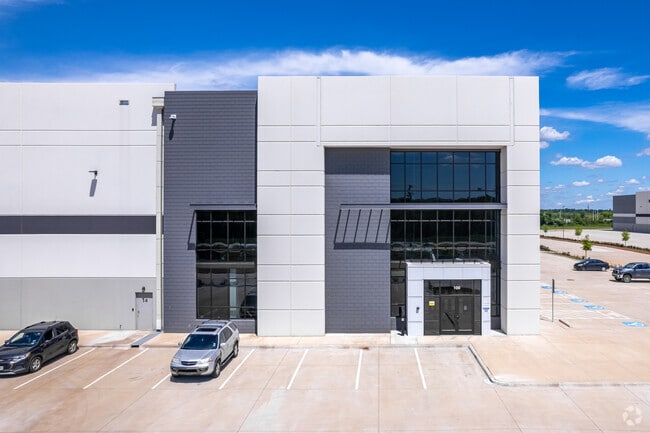
1900 E Southport Pkwy
65127161010010200
Robert Sloan
Warehouse
ROBERT SLOAN ABST 1271 PG 610 TR 1.2 ACS 23.00 INT202100390415 DD12302021 CO-DC 1271610100102 4NT12716101
X
Dallas
48113C0520K
Texas
2024
23 AC
2025
SE Dallas/I-45
016903
Dallas/Ft Worth
530,207 SF
Dallas-Fort Worth-Arlington, TX
DEMOGRAPHICS near 1900 E Southport Pkwy
1 Mile
3 Mile
5 Mile
2024 Total Population
56
11,090
33,254
2029 Population
60
11,448
33,660
Pop Growth 2024-2029
+ 7.14%
+ 3.23%
+ 1.22%
Average Age
31
33
33
2024 Total Households
17
3,322
8,940
HH Growth 2024-2029
+ 5.88%
+ 3.07%
+ 1.21%
Median Household Inc
$55,999
$49,271
$49,517
Avg Household Size
3.30
3.30
3.40
2024 Avg HH Vehicles
2.00
2.00
2.00
Median Home Value
$116,667
$113,392
$133,672
Median Year Built
2009
1995
1991
Nearby Places
Map Layers
Map Styles
 Street
 Aerial
- Restaurants
- Banks
- Shops
- Fitness
- Groceries
PUBLIC TRANSPORTATION
AIRPORT
Dallas Love Field
DRIVE
WALK
Distance
Dallas Love Field
36 min
21.4 mi
Dallas-Fort Worth International
DRIVE
WALK
Distance
Dallas-Fort Worth International
51 min
37.3 mi
Freight Ports
Port of Shreveport
DRIVE
WALK
Distance
Port of Shreveport
214 min
193.0 mi
Nearby Properties
Address
Land Use
TOTAL SIZE
Lot Size
Zoning
Address
Land Use
TOTAL SIZE
Lot Size
Zoning
1,097,520 SF
58.28 AC
Address
Land Use
TOTAL SIZE
Lot Size
Zoning
1,073,520 SF
55.17 AC
Z123
Address
Land Use
TOTAL SIZE
Lot Size
Zoning
1,039,360 SF
64.13 AC
Z123
Address
Land Use
TOTAL SIZE
Lot Size
Zoning
1,033,503 SF
51.34 AC
Address
Land Use
TOTAL SIZE
Lot Size
Zoning
960,665 SF
46.03 AC
Z31
Address
Land Use
TOTAL SIZE
Lot Size
Zoning
799,765 SF
45.66 AC
Z31
Address
Land Use
TOTAL SIZE
Lot Size
Zoning
754,897 SF
42.75 AC
Z123
Address
Land Use
TOTAL SIZE
Lot Size
Zoning
660,000 SF
39.24 AC
Z31
Address
Land Use
TOTAL SIZE
Lot Size
Zoning
698,880 SF
37.31 AC
Z31
Address
Land Use
TOTAL SIZE
Lot Size
Zoning
750,000 SF
37.12 AC
Z31
Address
Land Use
TOTAL SIZE
Lot Size
Zoning
587,000 SF
33.94 AC
Z123
Address
Land Use
TOTAL SIZE
Lot Size
Zoning
626,100 SF
30.45 AC
Z398
Address
Land Use
TOTAL SIZE
Lot Size
Zoning
570,000 SF
30.48 AC
Z251
Address
Land Use
TOTAL SIZE
Lot Size
Zoning
565,259 SF
38.69 AC
Z123
Address
Land Use
TOTAL SIZE
Lot Size
Zoning
826,620 SF
39.67 AC
Z123
Address
Land Use
TOTAL SIZE
Lot Size
Zoning
416,000 SF
28.69 AC
Z123
Address
Land Use
TOTAL SIZE
Lot Size
Zoning
611,040 SF
39.98 AC
Z251
Address
Land Use
TOTAL SIZE
Lot Size
Zoning
481,520 SF
26.82 AC
Z31
Address
Land Use
TOTAL SIZE
Lot Size
Zoning
431,190 SF
46.46 AC
Z251
Address
Land Use
TOTAL SIZE
Lot Size
Zoning
472,836 SF
31.34 AC
Z123
Address
Land Use
TOTAL SIZE
Lot Size
Zoning
395,099 SF
37.29 AC
Z123
Address
Land Use
TOTAL SIZE
Lot Size
Zoning
349,936 SF
24.34 AC
Z31
Address
Land Use
TOTAL SIZE
Lot Size
Zoning
334,800 SF
18.16 AC
Z251
Address
Land Use
TOTAL SIZE
Lot Size
Zoning
370,139 SF
15.42 AC
Z268
Address
Land Use
TOTAL SIZE
Lot Size
Zoning
80,980 SF
15.18 AC
AG
Address
Land Use
TOTAL SIZE
Lot Size
Zoning
293,570 SF
14.36 AC
Z251
Address
Land Use
TOTAL SIZE
Lot Size
Zoning
272,800 SF
16.89 AC
Z31
Address
Land Use
TOTAL SIZE
Lot Size
Zoning
379 SF
74.05 AC
Address
Land Use
TOTAL SIZE
Lot Size
Zoning
229,907 SF
12.87 AC
Z123
The World's #1 Commercial Real Estate Marketplace
Connect with us
© 2026 CoStar Group
The information above has been obtained from sources believed reliable. While we do not doubt its accuracy we have not verified it and make no guarantee, warranty or representation about it. It is your responsibility to independently confirm its accuracy and completeness. Any projections, opinions, assumptions, or estimates used are for example only and do not represent the current or future performance of the property. The value of this transaction to you depends on tax and other factors which should be evaluated by your tax, financial, and legal advisors. You and your advisors should conduct a careful, independent investigation of the property to determine to your satisfaction the suitability of the property for your needs.