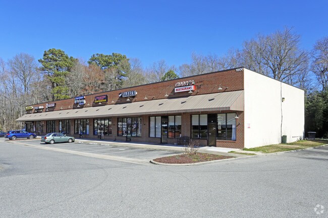
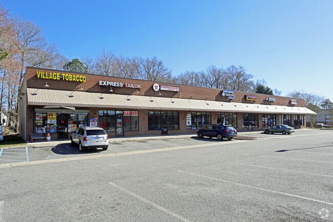
Property Record
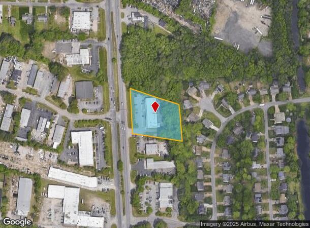
1900 George Washington Mem Hwy, Yorktown, VA 23693
NEARBY LISTINGS FOR SALE OR LEASE
Property Detail
1900 George Washington Mem Hwy
Virginia Beach-Norfolk-Newport News, VA-NC
Markos Mickey N Etals Subdiv
S03D-4070-0367
MARKOS MICKEY N ETALS SUBDIV LOT 3
Stripcommercialcenter
York
X
Virginia
5155270001H
3
2024
1.69 AC
2025
Hampton North
050203
Hampton Roads
10,800 SF
DEMOGRAPHICS near 1900 George Washington Mem Hwy
1 Mile
3 Mile
5 Mile
2024 Total Population
9,219
69,826
175,500
2029 Population
9,580
70,793
176,542
Pop Growth 2024-2029
+ 3.92%
+ 1.38%
+ 0.59%
Average Age
40
38
39
2024 Total Households
3,510
28,225
70,638
HH Growth 2024-2029
+ 3.73%
+ 0.98%
+ 0.39%
Median Household Inc
$97,363
$78,917
$75,107
Avg Household Size
2.60
2.40
2.40
2024 Avg HH Vehicles
2.00
2.00
2.00
Median Home Value
$360,839
$317,693
$283,415
Median Year Built
1993
1990
1984
Nearby Places
Map Layers
Map Styles
 Street
 Aerial
- Restaurants
- Banks
- Shops
- Fitness
- Groceries
PUBLIC TRANSPORTATION
COMMUTER RAIL
DRIVE
WALK
Distance
15 min
7.2 mi
AIRPORT
Newport News/Williamsburg International
DRIVE
WALK
Distance
Newport News/Williamsburg International
11 min
5.1 mi
Norfolk International
DRIVE
WALK
Distance
Norfolk International
38 min
25.2 mi
Nearby Properties
Address
Land Use
TOTAL SIZE
Lot Size
Zoning
Address
Land Use
TOTAL SIZE
Lot Size
Zoning
717,621 SF
141.28 AC
M1
Address
Land Use
TOTAL SIZE
Lot Size
Zoning
464,936 SF
33.26 AC
R7
Address
Land Use
TOTAL SIZE
Lot Size
Zoning
565,343 SF
46.70 AC
C1
Address
Land Use
TOTAL SIZE
Lot Size
Zoning
75,168 SF
824.63 AC
M1
Address
Land Use
TOTAL SIZE
Lot Size
Zoning
393,640 SF
14.12 AC
PLANNED DE
Address
Land Use
TOTAL SIZE
Lot Size
Zoning
25 AC
R8
Address
Land Use
TOTAL SIZE
Lot Size
Zoning
210,585 SF
32.06 AC
R9
Address
Land Use
TOTAL SIZE
Lot Size
Zoning
100 SF
7.27 AC
R9
Address
Land Use
TOTAL SIZE
Lot Size
Zoning
264,447 SF
2.30 AC
C4
Address
Land Use
TOTAL SIZE
Lot Size
Zoning
39,492 SF
798.51 AC
RESOURCE C
Address
Land Use
TOTAL SIZE
Lot Size
Zoning
71,551 SF
110 AC
O3
Address
Land Use
TOTAL SIZE
Lot Size
Zoning
4.62 AC
C4
Address
Land Use
TOTAL SIZE
Lot Size
Zoning
100 SF
7.68 AC
R9
Address
Land Use
TOTAL SIZE
Lot Size
Zoning
617 SF
73.49 AC
M1
Address
Land Use
TOTAL SIZE
Lot Size
Zoning
19.86 AC
R8
Address
Land Use
TOTAL SIZE
Lot Size
Zoning
2,095 SF
23.19 AC
MULTI-FAMI
Address
Land Use
TOTAL SIZE
Lot Size
Zoning
100 SF
14 AC
R7
Address
Land Use
TOTAL SIZE
Lot Size
Zoning
5,389 SF
24.08 AC
RMF,LB
Address
Land Use
TOTAL SIZE
Lot Size
Zoning
11.95 AC
R8
Address
Land Use
TOTAL SIZE
Lot Size
Zoning
517,920 SF
1.56 AC
C4
Address
Land Use
TOTAL SIZE
Lot Size
Zoning
13.10 AC
R5
Address
Land Use
TOTAL SIZE
Lot Size
Zoning
20.73 AC
R7
Address
Land Use
TOTAL SIZE
Lot Size
Zoning
3.95 AC
C4
Address
Land Use
TOTAL SIZE
Lot Size
Zoning
202 SF
18.37 AC
PLANNED DE
Address
Land Use
TOTAL SIZE
Lot Size
Zoning
60,000 SF
1.64 AC
C4
Address
Land Use
TOTAL SIZE
Lot Size
Zoning
4.60 AC
C4
Address
Land Use
TOTAL SIZE
Lot Size
Zoning
100 SF
16.23 AC
R7
Address
Land Use
TOTAL SIZE
Lot Size
Zoning
100 SF
11.10 AC
R7
Address
Land Use
TOTAL SIZE
Lot Size
Zoning
15,224 SF
3 AC
R9
Address
Land Use
TOTAL SIZE
Lot Size
Zoning
18.66 AC
R8
The World's #1 Commercial Real Estate Marketplace
Connect with us
© 2025 CoStar Group
The information above has been obtained from sources believed reliable. While we do not doubt its accuracy we have not verified it and make no guarantee, warranty or representation about it. It is your responsibility to independently confirm its accuracy and completeness. Any projections, opinions, assumptions, or estimates used are for example only and do not represent the current or future performance of the property. The value of this transaction to you depends on tax and other factors which should be evaluated by your tax, financial, and legal advisors. You and your advisors should conduct a careful, independent investigation of the property to determine to your satisfaction the suitability of the property for your needs.