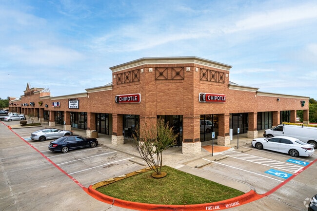
Property Record
1900 Long Prairie Rd, Flower Mound, TX 75022


Property Detail
1900 Long Prairie Rd
Dallas-Fort Worth-Arlington, TX
TOWNE VIEW PLAZA LOT 2AR1 (PT)
R199227
Denton
Commercialnec
Texas
B and X Area of moderate flood hazard, usually the area between the limits of the 100-year and 500-year floods.
2
2024
4.76 AC
2025
Lewisville
021727
Dallas/Ft Worth
32,293 SF
NEARBY LISTINGS FOR SALE OR LEASE
DEMOGRAPHICS near 1900 Long Prairie Rd
1 mile
3 mile
5 mile
2024 Total Population
10,713
74,693
215,337
2029 Population
11,860
82,933
237,246
Pop Growth 2024-2029
+ 10.71%
+ 11.03%
+ 10.17%
Average Age
41
40
39
2024 Total Households
3,536
26,387
79,364
HH Growth 2024-2029
+ 10.94%
+ 11.24%
+ 10.30%
Median Household Inc
$168,978
$144,162
$113,026
Avg Household Size
3.00
2.80
2.70
2024 Avg HH Vehicles
2.00
2.00
2.00
Median Home Value
$611,095
$561,923
$482,135
Median Year Built
1994
1996
1994
Nearby Places
Map Layers
Map Styles
 Street
 Aerial
Transit
 Traffic
 Biking
Places
Listings with unknown addresses are not visible on the map
- Restaurants
- Banks
- Shops
- Fitness
- Groceries
PUBLIC TRANSPORTATION
AIRPORT
Dallas-Fort Worth International
Drive
Walk
Distance
Dallas-Fort Worth International
17 min
10.0 mi
Dallas Love Field
Drive
Walk
Distance
Dallas Love Field
36 min
23.5 mi
SALE & LEASE HISTORY
LISTING DATE
SALE/LEASE

Sep 24, 2016
For Lease
Jan 26, 2017
For Lease
Aug 04, 2017
For Lease
Nearby Properties
Address
Land Use
TOTAL SIZE
Lot Size
Zoning
Address
Land Use
TOTAL SIZE
Lot Size
Zoning
563,145 SF
Address
Land Use
TOTAL SIZE
Lot Size
Zoning
527,463 SF
42.25 AC
Address
Land Use
TOTAL SIZE
Lot Size
Zoning
428,117 SF
67.02 AC
Address
Land Use
TOTAL SIZE
Lot Size
Zoning
531,979 SF
4.54 AC
Address
Land Use
TOTAL SIZE
Lot Size
Zoning
313,369 SF
55.25 AC
Address
Land Use
TOTAL SIZE
Lot Size
Zoning
394,048 SF
16.36 AC
Address
Land Use
TOTAL SIZE
Lot Size
Zoning
309,498 SF
9.57 AC
Address
Land Use
TOTAL SIZE
Lot Size
Zoning
284,952 SF
26.18 AC
Address
Land Use
TOTAL SIZE
Lot Size
Zoning
282,766 SF
9 AC
Address
Land Use
TOTAL SIZE
Lot Size
Zoning
231,043 SF
11.89 AC
Address
Land Use
TOTAL SIZE
Lot Size
Zoning
269,300 SF
60.39 AC
Address
Land Use
TOTAL SIZE
Lot Size
Zoning
748,710 SF
37.91 AC
Address
Land Use
TOTAL SIZE
Lot Size
Zoning
371,268 SF
7.45 AC
Address
Land Use
TOTAL SIZE
Lot Size
Zoning
226,888 SF
5.62 AC
Address
Land Use
TOTAL SIZE
Lot Size
Zoning
650,000 SF
32.01 AC
Address
Land Use
TOTAL SIZE
Lot Size
Zoning
634,805 SF
31.17 AC
Address
Land Use
TOTAL SIZE
Lot Size
Zoning
285,996 SF
13.88 AC
7G
Address
Land Use
TOTAL SIZE
Lot Size
Zoning
226,871 SF
6.22 AC
Address
Land Use
TOTAL SIZE
Lot Size
Zoning
241,095 SF
13.02 AC
Address
Land Use
TOTAL SIZE
Lot Size
Zoning
480,400 SF
26.61 AC
Address
Land Use
TOTAL SIZE
Lot Size
Zoning
465,860 SF
26.80 AC
Address
Land Use
TOTAL SIZE
Lot Size
Zoning
462,000 SF
25.64 AC
Address
Land Use
TOTAL SIZE
Lot Size
Zoning
606,362 SF
29.95 AC
Address
Land Use
TOTAL SIZE
Lot Size
Zoning
401,600 SF
23.07 AC
Address
Land Use
TOTAL SIZE
Lot Size
Zoning
240,886 SF
6.65 AC
Address
Land Use
TOTAL SIZE
Lot Size
Zoning
462,200 SF
26.53 AC
Address
Land Use
TOTAL SIZE
Lot Size
Zoning
91.17 AC
Address
Land Use
TOTAL SIZE
Lot Size
Zoning
327,800 SF
23.74 AC
Address
Land Use
TOTAL SIZE
Lot Size
Zoning
214,415 SF
1.16 AC
Address
Land Use
TOTAL SIZE
Lot Size
Zoning
156,748 SF
4.26 AC
The World's #1 Commercial Real Estate Marketplace
Connect with us
© 2026 CoStar Group
The information above has been obtained from sources believed reliable. While we do not doubt its accuracy we have not verified it and make no guarantee, warranty or representation about it. It is your responsibility to independently confirm its accuracy and completeness. Any projections, opinions, assumptions, or estimates used are for example only and do not represent the current or future performance of the property. The value of this transaction to you depends on tax and other factors which should be evaluated by your tax, financial, and legal advisors. You and your advisors should conduct a careful, independent investigation of the property to determine to your satisfaction the suitability of the property for your needs.