Property Record
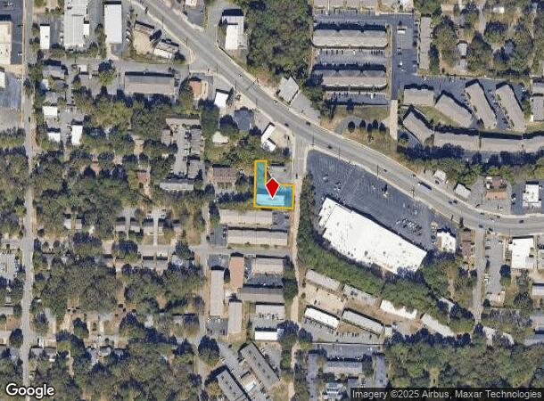
1900 N Bryant St, Little Rock, AR 72207
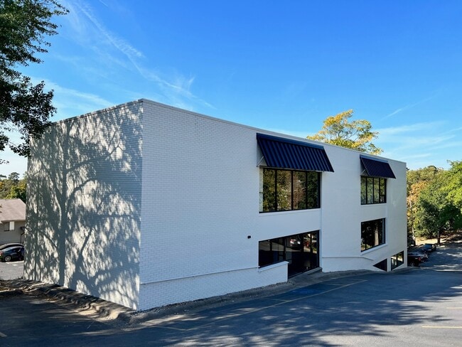
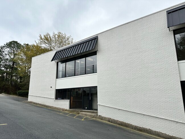
This Property Is For Sale
NEARBY LISTINGS FOR SALE OR LEASE
Property Detail
1900 N Bryant St
Little Rock-North Little Rock-Conway, AR
Vaughts Add
43L-208-01-002-00
ALL OF LT B & S20 OF OHIO ST LYING ADJ TO LTS 1 2 & 3 & N6 25 OF AN ALLEY ADJ TO LTS 1 2 & 3
Officebuilding
Pulaski
X
Arkansas
05119C0338H
b
2025
0.34 AC
2025
Midtown
002203
Little Rock/N Little Rock
7,500 SF
DEMOGRAPHICS near 1900 N Bryant St
1 Mile
3 Mile
5 Mile
2024 Total Population
11,331
63,087
150,143
2029 Population
11,200
62,825
150,704
Pop Growth 2024-2029
(1.16%)
(0.42%)
+ 0.37%
Average Age
41
40
39
2024 Total Households
5,503
30,001
67,885
HH Growth 2024-2029
(1.13%)
(0.47%)
+ 0.38%
Median Household Inc
$79,570
$57,640
$51,684
Avg Household Size
2.00
2.00
2.10
2024 Avg HH Vehicles
2.00
2.00
2.00
Median Home Value
$269,989
$205,203
$184,969
Median Year Built
1963
1970
1974
Nearby Places
Map Layers
Map Styles
 Street
 Aerial
- Restaurants
- Banks
- Shops
- Fitness
- Groceries
PUBLIC TRANSPORTATION
COMMUTER RAIL
DRIVE
WALK
Distance
10 min
5.1 mi
AIRPORT
Bill and Hillary Clinton Ntl/Adams Field
DRIVE
WALK
Distance
Bill and Hillary Clinton Ntl/Adams Field
19 min
11.1 mi
Nearby Properties
Address
Land Use
TOTAL SIZE
Lot Size
Zoning
Address
Land Use
TOTAL SIZE
Lot Size
Zoning
4,400,000 SF
27.97 AC
Address
Land Use
TOTAL SIZE
Lot Size
Zoning
1,665,090 SF
34.75 AC
Address
Land Use
TOTAL SIZE
Lot Size
Zoning
1,909,430 SF
29.12 AC
Address
Land Use
TOTAL SIZE
Lot Size
Zoning
802,734 SF
22.99 AC
Address
Land Use
TOTAL SIZE
Lot Size
Zoning
956,566 SF
70.39 AC
Address
Land Use
TOTAL SIZE
Lot Size
Zoning
475,613 SF
10.14 AC
Address
Land Use
TOTAL SIZE
Lot Size
Zoning
227,729 SF
36.49 AC
Address
Land Use
TOTAL SIZE
Lot Size
Zoning
603,434 SF
10.21 AC
Address
Land Use
TOTAL SIZE
Lot Size
Zoning
305,882 SF
7.82 AC
Address
Land Use
TOTAL SIZE
Lot Size
Zoning
576 SF
62.63 AC
Address
Land Use
TOTAL SIZE
Lot Size
Zoning
124,774 SF
21.05 AC
Address
Land Use
TOTAL SIZE
Lot Size
Zoning
7,859 SF
175.11 AC
Address
Land Use
TOTAL SIZE
Lot Size
Zoning
65.57 AC
Address
Land Use
TOTAL SIZE
Lot Size
Zoning
145,580 SF
19.89 AC
Address
Land Use
TOTAL SIZE
Lot Size
Zoning
39,635 SF
15.76 AC
Address
Land Use
TOTAL SIZE
Lot Size
Zoning
35,086 SF
6.48 AC
Address
Land Use
TOTAL SIZE
Lot Size
Zoning
140,675 SF
Address
Land Use
TOTAL SIZE
Lot Size
Zoning
168,041 SF
29.22 AC
Address
Land Use
TOTAL SIZE
Lot Size
Zoning
173,209 SF
26.54 AC
Address
Land Use
TOTAL SIZE
Lot Size
Zoning
19,142 SF
5.54 AC
Address
Land Use
TOTAL SIZE
Lot Size
Zoning
318,188 SF
8.86 AC
Address
Land Use
TOTAL SIZE
Lot Size
Zoning
293,057 SF
20.78 AC
Address
Land Use
TOTAL SIZE
Lot Size
Zoning
63,244 SF
14.21 AC
Address
Land Use
TOTAL SIZE
Lot Size
Zoning
404,617 SF
9.51 AC
Address
Land Use
TOTAL SIZE
Lot Size
Zoning
29,976 SF
27.38 AC
Address
Land Use
TOTAL SIZE
Lot Size
Zoning
35,964 SF
10.59 AC
Address
Land Use
TOTAL SIZE
Lot Size
Zoning
185,873 SF
Address
Land Use
TOTAL SIZE
Lot Size
Zoning
78,004 SF
4.44 AC
Address
Land Use
TOTAL SIZE
Lot Size
Zoning
40,758 SF
6.43 AC
Address
Land Use
TOTAL SIZE
Lot Size
Zoning
48,470 SF
26.37 AC
The World's #1 Commercial Real Estate Marketplace
Connect with us
© 2026 CoStar Group
The information above has been obtained from sources believed reliable. While we do not doubt its accuracy we have not verified it and make no guarantee, warranty or representation about it. It is your responsibility to independently confirm its accuracy and completeness. Any projections, opinions, assumptions, or estimates used are for example only and do not represent the current or future performance of the property. The value of this transaction to you depends on tax and other factors which should be evaluated by your tax, financial, and legal advisors. You and your advisors should conduct a careful, independent investigation of the property to determine to your satisfaction the suitability of the property for your needs.