Property Record
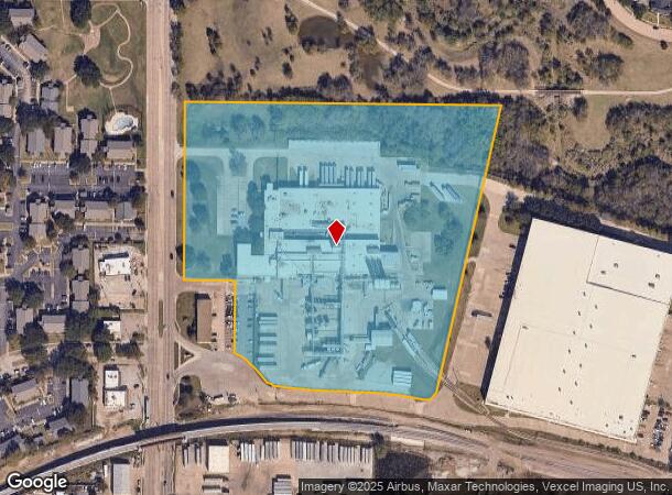
1900 N Josey Ln, Carrollton, TX 75006


NEARBY LISTINGS FOR SALE OR LEASE
Property Detail
1900 N Josey Ln
Dallas-Fort Worth-Arlington, TX
Glidden
14090580011R10000
GLIDDEN BLK 1 LT 1R1 ACS 15.537 VOL87130/2082 DD06251987 CO-DC 0905800101R01 11409058001
Lightindustrial
Dallas
AE
Texas
48113C0160K
1
2024
15.54 AC
2025
N Stemmons/Valwood
020700
Dallas/Ft Worth
65,124 SF
DEMOGRAPHICS near 1900 N Josey Ln
1 Mile
3 Mile
5 Mile
2024 Total Population
12,999
110,575
346,251
2029 Population
12,844
117,066
374,028
Pop Growth 2024-2029
(1.19%)
+ 5.87%
+ 8.02%
Average Age
37
39
38
2024 Total Households
4,291
42,909
148,115
HH Growth 2024-2029
(1.49%)
+ 6.20%
+ 8.23%
Median Household Inc
$70,438
$72,991
$78,120
Avg Household Size
2.90
2.50
2.30
2024 Avg HH Vehicles
2.00
2.00
2.00
Median Home Value
$280,402
$281,578
$343,795
Median Year Built
1976
1982
1988
Nearby Places
Map Layers
Map Styles
 Street
 Aerial
- Restaurants
- Banks
- Shops
- Fitness
- Groceries
PUBLIC TRANSPORTATION
COMMUTER RAIL
Trinity Mills Station (Green Line - Dallas Area Rapid Transit (DART))
DRIVE
WALK
Distance
Trinity Mills Station (Green Line - Dallas Area Rapid Transit (DART))
7 min
3.0 mi
DRIVE
WALK
Distance
13 min
7.6 mi
AIRPORT
Dallas Love Field
DRIVE
WALK
Distance
Dallas Love Field
26 min
14.7 mi
Dallas-Fort Worth International
DRIVE
WALK
Distance
Dallas-Fort Worth International
24 min
16.6 mi
Nearby Properties
Address
Land Use
TOTAL SIZE
Lot Size
Zoning
Address
Land Use
TOTAL SIZE
Lot Size
Zoning
417,990 SF
10.42 AC
Address
Land Use
TOTAL SIZE
Lot Size
Zoning
284,890 SF
40.44 AC
Z274
Address
Land Use
TOTAL SIZE
Lot Size
Zoning
561,139 SF
3.64 AC
Z09
Address
Land Use
TOTAL SIZE
Lot Size
Zoning
660,842 SF
4.82 AC
Z09
Address
Land Use
TOTAL SIZE
Lot Size
Zoning
584,128 SF
3.51 AC
Z241
Address
Land Use
TOTAL SIZE
Lot Size
Zoning
513,871 SF
3.63 AC
Z235
Address
Land Use
TOTAL SIZE
Lot Size
Zoning
396,669 SF
18.50 AC
Address
Land Use
TOTAL SIZE
Lot Size
Zoning
534,929 SF
4.19 AC
Z236
Address
Land Use
TOTAL SIZE
Lot Size
Zoning
321,732 SF
4.05 AC
Z235
Address
Land Use
TOTAL SIZE
Lot Size
Zoning
255,627 SF
14.79 AC
Z123
Address
Land Use
TOTAL SIZE
Lot Size
Zoning
315,426 SF
3.52 AC
Z241
Address
Land Use
TOTAL SIZE
Lot Size
Zoning
266,871 SF
87 SF
Address
Land Use
TOTAL SIZE
Lot Size
Zoning
725,972 SF
4 AC
Address
Land Use
TOTAL SIZE
Lot Size
Zoning
497,851 SF
3.34 AC
Z241
Address
Land Use
TOTAL SIZE
Lot Size
Zoning
189,500 SF
53.90 AC
Address
Land Use
TOTAL SIZE
Lot Size
Zoning
308,779 SF
19.42 AC
Z235
Address
Land Use
TOTAL SIZE
Lot Size
Zoning
268,132 SF
16.19 AC
Z235
Address
Land Use
TOTAL SIZE
Lot Size
Zoning
397,889 SF
23.14 AC
2A
Address
Land Use
TOTAL SIZE
Lot Size
Zoning
270,915 SF
3.91 AC
Z84
Address
Land Use
TOTAL SIZE
Lot Size
Zoning
330,000 SF
3.05 AC
Z236
Address
Land Use
TOTAL SIZE
Lot Size
Zoning
374,093 SF
21.54 AC
Z268
Address
Land Use
TOTAL SIZE
Lot Size
Zoning
210,289 SF
10.16 AC
Z147
Address
Land Use
TOTAL SIZE
Lot Size
Zoning
228,674 SF
11.81 AC
Z235
Address
Land Use
TOTAL SIZE
Lot Size
Zoning
294,764 SF
18 AC
Address
Land Use
TOTAL SIZE
Lot Size
Zoning
293,588 SF
17.04 AC
Address
Land Use
TOTAL SIZE
Lot Size
Zoning
262,065 SF
7.77 AC
1A
Address
Land Use
TOTAL SIZE
Lot Size
Zoning
90,900 SF
10.21 AC
Address
Land Use
TOTAL SIZE
Lot Size
Zoning
268,158 SF
12.25 AC
1G
Address
Land Use
TOTAL SIZE
Lot Size
Zoning
399,880 SF
25.21 AC
Z236
Address
Land Use
TOTAL SIZE
Lot Size
Zoning
222,452 SF
3.12 AC
Z137
The World's #1 Commercial Real Estate Marketplace
Connect with us
© 2025 CoStar Group
The information above has been obtained from sources believed reliable. While we do not doubt its accuracy we have not verified it and make no guarantee, warranty or representation about it. It is your responsibility to independently confirm its accuracy and completeness. Any projections, opinions, assumptions, or estimates used are for example only and do not represent the current or future performance of the property. The value of this transaction to you depends on tax and other factors which should be evaluated by your tax, financial, and legal advisors. You and your advisors should conduct a careful, independent investigation of the property to determine to your satisfaction the suitability of the property for your needs.