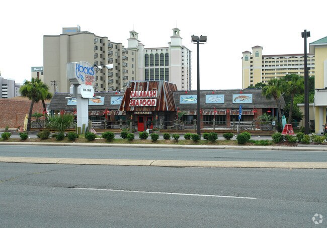
Property Record
406 20Th Ave N, Myrtle Beach, SC 29577

NEARBY LISTINGS FOR SALE OR LEASE
Property Detail
406 20Th Ave N
Myrtle Beach-Conway-North Myrtle Beach, SC-NC
East Chester Extension Section
42415020138
E CHESTER; LTS 5-8 BL 82-C
Nightclub
Horry
X
South Carolina
45051C0728K
5-8
2025
1.44 AC
2024
Downtown Myrtle Beach
050600
Myrtle Beach/Conway
10,013 SF
DEMOGRAPHICS near 406 20Th Ave N
1 Mile
3 Mile
5 Mile
2024 Total Population
3,150
30,811
74,440
2029 Population
3,827
37,863
91,507
Pop Growth 2024-2029
+ 21.49%
+ 22.89%
+ 22.93%
Average Age
40
43
43
2024 Total Households
1,362
13,505
32,089
HH Growth 2024-2029
+ 20.12%
+ 21.82%
+ 21.82%
Median Household Inc
$32,376
$40,679
$50,220
Avg Household Size
2.10
2.20
2.20
2024 Avg HH Vehicles
1.00
2.00
2.00
Median Home Value
$213,415
$220,813
$254,904
Median Year Built
1986
1990
1999
Nearby Places
- Restaurants
- Banks
- Shops
- Fitness
- Groceries
PUBLIC TRANSPORTATION
AIRPORT
Myrtle Beach International
DRIVE
WALK
Distance
Myrtle Beach International
11 min
4.9 mi
Freight Ports
Port of Wilmington
DRIVE
WALK
Distance
Port of Wilmington
95 min
72.5 mi
Nearby Properties
Address
Land Use
TOTAL SIZE
Lot Size
Zoning
Address
Land Use
TOTAL SIZE
Lot Size
Zoning
145,853 SF
57.87 AC
Address
Land Use
TOTAL SIZE
Lot Size
Zoning
42,670 SF
89.09 AC
Address
Land Use
TOTAL SIZE
Lot Size
Zoning
126,738 SF
25.90 AC
Address
Land Use
TOTAL SIZE
Lot Size
Zoning
540,224 SF
1 AC
Address
Land Use
TOTAL SIZE
Lot Size
Zoning
23,964 SF
25.28 AC
Address
Land Use
TOTAL SIZE
Lot Size
Zoning
128,560 SF
9.07 AC
Address
Land Use
TOTAL SIZE
Lot Size
Zoning
353,096 SF
0.51 AC
Address
Land Use
TOTAL SIZE
Lot Size
Zoning
243,600 SF
4.74 AC
Address
Land Use
TOTAL SIZE
Lot Size
Zoning
214,125 SF
0.61 AC
Address
Land Use
TOTAL SIZE
Lot Size
Zoning
17,772 SF
17.30 AC
Address
Land Use
TOTAL SIZE
Lot Size
Zoning
68,660 SF
1.22 AC
Address
Land Use
TOTAL SIZE
Lot Size
Zoning
199,961 SF
0.56 AC
Address
Land Use
TOTAL SIZE
Lot Size
Zoning
87,068 SF
19.76 AC
Address
Land Use
TOTAL SIZE
Lot Size
Zoning
203,336 SF
21.32 AC
Address
Land Use
TOTAL SIZE
Lot Size
Zoning
30,215 SF
18.46 AC
Address
Land Use
TOTAL SIZE
Lot Size
Zoning
140,000 SF
12.25 AC
Address
Land Use
TOTAL SIZE
Lot Size
Zoning
109.23 AC
Address
Land Use
TOTAL SIZE
Lot Size
Zoning
69,966 SF
6.90 AC
Address
Land Use
TOTAL SIZE
Lot Size
Zoning
138,726 SF
14.23 AC
Address
Land Use
TOTAL SIZE
Lot Size
Zoning
107,500 SF
11.44 AC
Address
Land Use
TOTAL SIZE
Lot Size
Zoning
5,928 SF
154.01 AC
Address
Land Use
TOTAL SIZE
Lot Size
Zoning
107,808 SF
6.97 AC
Address
Land Use
TOTAL SIZE
Lot Size
Zoning
29,028 SF
12.82 AC
Address
Land Use
TOTAL SIZE
Lot Size
Zoning
Address
Land Use
TOTAL SIZE
Lot Size
Zoning
42.46 AC
Address
Land Use
TOTAL SIZE
Lot Size
Zoning
35.63 AC
Address
Land Use
TOTAL SIZE
Lot Size
Zoning
135,997 SF
16.40 AC
Address
Land Use
TOTAL SIZE
Lot Size
Zoning
23,225 SF
10.11 AC
Address
Land Use
TOTAL SIZE
Lot Size
Zoning
66,568 SF
2.59 AC
The World's #1 Commercial Real Estate Marketplace
Connect with us
© 2025 CoStar Group
The information above has been obtained from sources believed reliable. While we do not doubt its accuracy we have not verified it and make no guarantee, warranty or representation about it. It is your responsibility to independently confirm its accuracy and completeness. Any projections, opinions, assumptions, or estimates used are for example only and do not represent the current or future performance of the property. The value of this transaction to you depends on tax and other factors which should be evaluated by your tax, financial, and legal advisors. You and your advisors should conduct a careful, independent investigation of the property to determine to your satisfaction the suitability of the property for your needs.