Property Record
1900 N Latson Rd, Howell, MI 48843
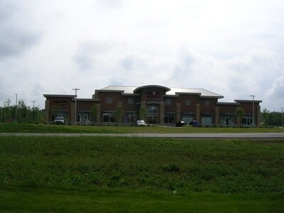

Property Detail
1900 N Latson Rd
07-28-100-018
SEC 28 T3N R5E PART OF NW 1/4 OF SEC 28, COMM AT THE NW COR SEC 28 THE SLY ALG W LN OF SEC 28 AND E LN OF SEC 29 S1*32'30" W
Commercialnec
Livingston
C,RM,PUD
Michigan
B and X Area of moderate flood hazard, usually the area between the limits of the 100-year and 500-year floods.
5.04 AC
2025
Livingston County
2025
Detroit
712602
Detroit-Warren-Dearborn, MI
12,870 SF
NEARBY LISTINGS FOR SALE OR LEASE
DEMOGRAPHICS near 1900 N Latson Rd
1 mile
3 mile
5 mile
2025 Total Population
2,645
19,373
44,848
2030 Population
2,699
19,625
45,436
Pop Growth 2025-2030
+ 2.04%
+ 1.30%
+ 1.31%
Average Age
40
42
42
2025 Total Households
915
7,661
17,688
HH Growth 2025-2030
+ 2.19%
+ 1.33%
+ 1.31%
Median Household Inc
$144,188
$101,898
$95,867
Avg Household Size
2.80
2.50
2.50
2025 Avg HH Vehicles
2.00
2.00
2.00
Median Home Value
$379,761
$328,120
$323,095
Median Year Built
2005
1998
1994
Nearby Places
Map Layers
Map Styles
 Street
 Aerial
Layers
 Traffic
 Biking
Places
Listings with unknown addresses are not visible on the map
- Restaurants
- Banks
- Shops
- Fitness
- Groceries
PUBLIC TRANSPORTATION
AIRPORT
Bishop International
Drive
Walk
Distance
Bishop International
50 min
32.2 mi
Nearby Properties
Address
Land Use
TOTAL SIZE
Lot Size
Zoning
Address
Land Use
TOTAL SIZE
Lot Size
Zoning
93,620 SF
17.47 AC
MUPUD
Address
Land Use
TOTAL SIZE
Lot Size
Zoning
75,407 SF
159.26 AC
R2
Address
Land Use
TOTAL SIZE
Lot Size
Zoning
199,635 SF
19.85 AC
RPUD
Address
Land Use
TOTAL SIZE
Lot Size
Zoning
210,003 SF
29.17 AC
MUPUD
Address
Land Use
TOTAL SIZE
Lot Size
Zoning
15.74 AC
RM
Address
Land Use
TOTAL SIZE
Lot Size
Zoning
161,366 SF
18.67 AC
HDR
Address
Land Use
TOTAL SIZE
Lot Size
Zoning
87,349 SF
9.68 AC
C,RM,PUD
Address
Land Use
TOTAL SIZE
Lot Size
Zoning
220,091 SF
21.88 AC
NRPUD
Address
Land Use
TOTAL SIZE
Lot Size
Zoning
91,380 SF
11.55 AC
HDR
Address
Land Use
TOTAL SIZE
Lot Size
Zoning
57,582 SF
5.32 AC
C,RM,PUD
Address
Land Use
TOTAL SIZE
Lot Size
Zoning
79,801 SF
10.60 AC
B-2
Address
Land Use
TOTAL SIZE
Lot Size
Zoning
43,959 SF
33.51 AC
IFZ
Address
Land Use
TOTAL SIZE
Lot Size
Zoning
121,850 SF
11.85 AC
I-1
Address
Land Use
TOTAL SIZE
Lot Size
Zoning
121,265 SF
15.10 AC
RCD
Address
Land Use
TOTAL SIZE
Lot Size
Zoning
116,885 SF
13.78 AC
RCD
Address
Land Use
TOTAL SIZE
Lot Size
Zoning
92,475 SF
18.66 AC
MI
Address
Land Use
TOTAL SIZE
Lot Size
Zoning
40,005 SF
4.87 AC
RM
Address
Land Use
TOTAL SIZE
Lot Size
Zoning
40,005 SF
3.30 AC
RM
Address
Land Use
TOTAL SIZE
Lot Size
Zoning
56,960 SF
11.27 AC
GCD
Address
Land Use
TOTAL SIZE
Lot Size
Zoning
40,005 SF
2.74 AC
RM
Address
Land Use
TOTAL SIZE
Lot Size
Zoning
44,100 SF
5.24 AC
MUPUD
Address
Land Use
TOTAL SIZE
Lot Size
Zoning
46,843 SF
3.81 AC
RM
Address
Land Use
TOTAL SIZE
Lot Size
Zoning
24,468 SF
4.53 AC
B-2
Address
Land Use
TOTAL SIZE
Lot Size
Zoning
13,944 SF
3.65 AC
HL-1
Address
Land Use
TOTAL SIZE
Lot Size
Zoning
3.86 AC
C,RM,PUD
Address
Land Use
TOTAL SIZE
Lot Size
Zoning
85,128 SF
10.88 AC
IND
Address
Land Use
TOTAL SIZE
Lot Size
Zoning
55,626 SF
MXD
Address
Land Use
TOTAL SIZE
Lot Size
Zoning
35,132 SF
1.90 AC
RM
Address
Land Use
TOTAL SIZE
Lot Size
Zoning
11,067 SF
1.01 AC
MXD
The World's #1 Commercial Real Estate Marketplace
Connect with us
© 2026 CoStar Group
The information above has been obtained from sources believed reliable. While we do not doubt its accuracy we have not verified it and make no guarantee, warranty or representation about it. It is your responsibility to independently confirm its accuracy and completeness. Any projections, opinions, assumptions, or estimates used are for example only and do not represent the current or future performance of the property. The value of this transaction to you depends on tax and other factors which should be evaluated by your tax, financial, and legal advisors. You and your advisors should conduct a careful, independent investigation of the property to determine to your satisfaction the suitability of the property for your needs.