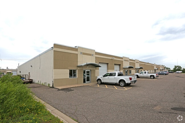
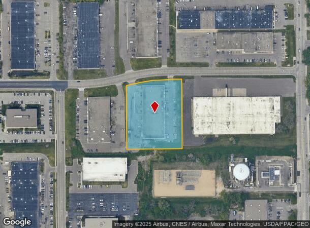
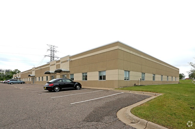
Property Record
1900 Oakcrest Ave, Saint Paul, MN 55113
Current Lease Availabilities
NEARBY LISTINGS FOR SALE OR LEASE
Property Detail
1900 Oakcrest Ave
Minneapolis-St. Paul-Bloomington, MN-WI
Rosedale Industrial Park,Secon
09-29-23-21-0011
ROSEDALE INDUSTRIAL PARK,SECON LOT 2 BLK 1
Industrialgeneral
Ramsey
X
Minnesota
27053C0250F
2
2024
2.57 AC
2025
North Central
041302
Minneapolis/St Paul
34,800 SF
DEMOGRAPHICS near 1900 Oakcrest Ave
1 Mile
3 Mile
5 Mile
2024 Total Population
3,939
83,560
320,306
2029 Population
3,859
81,487
314,982
Pop Growth 2024-2029
(2.03%)
(2.48%)
(1.66%)
Average Age
40
41
37
2024 Total Households
1,627
35,501
134,696
HH Growth 2024-2029
(1.97%)
(2.64%)
(1.72%)
Median Household Inc
$70,268
$83,360
$69,407
Avg Household Size
2.10
2.20
2.20
2024 Avg HH Vehicles
1.00
2.00
2.00
Median Home Value
$347,894
$325,860
$298,859
Median Year Built
1971
1964
1968
Nearby Places
Map Layers
Map Styles
 Street
 Aerial
- Restaurants
- Banks
- Shops
- Fitness
- Groceries
PUBLIC TRANSPORTATION
COMMUTER RAIL
Target Field Station (Northstar Corridor - Northstar Commuter Rail)
DRIVE
WALK
Distance
Target Field Station (Northstar Corridor - Northstar Commuter Rail)
15 min
7.9 mi
Fridley Station (Northstar Corridor - Northstar Commuter Rail)
DRIVE
WALK
Distance
Fridley Station (Northstar Corridor - Northstar Commuter Rail)
15 min
9.4 mi
AIRPORT
Minneapolis-St Paul International/Wold-Chamberlain
DRIVE
WALK
Distance
Minneapolis-St Paul International/Wold-Chamberlain
26 min
12.7 mi
Nearby Properties
Address
Land Use
TOTAL SIZE
Lot Size
Zoning
Address
Land Use
TOTAL SIZE
Lot Size
Zoning
36,300 SF
223.37 AC
Address
Land Use
TOTAL SIZE
Lot Size
Zoning
70,115 SF
191.32 AC
Address
Land Use
TOTAL SIZE
Lot Size
Zoning
37.24 AC
Address
Land Use
TOTAL SIZE
Lot Size
Zoning
Address
Land Use
TOTAL SIZE
Lot Size
Zoning
48.52 AC
Address
Land Use
TOTAL SIZE
Lot Size
Zoning
294,047 SF
7.99 AC
Address
Land Use
TOTAL SIZE
Lot Size
Zoning
142,933 SF
5.57 AC
Address
Land Use
TOTAL SIZE
Lot Size
Zoning
431,472 SF
7.04 AC
Address
Land Use
TOTAL SIZE
Lot Size
Zoning
4,808 SF
269.81 AC
Address
Land Use
TOTAL SIZE
Lot Size
Zoning
476,695 SF
21.51 AC
Address
Land Use
TOTAL SIZE
Lot Size
Zoning
276,144 SF
347.68 AC
Address
Land Use
TOTAL SIZE
Lot Size
Zoning
220 SF
19.66 AC
Address
Land Use
TOTAL SIZE
Lot Size
Zoning
462,598 SF
17.20 AC
I2
Address
Land Use
TOTAL SIZE
Lot Size
Zoning
658,453 SF
40.22 AC
Address
Land Use
TOTAL SIZE
Lot Size
Zoning
Address
Land Use
TOTAL SIZE
Lot Size
Zoning
792 SF
42.69 AC
Address
Land Use
TOTAL SIZE
Lot Size
Zoning
2,296 SF
128.65 AC
Address
Land Use
TOTAL SIZE
Lot Size
Zoning
419,070 SF
45.50 AC
Address
Land Use
TOTAL SIZE
Lot Size
Zoning
167,511 SF
14.49 AC
Address
Land Use
TOTAL SIZE
Lot Size
Zoning
19,514 SF
70.59 AC
Address
Land Use
TOTAL SIZE
Lot Size
Zoning
255,096 SF
2.61 AC
Address
Land Use
TOTAL SIZE
Lot Size
Zoning
335,252 SF
19.06 AC
Address
Land Use
TOTAL SIZE
Lot Size
Zoning
294,500 SF
5.95 AC
Address
Land Use
TOTAL SIZE
Lot Size
Zoning
201,030 SF
7.59 AC
Address
Land Use
TOTAL SIZE
Lot Size
Zoning
170,875 SF
2.76 AC
Address
Land Use
TOTAL SIZE
Lot Size
Zoning
150,341 SF
12.86 AC
C3S
Address
Land Use
TOTAL SIZE
Lot Size
Zoning
6.11 AC
Address
Land Use
TOTAL SIZE
Lot Size
Zoning
272,002 SF
8.16 AC
Address
Land Use
TOTAL SIZE
Lot Size
Zoning
404,642 SF
15.97 AC
Address
Land Use
TOTAL SIZE
Lot Size
Zoning
599,778 SF
21.76 AC
I2
The World's #1 Commercial Real Estate Marketplace
Connect with us
© 2025 CoStar Group
The information above has been obtained from sources believed reliable. While we do not doubt its accuracy we have not verified it and make no guarantee, warranty or representation about it. It is your responsibility to independently confirm its accuracy and completeness. Any projections, opinions, assumptions, or estimates used are for example only and do not represent the current or future performance of the property. The value of this transaction to you depends on tax and other factors which should be evaluated by your tax, financial, and legal advisors. You and your advisors should conduct a careful, independent investigation of the property to determine to your satisfaction the suitability of the property for your needs.