Property Record
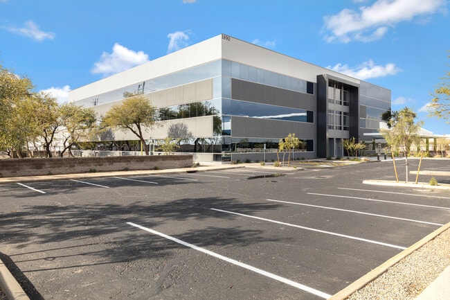
1890 S Price Rd, Chandler, AZ 85286


NEARBY LISTINGS FOR SALE OR LEASE
Property Detail
1890 S Price Rd
Phoenix-Mesa-Scottsdale, AZ
Exeter Campus Mld
303-25-145
EXETER CAMPUS MLD MCR 1816-29
Officebuilding
Maricopa
X
Arizona
04013C2720L
2a
2025
3.46 AC
2025
Chandler
811800
Phoenix
43,044 SF
DEMOGRAPHICS near 1890 S Price Rd
1 Mile
3 Mile
5 Mile
2024 Total Population
4,632
81,986
214,966
2029 Population
4,957
88,880
232,192
Pop Growth 2024-2029
+ 7.02%
+ 8.41%
+ 8.01%
Average Age
37
37
40
2024 Total Households
1,703
31,560
83,617
HH Growth 2024-2029
+ 7.05%
+ 8.49%
+ 8.16%
Median Household Inc
$111,896
$97,330
$92,728
Avg Household Size
2.70
2.50
2.50
2024 Avg HH Vehicles
2.00
2.00
2.00
Median Home Value
$626,415
$450,930
$418,042
Median Year Built
2004
1997
1994
Nearby Places
Map Layers
Map Styles
 Street
 Aerial
- Restaurants
- Banks
- Shops
- Fitness
- Groceries
PUBLIC TRANSPORTATION
AIRPORT
Phoenix-Mesa Gateway
DRIVE
WALK
Distance
Phoenix-Mesa Gateway
23 min
15.2 mi
Phoenix Sky Harbor International
DRIVE
WALK
Distance
Phoenix Sky Harbor International
26 min
17.8 mi
SALE & LEASE HISTORY
LISTING DATE
SALE/LEASE

May 27, 2022
For Lease
Jun 30, 2021
For Lease
Nearby Properties
Address
Land Use
TOTAL SIZE
Lot Size
Zoning
Address
Land Use
TOTAL SIZE
Lot Size
Zoning
221,091 SF
14.76 AC
I-1
Address
Land Use
TOTAL SIZE
Lot Size
Zoning
1,420,114 SF
66.08 AC
PAD
Address
Land Use
TOTAL SIZE
Lot Size
Zoning
71,100 SF
9.07 AC
PAD
Address
Land Use
TOTAL SIZE
Lot Size
Zoning
733,019 SF
13.13 AC
PAD
Address
Land Use
TOTAL SIZE
Lot Size
Zoning
10.02 AC
Address
Land Use
TOTAL SIZE
Lot Size
Zoning
24,739 SF
5.39 AC
PAD
Address
Land Use
TOTAL SIZE
Lot Size
Zoning
51,091 SF
3.59 AC
PAD
Address
Land Use
TOTAL SIZE
Lot Size
Zoning
3,688,548 SF
285.19 AC
PAD
Address
Land Use
TOTAL SIZE
Lot Size
Zoning
687,690 SF
44.05 AC
PAD
Address
Land Use
TOTAL SIZE
Lot Size
Zoning
724,125 SF
41.62 AC
PAD
Address
Land Use
TOTAL SIZE
Lot Size
Zoning
724,125 SF
39.23 AC
Address
Land Use
TOTAL SIZE
Lot Size
Zoning
774,482 SF
25.50 AC
PAD
Address
Land Use
TOTAL SIZE
Lot Size
Zoning
519,664 SF
20.95 AC
PAD
Address
Land Use
TOTAL SIZE
Lot Size
Zoning
2.57 AC
Address
Land Use
TOTAL SIZE
Lot Size
Zoning
1.83 AC
Address
Land Use
TOTAL SIZE
Lot Size
Zoning
456,122 SF
25.97 AC
PAD
Address
Land Use
TOTAL SIZE
Lot Size
Zoning
24,038 SF
40.27 AC
AG1
Address
Land Use
TOTAL SIZE
Lot Size
Zoning
1.64 AC
Address
Land Use
TOTAL SIZE
Lot Size
Zoning
263,599 SF
18.33 AC
PAD
Address
Land Use
TOTAL SIZE
Lot Size
Zoning
416,098 SF
22.48 AC
Address
Land Use
TOTAL SIZE
Lot Size
Zoning
395,055 SF
8.33 AC
PAD
Address
Land Use
TOTAL SIZE
Lot Size
Zoning
331,556 SF
19.73 AC
PAD
Address
Land Use
TOTAL SIZE
Lot Size
Zoning
374,847 SF
20.84 AC
PAD
Address
Land Use
TOTAL SIZE
Lot Size
Zoning
269,504 SF
8.87 AC
I-1
Address
Land Use
TOTAL SIZE
Lot Size
Zoning
256,618 SF
19.49 AC
PAD
Address
Land Use
TOTAL SIZE
Lot Size
Zoning
58,989 SF
37.62 AC
PAD
Address
Land Use
TOTAL SIZE
Lot Size
Zoning
403,326 SF
8.71 AC
PAD
Address
Land Use
TOTAL SIZE
Lot Size
Zoning
329,305 SF
18.06 AC
PAD
The World's #1 Commercial Real Estate Marketplace
Connect with us
© 2025 CoStar Group
The information above has been obtained from sources believed reliable. While we do not doubt its accuracy we have not verified it and make no guarantee, warranty or representation about it. It is your responsibility to independently confirm its accuracy and completeness. Any projections, opinions, assumptions, or estimates used are for example only and do not represent the current or future performance of the property. The value of this transaction to you depends on tax and other factors which should be evaluated by your tax, financial, and legal advisors. You and your advisors should conduct a careful, independent investigation of the property to determine to your satisfaction the suitability of the property for your needs.