Property Record
1900 Sw Childs Rd, Lake Oswego, OR 97034
NEARBY LISTINGS FOR SALE OR LEASE
Property Detail
1900 Sw Childs Rd
Portland-Vancouver-Hillsboro, OR-WA
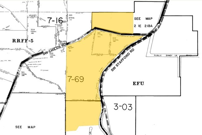
SECTION 21 TOWNSHIP 2S RANGE 1E QUARTER B TAX LOT 00600
00356849
Clackamas
Vacantlandnec
Oregon
X
600
41067C0575E
14.17 AC
0
Lake Oswego/West Linn
2025
Portland
020404
DEMOGRAPHICS near 1900 Sw Childs Rd
1 Mile
3 Mile
5 Mile
2024 Total Population
3,549
63,067
201,720
2029 Population
3,617
64,596
204,740
Pop Growth 2024-2029
+ 1.92%
+ 2.42%
+ 1.50%
Average Age
44
44
43
2024 Total Households
1,250
25,439
80,689
HH Growth 2024-2029
+ 1.84%
+ 2.48%
+ 1.53%
Median Household Inc
$166,082
$120,962
$101,399
Avg Household Size
2.80
2.40
2.40
2024 Avg HH Vehicles
2.00
2.00
2.00
Median Home Value
$858,799
$799,760
$647,843
Median Year Built
1978
1982
1981
Nearby Places
Map Layers
Map Styles
 Street
 Aerial
- Restaurants
- Banks
- Shops
- Fitness
- Groceries
PUBLIC TRANSPORTATION
COMMUTER RAIL
Tualatin (Westside Express Service - Tri-County Metropolitan Transportation District of Oregon Rail (TriMet Rail))
DRIVE
WALK
Distance
Tualatin (Westside Express Service - Tri-County Metropolitan Transportation District of Oregon Rail (TriMet Rail))
9 min
5.4 mi
Tigard Transit Center (Westside Express Service - Tri-County Metropolitan Transportation District of Oregon Rail (TriMet Rail))
DRIVE
WALK
Distance
Tigard Transit Center (Westside Express Service - Tri-County Metropolitan Transportation District of Oregon Rail (TriMet Rail))
16 min
9.8 mi
AIRPORT
Portland International
DRIVE
WALK
Distance
Portland International
37 min
25.5 mi
Freight Ports
Port of Portland
DRIVE
WALK
Distance
Port of Portland
26 min
13.9 mi
Nearby Properties
Address
Land Use
TOTAL SIZE
Lot Size
Zoning
Address
Land Use
TOTAL SIZE
Lot Size
Zoning
511,394 SF
18.68 AC
MUC
Address
Land Use
TOTAL SIZE
Lot Size
Zoning
Address
Land Use
TOTAL SIZE
Lot Size
Zoning
Address
Land Use
TOTAL SIZE
Lot Size
Zoning
216,381 SF
24.95 AC
CG
Address
Land Use
TOTAL SIZE
Lot Size
Zoning
28.30 AC
EC/R-0
Address
Land Use
TOTAL SIZE
Lot Size
Zoning
20.82 AC
R-5
Address
Land Use
TOTAL SIZE
Lot Size
Zoning
6 AC
MC
Address
Land Use
TOTAL SIZE
Lot Size
Zoning
Address
Land Use
TOTAL SIZE
Lot Size
Zoning
4 AC
MC
Address
Land Use
TOTAL SIZE
Lot Size
Zoning
1 SF
1 AC
PF
Address
Land Use
TOTAL SIZE
Lot Size
Zoning
18 AC
RMH
Address
Land Use
TOTAL SIZE
Lot Size
Zoning
10.81 AC
RH
Address
Land Use
TOTAL SIZE
Lot Size
Zoning
190,012 SF
4.59 AC
IP
Address
Land Use
TOTAL SIZE
Lot Size
Zoning
71,930 SF
22.68 AC
CO
Address
Land Use
TOTAL SIZE
Lot Size
Zoning
1 SF
0.14 AC
EC
Address
Land Use
TOTAL SIZE
Lot Size
Zoning
10.35 AC
PF
Address
Land Use
TOTAL SIZE
Lot Size
Zoning
21.39 AC
CI
Address
Land Use
TOTAL SIZE
Lot Size
Zoning
3 AC
CR&D
Address
Land Use
TOTAL SIZE
Lot Size
Zoning
5.12 AC
CR&D
Address
Land Use
TOTAL SIZE
Lot Size
Zoning
60,052 SF
3.28 AC
MUC
Address
Land Use
TOTAL SIZE
Lot Size
Zoning
5 AC
CR&D
Address
Land Use
TOTAL SIZE
Lot Size
Zoning
35.26 AC
PNA
Address
Land Use
TOTAL SIZE
Lot Size
Zoning
3,162 SF
4 AC
CR&D
Address
Land Use
TOTAL SIZE
Lot Size
Zoning
3.31 AC
MC
Address
Land Use
TOTAL SIZE
Lot Size
Zoning
3 AC
MC
Address
Land Use
TOTAL SIZE
Lot Size
Zoning
1 SF
4.73 AC
R-3
Address
Land Use
TOTAL SIZE
Lot Size
Zoning
493,569 SF
6.84 AC
MUC-1
Address
Land Use
TOTAL SIZE
Lot Size
Zoning
1,008 SF
10 AC
R3
Address
Land Use
TOTAL SIZE
Lot Size
Zoning
3 AC
MC
Address
Land Use
TOTAL SIZE
Lot Size
Zoning
159,395 SF
3.60 AC
MUC
The World's #1 Commercial Real Estate Marketplace
Connect with us
© 2026 CoStar Group
The information above has been obtained from sources believed reliable. While we do not doubt its accuracy we have not verified it and make no guarantee, warranty or representation about it. It is your responsibility to independently confirm its accuracy and completeness. Any projections, opinions, assumptions, or estimates used are for example only and do not represent the current or future performance of the property. The value of this transaction to you depends on tax and other factors which should be evaluated by your tax, financial, and legal advisors. You and your advisors should conduct a careful, independent investigation of the property to determine to your satisfaction the suitability of the property for your needs.