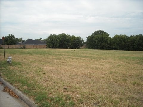
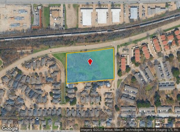
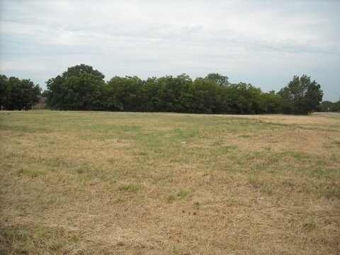
Property Record
1900 W Abram St, Arlington, TX 76010
NEARBY LISTINGS FOR SALE OR LEASE
Property Detail
1900 W Abram St
Dallas-Fort Worth-Arlington, TX
Milby, William P Survey
04051661
MILBY, WILLIAM P SURVEY ABSTRACT 1059 TRACT 15
Residentialacreage
Tarrant
X
Texas
48439C0335K
4.22 AC
2024
Arlington/Mansfield
2025
Dallas/Ft Worth
122901
DEMOGRAPHICS near 1900 W Abram St
1 Mile
3 Mile
5 Mile
2024 Total Population
16,480
119,184
294,193
2029 Population
17,375
126,050
310,335
Pop Growth 2024-2029
+ 5.43%
+ 5.76%
+ 5.49%
Average Age
35
37
37
2024 Total Households
6,038
45,525
112,088
HH Growth 2024-2029
+ 5.52%
+ 5.88%
+ 5.60%
Median Household Inc
$55,409
$53,778
$55,787
Avg Household Size
2.40
2.50
2.50
2024 Avg HH Vehicles
2.00
2.00
2.00
Median Home Value
$245,419
$252,199
$242,002
Median Year Built
1976
1977
1980
Nearby Places
Map Layers
Map Styles
 Street
 Aerial
- Restaurants
- Banks
- Shops
- Fitness
- Groceries
PUBLIC TRANSPORTATION
COMMUTER RAIL
Hurst/Bell (Trinity Railway Express - Dallas Area Rapid Transit (DART))
DRIVE
WALK
Distance
Hurst/Bell (Trinity Railway Express - Dallas Area Rapid Transit (DART))
17 min
6.9 mi
AIRPORT
Dallas-Fort Worth International
DRIVE
WALK
Distance
Dallas-Fort Worth International
28 min
17.8 mi
Dallas Love Field
DRIVE
WALK
Distance
Dallas Love Field
38 min
26.0 mi
Nearby Properties
Address
Land Use
TOTAL SIZE
Lot Size
Zoning
Address
Land Use
TOTAL SIZE
Lot Size
Zoning
3,015,800 SF
72.86 AC
Address
Land Use
TOTAL SIZE
Lot Size
Zoning
269,257 SF
21.33 AC
Address
Land Use
TOTAL SIZE
Lot Size
Zoning
1,129,022 SF
16.84 AC
Address
Land Use
TOTAL SIZE
Lot Size
Zoning
320,636 SF
12.71 AC
Address
Land Use
TOTAL SIZE
Lot Size
Zoning
595,207 SF
7.20 AC
Address
Land Use
TOTAL SIZE
Lot Size
Zoning
492,970 SF
44.82 AC
Address
Land Use
TOTAL SIZE
Lot Size
Zoning
462,207 SF
2.82 AC
Address
Land Use
TOTAL SIZE
Lot Size
Zoning
578,395 SF
6.22 AC
Address
Land Use
TOTAL SIZE
Lot Size
Zoning
422,300 SF
2.50 AC
Address
Land Use
TOTAL SIZE
Lot Size
Zoning
347,421 SF
4.47 AC
Address
Land Use
TOTAL SIZE
Lot Size
Zoning
548,806 SF
5.56 AC
Address
Land Use
TOTAL SIZE
Lot Size
Zoning
377,463 SF
19.50 AC
Address
Land Use
TOTAL SIZE
Lot Size
Zoning
492,837 SF
4.99 AC
Address
Land Use
TOTAL SIZE
Lot Size
Zoning
389,946 SF
2.35 AC
Address
Land Use
TOTAL SIZE
Lot Size
Zoning
462,396 SF
25.76 AC
Address
Land Use
TOTAL SIZE
Lot Size
Zoning
296,092 SF
7.66 AC
Address
Land Use
TOTAL SIZE
Lot Size
Zoning
327,309 SF
3.45 AC
Address
Land Use
TOTAL SIZE
Lot Size
Zoning
720,000 SF
9.80 AC
Address
Land Use
TOTAL SIZE
Lot Size
Zoning
288,378 SF
15.40 AC
Address
Land Use
TOTAL SIZE
Lot Size
Zoning
218,000 SF
3.98 AC
Address
Land Use
TOTAL SIZE
Lot Size
Zoning
386,575 SF
42.27 AC
Address
Land Use
TOTAL SIZE
Lot Size
Zoning
346,354 SF
4.25 AC
Address
Land Use
TOTAL SIZE
Lot Size
Zoning
28,825 SF
81.97 AC
Address
Land Use
TOTAL SIZE
Lot Size
Zoning
257,077 SF
14.49 AC
Address
Land Use
TOTAL SIZE
Lot Size
Zoning
294,373 SF
12.33 AC
Address
Land Use
TOTAL SIZE
Lot Size
Zoning
194,512 SF
3.25 AC
Address
Land Use
TOTAL SIZE
Lot Size
Zoning
242,811 SF
13.60 AC
Address
Land Use
TOTAL SIZE
Lot Size
Zoning
247,688 SF
11.75 AC
Address
Land Use
TOTAL SIZE
Lot Size
Zoning
268,643 SF
12.50 AC
Address
Land Use
TOTAL SIZE
Lot Size
Zoning
320,311 SF
15.06 AC
The World's #1 Commercial Real Estate Marketplace
Connect with us
© 2026 CoStar Group
The information above has been obtained from sources believed reliable. While we do not doubt its accuracy we have not verified it and make no guarantee, warranty or representation about it. It is your responsibility to independently confirm its accuracy and completeness. Any projections, opinions, assumptions, or estimates used are for example only and do not represent the current or future performance of the property. The value of this transaction to you depends on tax and other factors which should be evaluated by your tax, financial, and legal advisors. You and your advisors should conduct a careful, independent investigation of the property to determine to your satisfaction the suitability of the property for your needs.