Property Record
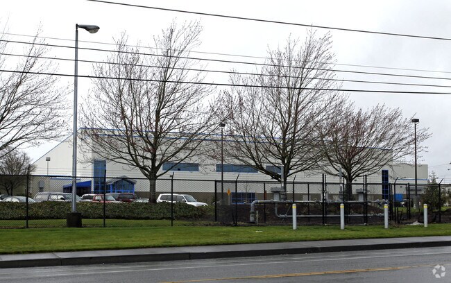
19000 Wi Ne Sandy Blvd, Portland, OR 97230


Property Detail
19000 Wi Ne Sandy Blvd
R321336
SECTION 29 1N 3E, TL 1400 21.38 ACRES, SPLIT MAP & SPLIT LEVY R321383 (R943291180), ENTERPRISE ZONE
Industrialgeneral
MULTNOMAH
HI
Oregon
B and X Area of moderate flood hazard, usually the area between the limits of the 100-year and 500-year floods.
21.39 AC
2025
East Columbia Corridor
2025
Portland
009400
Portland-Vancouver-Hillsboro, OR-WA
NEARBY LISTINGS FOR SALE OR LEASE
-
-
View all Portland listings for sale on LoopNet.com
DEMOGRAPHICS near 19000 Wi Ne Sandy Blvd
1 mile
3 mile
5 mile
2025 Total Population
5,629
92,247
276,231
2030 Population
5,481
90,961
273,619
Pop Growth 2025-2030
(2.63%)
(1.39%)
(0.95%)
Average Age
41
40
40
2025 Total Households
2,053
33,223
100,342
HH Growth 2025-2030
(2.92%)
(1.66%)
(1.16%)
Median Household Inc
$71,889
$63,231
$73,009
Avg Household Size
2.70
2.70
2.60
2025 Avg HH Vehicles
2.00
2.00
2.00
Median Home Value
$380,246
$427,833
$456,243
Median Year Built
1984
1979
1981
Nearby Places
Map Layers
Map Styles
 Street
 Aerial
Layers
 Traffic
 Biking
Places
Listings with unknown addresses are not visible on the map
- Restaurants
- Banks
- Shops
- Fitness
- Groceries
PUBLIC TRANSPORTATION
AIRPORT
Portland International
Drive
Walk
Distance
Portland International
16 min
7.3 mi
Freight Ports
Port of Portland
Drive
Walk
Distance
Port of Portland
23 min
14.8 mi
Nearby Properties
Address
Land Use
TOTAL SIZE
Lot Size
Zoning
Address
Land Use
TOTAL SIZE
Lot Size
Zoning
21.39 AC
NULL
Address
Land Use
TOTAL SIZE
Lot Size
Zoning
3,800 SF
27.96 AC
LI
Address
Land Use
TOTAL SIZE
Lot Size
Zoning
Address
Land Use
TOTAL SIZE
Lot Size
Zoning
64.20 AC
HI
Address
Land Use
TOTAL SIZE
Lot Size
Zoning
137.54 AC
GI
Address
Land Use
TOTAL SIZE
Lot Size
Zoning
365,000 SF
38.87 AC
GI
Address
Land Use
TOTAL SIZE
Lot Size
Zoning
260,995 SF
6.49 AC
RTC
Address
Land Use
TOTAL SIZE
Lot Size
Zoning
698,484 SF
34.21 AC
GI
Address
Land Use
TOTAL SIZE
Lot Size
Zoning
109,231 SF
7.87 AC
HI
Address
Land Use
TOTAL SIZE
Lot Size
Zoning
123,716 SF
20.03 AC
LDR-5
Address
Land Use
TOTAL SIZE
Lot Size
Zoning
8.69 AC
NULL
Address
Land Use
TOTAL SIZE
Lot Size
Zoning
60,788 SF
10.21 AC
GI
Address
Land Use
TOTAL SIZE
Lot Size
Zoning
836,366 SF
38.86 AC
LI
Address
Land Use
TOTAL SIZE
Lot Size
Zoning
378,000 SF
18.91 AC
LI
Address
Land Use
TOTAL SIZE
Lot Size
Zoning
489,695 SF
23.76 AC
IG2P
Address
Land Use
TOTAL SIZE
Lot Size
Zoning
175,276 SF
13.05 AC
IG2
Address
Land Use
TOTAL SIZE
Lot Size
Zoning
191,466 SF
34.68 AC
R/CSP
Address
Land Use
TOTAL SIZE
Lot Size
Zoning
492,161 SF
28.13 AC
IG2
Address
Land Use
TOTAL SIZE
Lot Size
Zoning
219,470 SF
9.77 AC
R_MF
Address
Land Use
TOTAL SIZE
Lot Size
Zoning
Address
Land Use
TOTAL SIZE
Lot Size
Zoning
129,462 SF
15.90 AC
R7
Address
Land Use
TOTAL SIZE
Lot Size
Zoning
118,460 SF
28.10 AC
BP
Address
Land Use
TOTAL SIZE
Lot Size
Zoning
357,603 SF
22.69 AC
GI
Address
Land Use
TOTAL SIZE
Lot Size
Zoning
85,380 SF
5.04 AC
TD
Address
Land Use
TOTAL SIZE
Lot Size
Zoning
86,138 SF
5.93 AC
R7
Address
Land Use
TOTAL SIZE
Lot Size
Zoning
254,580 SF
4.76 AC
TDHC
Address
Land Use
TOTAL SIZE
Lot Size
Zoning
304,649 SF
14.13 AC
GI
Address
Land Use
TOTAL SIZE
Lot Size
Zoning
11,000 SF
8.60 AC
IG2
Address
Land Use
TOTAL SIZE
Lot Size
Zoning
733,232 SF
37.41 AC
NULL
The World's #1 Commercial Real Estate Marketplace
Connect with us
© 2026 CoStar Group
The information above has been obtained from sources believed reliable. While we do not doubt its accuracy we have not verified it and make no guarantee, warranty or representation about it. It is your responsibility to independently confirm its accuracy and completeness. Any projections, opinions, assumptions, or estimates used are for example only and do not represent the current or future performance of the property. The value of this transaction to you depends on tax and other factors which should be evaluated by your tax, financial, and legal advisors. You and your advisors should conduct a careful, independent investigation of the property to determine to your satisfaction the suitability of the property for your needs.