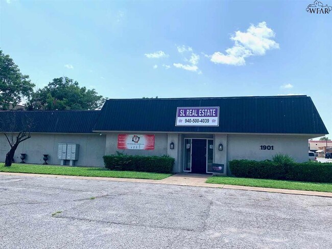
Property Record
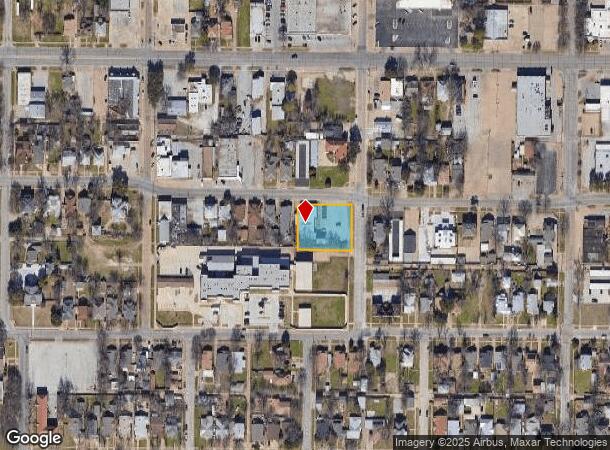
1901 10Th St, Wichita Falls, TX 76301
NEARBY LISTINGS FOR SALE OR LEASE
Property Detail
1901 10Th St
Wichita Falls, TX
Bellevue Addition
157503
LOT 2-A BLK 12 BELLEVUE ADDITION
Officebuilding
Wichita
X
Texas
48485C0320G
2-a
2024
0.59 AC
2025
West Wichita Falls
010700
Other Market Areas
6,579 SF
DEMOGRAPHICS near 1901 10Th St
1 Mile
3 Mile
5 Mile
2024 Total Population
11,053
50,467
86,239
2029 Population
11,427
52,029
88,383
Pop Growth 2024-2029
+ 3.38%
+ 3.10%
+ 2.49%
Average Age
38
38
38
2024 Total Households
4,509
20,269
34,834
HH Growth 2024-2029
+ 3.55%
+ 3.18%
+ 2.57%
Median Household Inc
$38,257
$43,022
$48,241
Avg Household Size
2.30
2.30
2.30
2024 Avg HH Vehicles
1.00
2.00
2.00
Median Home Value
$74,462
$99,209
$123,983
Median Year Built
1951
1961
1968
Nearby Places
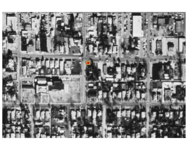
Map Layers
Map Styles
 Street
 Aerial
- Restaurants
- Banks
- Shops
- Fitness
- Groceries
SALE & LEASE HISTORY
LISTING DATE
SALE/LEASE

Oct 02, 2020
For Sale
Nearby Properties
Address
Land Use
TOTAL SIZE
Lot Size
Zoning
Address
Land Use
TOTAL SIZE
Lot Size
Zoning
1,172,641 SF
100 AC
Address
Land Use
TOTAL SIZE
Lot Size
Zoning
400,968 SF
123.30 AC
Address
Land Use
TOTAL SIZE
Lot Size
Zoning
164,255 SF
5.23 AC
Address
Land Use
TOTAL SIZE
Lot Size
Zoning
398,646 SF
7.51 AC
GC
Address
Land Use
TOTAL SIZE
Lot Size
Zoning
203,569 SF
27.74 AC
Address
Land Use
TOTAL SIZE
Lot Size
Zoning
245,152 SF
5.12 AC
GC
Address
Land Use
TOTAL SIZE
Lot Size
Zoning
275,676 SF
22.58 AC
Address
Land Use
TOTAL SIZE
Lot Size
Zoning
247,406 SF
10 AC
Address
Land Use
TOTAL SIZE
Lot Size
Zoning
233,084 SF
44.31 AC
SF2
Address
Land Use
TOTAL SIZE
Lot Size
Zoning
157,968 SF
7.40 AC
GC
Address
Land Use
TOTAL SIZE
Lot Size
Zoning
24,741 SF
37.75 AC
Address
Land Use
TOTAL SIZE
Lot Size
Zoning
132,937 SF
21.85 AC
Address
Land Use
TOTAL SIZE
Lot Size
Zoning
266,509 SF
14.25 AC
SF2
Address
Land Use
TOTAL SIZE
Lot Size
Zoning
200,421 SF
18.57 AC
MFR
Address
Land Use
TOTAL SIZE
Lot Size
Zoning
138,336 SF
18.97 AC
GC
Address
Land Use
TOTAL SIZE
Lot Size
Zoning
167,247 SF
2.61 AC
CBD
Address
Land Use
TOTAL SIZE
Lot Size
Zoning
51,240 SF
3.46 AC
GC
Address
Land Use
TOTAL SIZE
Lot Size
Zoning
158,687 SF
14.68 AC
GC
Address
Land Use
TOTAL SIZE
Lot Size
Zoning
62,791 SF
63.60 AC
Address
Land Use
TOTAL SIZE
Lot Size
Zoning
784,240 SF
58.86 AC
GC
Address
Land Use
TOTAL SIZE
Lot Size
Zoning
151,854 SF
5.11 AC
Address
Land Use
TOTAL SIZE
Lot Size
Zoning
125,992 SF
4.22 AC
Address
Land Use
TOTAL SIZE
Lot Size
Zoning
80,294 SF
9.17 AC
Address
Land Use
TOTAL SIZE
Lot Size
Zoning
226,866 SF
12.10 AC
MFR
Address
Land Use
TOTAL SIZE
Lot Size
Zoning
120,073 SF
17.43 AC
Address
Land Use
TOTAL SIZE
Lot Size
Zoning
136,522 SF
4.11 AC
Address
Land Use
TOTAL SIZE
Lot Size
Zoning
82,217 SF
10.57 AC
SF2
Address
Land Use
TOTAL SIZE
Lot Size
Zoning
95,926 SF
1.21 AC
CBD
Address
Land Use
TOTAL SIZE
Lot Size
Zoning
224,276 SF
23 AC
Address
Land Use
TOTAL SIZE
Lot Size
Zoning
82,761 SF
2.01 AC
GC
The World's #1 Commercial Real Estate Marketplace
Connect with us
© 2025 CoStar Group
The information above has been obtained from sources believed reliable. While we do not doubt its accuracy we have not verified it and make no guarantee, warranty or representation about it. It is your responsibility to independently confirm its accuracy and completeness. Any projections, opinions, assumptions, or estimates used are for example only and do not represent the current or future performance of the property. The value of this transaction to you depends on tax and other factors which should be evaluated by your tax, financial, and legal advisors. You and your advisors should conduct a careful, independent investigation of the property to determine to your satisfaction the suitability of the property for your needs.