Property Record
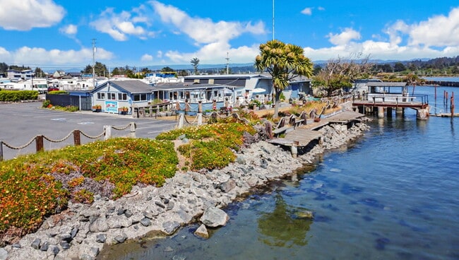
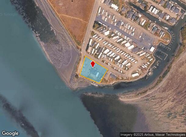
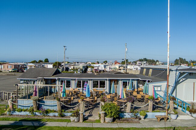
1901 Buhne St, Eureka, CA 95501
Property Detail
1901 Buhne St
305-092-009-000
L13 B4 /KING SALMON RES RES6C 75B N 620007B C
Restaurantbuilding
HUMBOLDT
CR/F
California
AE The base floodplain where base flood elevations are provided. AE Zones are now used on new format FIRMs instead of A1-A30 Zones.
13
2024
0.96 AC
2025
Eureka/Crescent City
000600
Other Market Areas
1,560 SF
Eureka-Arcata, CA
NEARBY LISTINGS FOR SALE OR LEASE
-
-
View all Eureka listings for sale on LoopNet.com
DEMOGRAPHICS near 1901 Buhne St
1 mile
3 mile
5 mile
2025 Total Population
1,198
6,814
33,038
2030 Population
1,147
6,660
32,414
Pop Growth 2025-2030
(4.26%)
(2.26%)
(1.89%)
Average Age
44
43
42
2025 Total Households
544
2,749
13,351
HH Growth 2025-2030
(4.78%)
(2.55%)
(2.01%)
Median Household Inc
$54,583
$71,863
$69,411
Avg Household Size
2.10
2.30
2.40
2025 Avg HH Vehicles
2.00
2.00
2.00
Median Home Value
$375,430
$436,660
$443,603
Median Year Built
1979
1978
1961
Nearby Places
Map Layers
Map Styles
 Street
 Aerial
Layers
 Traffic
 Biking
Places
Listings with unknown addresses are not visible on the map
- Restaurants
- Banks
- Shops
- Fitness
- Groceries
PUBLIC TRANSPORTATION
AIRPORT
California Redwood Coast-Humboldt County
Drive
Walk
Distance
California Redwood Coast-Humboldt County
38 min
23.3 mi
SALE & LEASE HISTORY
LISTING DATE
SALE/LEASE

Jun 29, 2023
For Sale
Nearby Properties
Address
Land Use
TOTAL SIZE
Lot Size
Zoning
Address
Land Use
TOTAL SIZE
Lot Size
Zoning
11.29 AC
P
Address
Land Use
TOTAL SIZE
Lot Size
Zoning
55,552 SF
7.98 AC
A,AC,CS-PD
Address
Land Use
TOTAL SIZE
Lot Size
Zoning
5.22 AC
CS
Address
Land Use
TOTAL SIZE
Lot Size
Zoning
15,034 SF
4.75 AC
CS
Address
Land Use
TOTAL SIZE
Lot Size
Zoning
1.42 AC
CG/W
Address
Land Use
TOTAL SIZE
Lot Size
Zoning
19,887 SF
1.64 AC
P
Address
Land Use
TOTAL SIZE
Lot Size
Zoning
6,144 SF
5 AC
CS
Address
Land Use
TOTAL SIZE
Lot Size
Zoning
1.36 AC
CS
Address
Land Use
TOTAL SIZE
Lot Size
Zoning
15.49 AC
P
Address
Land Use
TOTAL SIZE
Lot Size
Zoning
0.89 AC
CS
Address
Land Use
TOTAL SIZE
Lot Size
Zoning
2.42 AC
RS-20/W
Address
Land Use
TOTAL SIZE
Lot Size
Zoning
2.86 AC
R-4*-Q
Address
Land Use
TOTAL SIZE
Lot Size
Zoning
5.99 AC
RM-15;R-1*
Address
Land Use
TOTAL SIZE
Lot Size
Zoning
35.80 AC
MC
Address
Land Use
TOTAL SIZE
Lot Size
Zoning
6,000 SF
2.25 AC
CS
Address
Land Use
TOTAL SIZE
Lot Size
Zoning
6,514 SF
16.50 AC
AE-60/F,T
Address
Land Use
TOTAL SIZE
Lot Size
Zoning
0.50 AC
CS
Address
Land Use
TOTAL SIZE
Lot Size
Zoning
1.73 AC
CG/C,W,F
Address
Land Use
TOTAL SIZE
Lot Size
Zoning
3.94 AC
NR,CS
Address
Land Use
TOTAL SIZE
Lot Size
Zoning
4,292 SF
10.32 AC
AG-B-5
Address
Land Use
TOTAL SIZE
Lot Size
Zoning
0.73 AC
RM-20/F,T
Address
Land Use
TOTAL SIZE
Lot Size
Zoning
877 SF
0.88 AC
CS
Address
Land Use
TOTAL SIZE
Lot Size
Zoning
1.20 AC
CS
Address
Land Use
TOTAL SIZE
Lot Size
Zoning
4,085 SF
0.92 AC
CS
Address
Land Use
TOTAL SIZE
Lot Size
Zoning
0.65 AC
CG/W
Address
Land Use
TOTAL SIZE
Lot Size
Zoning
0.60 AC
CS
Address
Land Use
TOTAL SIZE
Lot Size
Zoning
10.74 AC
AG-B-6
Address
Land Use
TOTAL SIZE
Lot Size
Zoning
0.92 AC
C-3-Q
Address
Land Use
TOTAL SIZE
Lot Size
Zoning
1.90 AC
CS
Address
Land Use
TOTAL SIZE
Lot Size
Zoning
2.66 AC
CR/F
The World's #1 Commercial Real Estate Marketplace
Connect with us
© 2026 CoStar Group
The information above has been obtained from sources believed reliable. While we do not doubt its accuracy we have not verified it and make no guarantee, warranty or representation about it. It is your responsibility to independently confirm its accuracy and completeness. Any projections, opinions, assumptions, or estimates used are for example only and do not represent the current or future performance of the property. The value of this transaction to you depends on tax and other factors which should be evaluated by your tax, financial, and legal advisors. You and your advisors should conduct a careful, independent investigation of the property to determine to your satisfaction the suitability of the property for your needs.