Property Record
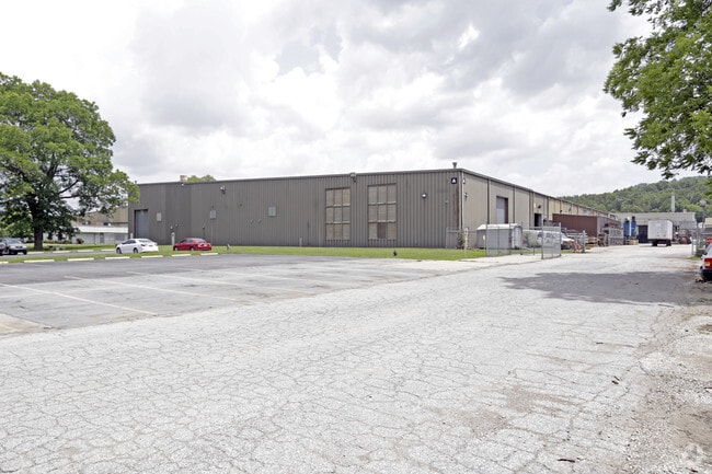
1901 E Borick Dr, Fayetteville, AR 72701


Property Detail
1901 E Borick Dr
765-19959-000
PT LOT 18 7.00 A.
Lightindustrial
WASHINGTON
AA1
Arkansas
B and X Area of moderate flood hazard, usually the area between the limits of the 100-year and 500-year floods.
18
2025
30.99 AC
2025
Outlying Washington Cnty
011107
Fayetteville/Springdale/Rogers
302,144 SF
Fayetteville-Springdale-Rogers, AR
NEARBY LISTINGS FOR SALE OR LEASE
DEMOGRAPHICS near 1901 E Borick Dr
1 mile
3 mile
5 mile
2025 Total Population
436
23,608
72,663
2030 Population
481
25,471
77,846
Pop Growth 2025-2030
+ 10.32%
+ 7.89%
+ 7.13%
Average Age
36
36
34
2025 Total Households
181
9,957
29,543
HH Growth 2025-2030
+ 10.50%
+ 8.21%
+ 7.79%
Median Household Inc
$44,166
$47,107
$48,769
Avg Household Size
2.30
2.20
2.10
2025 Avg HH Vehicles
2.00
2.00
2.00
Median Home Value
$380,768
$407,561
$383,320
Median Year Built
2006
1996
1992
Nearby Places
Map Layers
Map Styles
 Street
 Aerial
Layers
 Traffic
 Biking
Places
Listings with unknown addresses are not visible on the map
- Restaurants
- Banks
- Shops
- Fitness
- Groceries
PUBLIC TRANSPORTATION
AIRPORT
Northwest Arkansas Ntl
Drive
Walk
Distance
Northwest Arkansas Ntl
50 min
26.9 mi
Freight Ports
Tulsa Port of Inola
Drive
Walk
Distance
Tulsa Port of Inola
119 min
95.0 mi
SALE & LEASE HISTORY
LISTING DATE
SALE/LEASE

Dec 15, 2020
For Sale
Nearby Properties
Address
Land Use
TOTAL SIZE
Lot Size
Zoning
Address
Land Use
TOTAL SIZE
Lot Size
Zoning
27,060 SF
26.31 AC
Address
Land Use
TOTAL SIZE
Lot Size
Zoning
45,300 SF
16.38 AC
Address
Land Use
TOTAL SIZE
Lot Size
Zoning
371,436 SF
29.18 AC
I2
Address
Land Use
TOTAL SIZE
Lot Size
Zoning
191,928 SF
0.81 AC
C4
Address
Land Use
TOTAL SIZE
Lot Size
Zoning
325,150 SF
23.71 AC
I2
Address
Land Use
TOTAL SIZE
Lot Size
Zoning
99,793 SF
6.98 AC
Address
Land Use
TOTAL SIZE
Lot Size
Zoning
663,900 SF
46.74 AC
I2
Address
Land Use
TOTAL SIZE
Lot Size
Zoning
40,501 SF
1.13 AC
R0
Address
Land Use
TOTAL SIZE
Lot Size
Zoning
206,047 SF
26.94 AC
R1
Address
Land Use
TOTAL SIZE
Lot Size
Zoning
75,456 SF
4.25 AC
I1
Address
Land Use
TOTAL SIZE
Lot Size
Zoning
174,848 SF
27.32 AC
R1
Address
Land Use
TOTAL SIZE
Lot Size
Zoning
22,230 SF
0.44 AC
Address
Land Use
TOTAL SIZE
Lot Size
Zoning
53,160 SF
4.40 AC
Address
Land Use
TOTAL SIZE
Lot Size
Zoning
84,944 SF
2.50 AC
I1
Address
Land Use
TOTAL SIZE
Lot Size
Zoning
268,375 SF
48.22 AC
I1
Address
Land Use
TOTAL SIZE
Lot Size
Zoning
67,610 SF
0.23 AC
R0
Address
Land Use
TOTAL SIZE
Lot Size
Zoning
57,991 SF
0.22 AC
Address
Land Use
TOTAL SIZE
Lot Size
Zoning
153,718 SF
12.63 AC
I2
Address
Land Use
TOTAL SIZE
Lot Size
Zoning
19,400 SF
11.83 AC
R2
Address
Land Use
TOTAL SIZE
Lot Size
Zoning
177,254 SF
12.68 AC
I2
Address
Land Use
TOTAL SIZE
Lot Size
Zoning
45,204 SF
2.28 AC
Address
Land Use
TOTAL SIZE
Lot Size
Zoning
20,168 SF
0.30 AC
C4
Address
Land Use
TOTAL SIZE
Lot Size
Zoning
44,348 SF
0.18 AC
Address
Land Use
TOTAL SIZE
Lot Size
Zoning
228,820 SF
13.09 AC
I1
Address
Land Use
TOTAL SIZE
Lot Size
Zoning
58,189 SF
0.85 AC
Address
Land Use
TOTAL SIZE
Lot Size
Zoning
73,986 SF
3.55 AC
C2
Address
Land Use
TOTAL SIZE
Lot Size
Zoning
64,934 SF
0.33 AC
Address
Land Use
TOTAL SIZE
Lot Size
Zoning
70,649 SF
7.54 AC
I1
Address
Land Use
TOTAL SIZE
Lot Size
Zoning
86,748 SF
3.84 AC
The World's #1 Commercial Real Estate Marketplace
Connect with us
© 2026 CoStar Group
The information above has been obtained from sources believed reliable. While we do not doubt its accuracy we have not verified it and make no guarantee, warranty or representation about it. It is your responsibility to independently confirm its accuracy and completeness. Any projections, opinions, assumptions, or estimates used are for example only and do not represent the current or future performance of the property. The value of this transaction to you depends on tax and other factors which should be evaluated by your tax, financial, and legal advisors. You and your advisors should conduct a careful, independent investigation of the property to determine to your satisfaction the suitability of the property for your needs.