Property Record
1901 E Sh 21, Paige, TX 78659
Property Detail
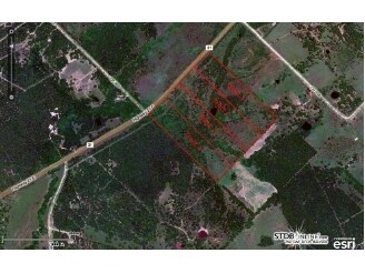
1901 E Sh 21
27102
ABS A124 CARMEAN, JOHN,15.477 ACRES
Agriculturalland
BASTROP
B and X Area of moderate flood hazard, usually the area between the limits of the 100-year and 500-year floods.
Texas
2024
15.48 AC
2025
Bastrop County
950503
Austin
2,754 SF
Austin-Round Rock-San Marcos, TX
NEARBY LISTINGS FOR SALE OR LEASE
-
-
View all Paige listings for sale on LoopNet.com
DEMOGRAPHICS near 1901 E Sh 21
1 mile
3 mile
5 mile
2025 Total Population
140
2,100
5,008
2030 Population
159
2,390
5,693
Pop Growth 2025-2030
+ 13.57%
+ 13.81%
+ 13.68%
Average Age
41
41
41
2025 Total Households
54
801
1,871
HH Growth 2025-2030
+ 14.81%
+ 14.23%
+ 14.11%
Median Household Inc
$68,571
$71,714
$85,368
Avg Household Size
2.60
2.60
2.60
2025 Avg HH Vehicles
2.00
2.00
2.00
Median Home Value
$345,454
$381,436
$382,596
Median Year Built
2008
2008
2006
Nearby Places
Map Layers
Map Styles
 Street
 Aerial
Transit
 Traffic
 Biking
Places
Listings with unknown addresses are not visible on the map
- Restaurants
- Banks
- Shops
- Fitness
- Groceries
PUBLIC TRANSPORTATION
AIRPORT
Austin-Bergstrom International
Drive
Walk
Distance
Austin-Bergstrom International
51 min
37.0 mi
Freight Ports
Calhoun Port
Drive
Walk
Distance
Calhoun Port
174 min
147.7 mi
SALE & LEASE HISTORY
LISTING DATE
SALE/LEASE

Sep 24, 2016
For Sale
Nearby Properties
Address
Land Use
TOTAL SIZE
Lot Size
Zoning
Address
Land Use
TOTAL SIZE
Lot Size
Zoning
22,848 SF
30.21 AC
Address
Land Use
TOTAL SIZE
Lot Size
Zoning
14,257 SF
19.67 AC
Address
Land Use
TOTAL SIZE
Lot Size
Zoning
13,706 SF
5.03 AC
Address
Land Use
TOTAL SIZE
Lot Size
Zoning
11,972 SF
67 AC
Address
Land Use
TOTAL SIZE
Lot Size
Zoning
10,455 SF
7.11 AC
Address
Land Use
TOTAL SIZE
Lot Size
Zoning
2,560 SF
34.96 AC
Address
Land Use
TOTAL SIZE
Lot Size
Zoning
4,582 SF
225.72 AC
Address
Land Use
TOTAL SIZE
Lot Size
Zoning
7,231 SF
200 AC
Address
Land Use
TOTAL SIZE
Lot Size
Zoning
6,008 SF
93.37 AC
Address
Land Use
TOTAL SIZE
Lot Size
Zoning
9,090 SF
3.47 AC
Address
Land Use
TOTAL SIZE
Lot Size
Zoning
2,146 SF
10.36 AC
Address
Land Use
TOTAL SIZE
Lot Size
Zoning
5,900 SF
21.76 AC
Address
Land Use
TOTAL SIZE
Lot Size
Zoning
2,364 SF
165.77 AC
Address
Land Use
TOTAL SIZE
Lot Size
Zoning
3,124 SF
13.10 AC
Address
Land Use
TOTAL SIZE
Lot Size
Zoning
3,160 SF
59.49 AC
Address
Land Use
TOTAL SIZE
Lot Size
Zoning
2,232 SF
10.99 AC
Address
Land Use
TOTAL SIZE
Lot Size
Zoning
1,892 SF
103.67 AC
Address
Land Use
TOTAL SIZE
Lot Size
Zoning
2,758 SF
129.90 AC
Address
Land Use
TOTAL SIZE
Lot Size
Zoning
3,439 SF
0.96 AC
Address
Land Use
TOTAL SIZE
Lot Size
Zoning
19.82 AC
Address
Land Use
TOTAL SIZE
Lot Size
Zoning
280 SF
16.46 AC
Address
Land Use
TOTAL SIZE
Lot Size
Zoning
1,636 SF
13.16 AC
Address
Land Use
TOTAL SIZE
Lot Size
Zoning
2,934 SF
50.28 AC
Address
Land Use
TOTAL SIZE
Lot Size
Zoning
1,633 SF
1.78 AC
Address
Land Use
TOTAL SIZE
Lot Size
Zoning
1,970 SF
0.59 AC
Address
Land Use
TOTAL SIZE
Lot Size
Zoning
2,124 SF
10.87 AC
Address
Land Use
TOTAL SIZE
Lot Size
Zoning
2,604 SF
40.80 AC
Address
Land Use
TOTAL SIZE
Lot Size
Zoning
2,166 SF
7 AC
Address
Land Use
TOTAL SIZE
Lot Size
Zoning
3,180 SF
3.55 AC
The World's #1 Commercial Real Estate Marketplace
Connect with us
© 2026 CoStar Group
The information above has been obtained from sources believed reliable. While we do not doubt its accuracy we have not verified it and make no guarantee, warranty or representation about it. It is your responsibility to independently confirm its accuracy and completeness. Any projections, opinions, assumptions, or estimates used are for example only and do not represent the current or future performance of the property. The value of this transaction to you depends on tax and other factors which should be evaluated by your tax, financial, and legal advisors. You and your advisors should conduct a careful, independent investigation of the property to determine to your satisfaction the suitability of the property for your needs.