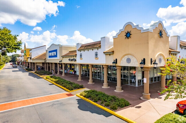
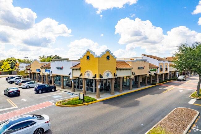
Property Record
1901 E State Road 60, Valrico, FL 33594

Current Lease Availabilities
Property Detail
1901 E State Road 60
U-25-29-20-ZZZ-000002-59860.0
FROM NE COR OF NE 1/4 RUN S 132.20 FT AND W 55 FT THN W 148 FT FOR POB THN W 478.38 FT S 131.14 FT W 164 FT N 131 FT W 327.83 FT S 600 FT E 1119.96 FT N 376.75 FT W 153 FT AND N 181 FT TO POB LESS E 28 FT OF S 24 FT AND LESS RD R/W AND LESS COM AT NE
Regionalshoppingcenterormallwithanchorstore
Hillsborough
PD
Florida
B and X Area of moderate flood hazard, usually the area between the limits of the 100-year and 500-year floods.
59860
2024
13.22 AC
2025
Eastern Outlying
013312
Tampa/St Petersburg
134,594 SF
Tampa-St. Petersburg-Clearwater, FL
NEARBY LISTINGS FOR SALE OR LEASE
DEMOGRAPHICS near 1901 E State Road 60
1 mile
3 mile
5 mile
2025 Total Population
13,982
82,543
196,147
2030 Population
14,937
88,315
210,018
Pop Growth 2025-2030
+ 6.83%
+ 6.99%
+ 7.07%
Average Age
42
41
40
2025 Total Households
5,216
30,142
72,508
HH Growth 2025-2030
+ 7.04%
+ 7.15%
+ 7.25%
Median Household Inc
$82,416
$90,109
$85,677
Avg Household Size
2.60
2.70
2.60
2025 Avg HH Vehicles
2.00
2.00
2.00
Median Home Value
$365,384
$386,592
$383,126
Median Year Built
1990
1989
1992
Nearby Places
Map Layers
Map Styles
 Street
 Aerial
Layers
 Traffic
 Biking
Places
Listings with unknown addresses are not visible on the map
- Restaurants
- Banks
- Shops
- Fitness
- Groceries
PUBLIC TRANSPORTATION
AIRPORT
Tampa International
Drive
Walk
Distance
Tampa International
35 min
22.0 mi
St Pete-Clearwater International
Drive
Walk
Distance
St Pete-Clearwater International
52 min
31.2 mi
Freight Ports
Port of Tampa Bay
Drive
Walk
Distance
Port of Tampa Bay
25 min
14.1 mi
Nearby Properties
Address
Land Use
TOTAL SIZE
Lot Size
Zoning
Address
Land Use
TOTAL SIZE
Lot Size
Zoning
536,433 SF
18.23 AC
PD
Address
Land Use
TOTAL SIZE
Lot Size
Zoning
88,895 SF
587.01 AC
AR
Address
Land Use
TOTAL SIZE
Lot Size
Zoning
402,388 SF
34.49 AC
PD
Address
Land Use
TOTAL SIZE
Lot Size
Zoning
288,270 SF
78.75 AC
PD
Address
Land Use
TOTAL SIZE
Lot Size
Zoning
113,979 SF
18.40 AC
PD
Address
Land Use
TOTAL SIZE
Lot Size
Zoning
219,902 SF
16.65 AC
PD
Address
Land Use
TOTAL SIZE
Lot Size
Zoning
172,136 SF
21.94 AC
PD
Address
Land Use
TOTAL SIZE
Lot Size
Zoning
143,487 SF
8.85 AC
RMC-9
Address
Land Use
TOTAL SIZE
Lot Size
Zoning
185,184 SF
9.65 AC
PD
Address
Land Use
TOTAL SIZE
Lot Size
Zoning
123,646 SF
16.10 AC
RSC-6
Address
Land Use
TOTAL SIZE
Lot Size
Zoning
140,058 SF
8.71 AC
RMC-20
Address
Land Use
TOTAL SIZE
Lot Size
Zoning
141,626 SF
8.88 AC
PD
Address
Land Use
TOTAL SIZE
Lot Size
Zoning
302,054 SF
68.34 AC
RSC-6
Address
Land Use
TOTAL SIZE
Lot Size
Zoning
163,427 SF
38.66 AC
RSC-6
Address
Land Use
TOTAL SIZE
Lot Size
Zoning
156,266 SF
9.27 AC
PD
Address
Land Use
TOTAL SIZE
Lot Size
Zoning
361,657 SF
24.15 AC
PD
Address
Land Use
TOTAL SIZE
Lot Size
Zoning
124,207 SF
28.64 AC
RSC-6
Address
Land Use
TOTAL SIZE
Lot Size
Zoning
209,392 SF
27.16 AC
PD
Address
Land Use
TOTAL SIZE
Lot Size
Zoning
158,777 SF
15.23 AC
TND
Address
Land Use
TOTAL SIZE
Lot Size
Zoning
107,525 SF
2.84 AC
PD
Address
Land Use
TOTAL SIZE
Lot Size
Zoning
116,149 SF
8.14 AC
RMC-9
Address
Land Use
TOTAL SIZE
Lot Size
Zoning
147,527 SF
9.25 AC
PD
Address
Land Use
TOTAL SIZE
Lot Size
Zoning
106,224 SF
4.48 AC
PD
Address
Land Use
TOTAL SIZE
Lot Size
Zoning
85,972 SF
10.49 AC
PD
Address
Land Use
TOTAL SIZE
Lot Size
Zoning
216,537 SF
31.18 AC
PD
Address
Land Use
TOTAL SIZE
Lot Size
Zoning
58,988 SF
4.40 AC
PD
Address
Land Use
TOTAL SIZE
Lot Size
Zoning
7,064 SF
58.34 AC
PD
Address
Land Use
TOTAL SIZE
Lot Size
Zoning
94,502 SF
10.38 AC
BMS-TC2
Address
Land Use
TOTAL SIZE
Lot Size
Zoning
165,601 SF
21.55 AC
PD
The World's #1 Commercial Real Estate Marketplace
Connect with us
© 2026 CoStar Group
The information above has been obtained from sources believed reliable. While we do not doubt its accuracy we have not verified it and make no guarantee, warranty or representation about it. It is your responsibility to independently confirm its accuracy and completeness. Any projections, opinions, assumptions, or estimates used are for example only and do not represent the current or future performance of the property. The value of this transaction to you depends on tax and other factors which should be evaluated by your tax, financial, and legal advisors. You and your advisors should conduct a careful, independent investigation of the property to determine to your satisfaction the suitability of the property for your needs.