Property Record
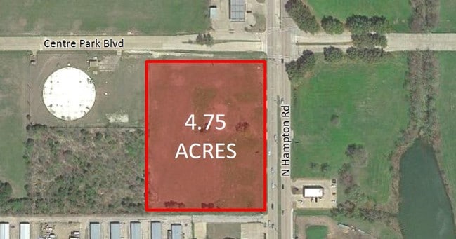
1901 N Hampton Rd, Desoto, TX 75115


NEARBY LISTINGS FOR SALE OR LEASE
Property Detail
1901 N Hampton Rd
Dallas-Fort Worth-Arlington, TX
Platinum Milestone
65011077510030000
PLATINUM MILESTONE BLK A LT 1 ACS 4.743 INT201700144632 DD05192017 CO-DC 0110775100300 5CS01107751
Hospitalprivate
Dallas
X
Texas
48113C0490K
1
2024
4.74 AC
2025
Southwest Dallas
016634
Dallas/Ft Worth
53,578 SF
DEMOGRAPHICS near 1901 N Hampton Rd
1 Mile
3 Mile
5 Mile
2024 Total Population
4,905
76,063
208,942
2029 Population
4,864
75,102
205,913
Pop Growth 2024-2029
(0.84%)
(1.26%)
(1.45%)
Average Age
41
38
38
2024 Total Households
2,075
27,871
72,473
HH Growth 2024-2029
(1.11%)
(1.51%)
(1.67%)
Median Household Inc
$48,571
$52,908
$59,077
Avg Household Size
2.30
2.70
2.80
2024 Avg HH Vehicles
2.00
2.00
2.00
Median Home Value
$237,316
$215,289
$214,090
Median Year Built
1986
1984
1985
Nearby Places
Map Layers
Map Styles
 Street
 Aerial
- Restaurants
- Banks
- Shops
- Fitness
- Groceries
PUBLIC TRANSPORTATION
AIRPORT
Dallas Love Field
DRIVE
WALK
Distance
Dallas Love Field
30 min
17.7 mi
Dallas-Fort Worth International
DRIVE
WALK
Distance
Dallas-Fort Worth International
39 min
29.1 mi
Nearby Properties
Address
Land Use
TOTAL SIZE
Lot Size
Zoning
Address
Land Use
TOTAL SIZE
Lot Size
Zoning
726,662 SF
44.94 AC
Z239
Address
Land Use
TOTAL SIZE
Lot Size
Zoning
1,316,325 SF
54.36 AC
Z111
Address
Land Use
TOTAL SIZE
Lot Size
Zoning
1,126,320 SF
63.41 AC
Z111
Address
Land Use
TOTAL SIZE
Lot Size
Zoning
1,167,500 SF
46.04 AC
Z06
Address
Land Use
TOTAL SIZE
Lot Size
Zoning
951,480 SF
50.63 AC
Z109
Address
Land Use
TOTAL SIZE
Lot Size
Zoning
948,392 SF
50.80 AC
Z109
Address
Land Use
TOTAL SIZE
Lot Size
Zoning
872,640 SF
46.97 AC
Z125
Address
Land Use
TOTAL SIZE
Lot Size
Zoning
823,000 SF
45.10 AC
Z298
Address
Land Use
TOTAL SIZE
Lot Size
Zoning
662,230 SF
38.49 AC
Z248
Address
Land Use
TOTAL SIZE
Lot Size
Zoning
660,400 SF
35.93 AC
Z125
Address
Land Use
TOTAL SIZE
Lot Size
Zoning
595,148 SF
34.96 AC
Z39
Address
Land Use
TOTAL SIZE
Lot Size
Zoning
123,880 SF
16.80 AC
Z236
Address
Land Use
TOTAL SIZE
Lot Size
Zoning
610,806 SF
33.66 AC
Z125
Address
Land Use
TOTAL SIZE
Lot Size
Zoning
610,806 SF
34.20 AC
Z125
Address
Land Use
TOTAL SIZE
Lot Size
Zoning
507,318 SF
28.40 AC
Z111
Address
Land Use
TOTAL SIZE
Lot Size
Zoning
172,840 SF
49.65 AC
Z164
Address
Land Use
TOTAL SIZE
Lot Size
Zoning
552,200 SF
41.36 AC
Z109
Address
Land Use
TOTAL SIZE
Lot Size
Zoning
610,669 SF
41.65 AC
Z125
Address
Land Use
TOTAL SIZE
Lot Size
Zoning
489,310 SF
33.91 AC
Z111
Address
Land Use
TOTAL SIZE
Lot Size
Zoning
374,400 SF
6.15 AC
Z150
Address
Land Use
TOTAL SIZE
Lot Size
Zoning
531,254 SF
33.40 AC
Z06
Address
Land Use
TOTAL SIZE
Lot Size
Zoning
469,000 SF
28.81 AC
Z125
Address
Land Use
TOTAL SIZE
Lot Size
Zoning
453,600 SF
29.54 AC
Z236
Address
Land Use
TOTAL SIZE
Lot Size
Zoning
421,890 SF
23.95 AC
Z111
Address
Land Use
TOTAL SIZE
Lot Size
Zoning
406,400 SF
22.15 AC
Z125
Address
Land Use
TOTAL SIZE
Lot Size
Zoning
400,000 SF
24.69 AC
Z116
Address
Land Use
TOTAL SIZE
Lot Size
Zoning
444,216 SF
23.99 AC
Z39
Address
Land Use
TOTAL SIZE
Lot Size
Zoning
344,952 SF
14.39 AC
Z239
Address
Land Use
TOTAL SIZE
Lot Size
Zoning
253,794 SF
10.23 AC
Z201
Address
Land Use
TOTAL SIZE
Lot Size
Zoning
222,576 SF
35.20 AC
Z239
The World's #1 Commercial Real Estate Marketplace
Connect with us
© 2025 CoStar Group
The information above has been obtained from sources believed reliable. While we do not doubt its accuracy we have not verified it and make no guarantee, warranty or representation about it. It is your responsibility to independently confirm its accuracy and completeness. Any projections, opinions, assumptions, or estimates used are for example only and do not represent the current or future performance of the property. The value of this transaction to you depends on tax and other factors which should be evaluated by your tax, financial, and legal advisors. You and your advisors should conduct a careful, independent investigation of the property to determine to your satisfaction the suitability of the property for your needs.