Property Record
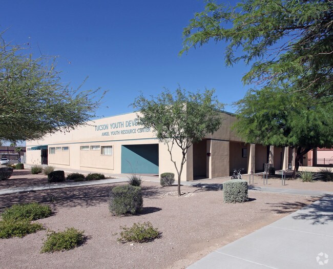
1901 N Stone Ave, Tucson, AZ 85705


Property Detail
1901 N Stone Ave
115-06-117B
BRONX PARK LOT 8 EXC N4.10 E88.40 W100.32 & LOTS 9 10 & 11 & W119.55 N8 ABAND PLATA ST ADJ TO LOT 11 BLK 27
Privateschool
Pima
I1
Arizona
B and X Area of moderate flood hazard, usually the area between the limits of the 100-year and 500-year floods.
8
0
0.76 AC
2026
West Tucson
001302
Tucson
8,250 SF
Tucson, AZ
NEARBY LISTINGS FOR SALE OR LEASE
-
-
View all Tucson listings for sale on LoopNet.com
DEMOGRAPHICS near 1901 N Stone Ave
1 mile
3 mile
5 mile
2025 Total Population
18,631
130,796
268,674
2030 Population
19,335
134,771
276,842
Pop Growth 2025-2030
+ 3.78%
+ 3.04%
+ 3.04%
Average Age
36
36
38
2025 Total Households
8,855
58,008
118,507
HH Growth 2025-2030
+ 3.92%
+ 3.17%
+ 3.19%
Median Household Inc
$35,851
$42,482
$48,817
Avg Household Size
2.00
2.00
2.10
2025 Avg HH Vehicles
1.00
1.00
2.00
Median Home Value
$268,279
$283,333
$279,649
Median Year Built
1974
1974
1975
Nearby Places
Map Layers
Map Styles
 Street
 Aerial
Layers
 Traffic
 Biking
Places
Listings with unknown addresses are not visible on the map
- Restaurants
- Banks
- Shops
- Fitness
- Groceries
PUBLIC TRANSPORTATION
COMMUTER RAIL
Drive
Walk
Distance
4 min
1.8 mi
AIRPORT
Tucson International
Drive
Walk
Distance
Tucson International
20 min
11.0 mi
Nearby Properties
Address
Land Use
TOTAL SIZE
Lot Size
Zoning
Address
Land Use
TOTAL SIZE
Lot Size
Zoning
251,851 SF
0.74 AC
Address
Land Use
TOTAL SIZE
Lot Size
Zoning
6,691,842 SF
179.97 AC
Address
Land Use
TOTAL SIZE
Lot Size
Zoning
1,316,364 SF
12.21 AC
Address
Land Use
TOTAL SIZE
Lot Size
Zoning
1,811,513 SF
30.09 AC
Address
Land Use
TOTAL SIZE
Lot Size
Zoning
134,710 SF
9.59 AC
I1
Address
Land Use
TOTAL SIZE
Lot Size
Zoning
663,900 SF
14.54 AC
Address
Land Use
TOTAL SIZE
Lot Size
Zoning
106,852 SF
19.50 AC
I1
Address
Land Use
TOTAL SIZE
Lot Size
Zoning
640,899 SF
13.61 AC
Address
Land Use
TOTAL SIZE
Lot Size
Zoning
813,186 SF
3.65 AC
OCR2
Address
Land Use
TOTAL SIZE
Lot Size
Zoning
89,497 SF
0.51 AC
Address
Land Use
TOTAL SIZE
Lot Size
Zoning
657,188 SF
24.97 AC
PAD5
Address
Land Use
TOTAL SIZE
Lot Size
Zoning
866,763 SF
17.17 AC
O3
Address
Land Use
TOTAL SIZE
Lot Size
Zoning
326,845 SF
0.71 AC
Address
Land Use
TOTAL SIZE
Lot Size
Zoning
837,885 SF
16.41 AC
R2
Address
Land Use
TOTAL SIZE
Lot Size
Zoning
60,426 SF
0.43 AC
OCR2
Address
Land Use
TOTAL SIZE
Lot Size
Zoning
451,596 SF
18.92 AC
C3
Address
Land Use
TOTAL SIZE
Lot Size
Zoning
60,377 SF
6.25 AC
I1
Address
Land Use
TOTAL SIZE
Lot Size
Zoning
239,060 SF
7.85 AC
Address
Land Use
TOTAL SIZE
Lot Size
Zoning
495,871 SF
3.56 AC
Address
Land Use
TOTAL SIZE
Lot Size
Zoning
226,240 SF
0.33 AC
R2
Address
Land Use
TOTAL SIZE
Lot Size
Zoning
278,566 SF
0.60 AC
C1
Address
Land Use
TOTAL SIZE
Lot Size
Zoning
21,126 SF
1.10 AC
O3
Address
Land Use
TOTAL SIZE
Lot Size
Zoning
652,898 SF
233.08 AC
RX2
Address
Land Use
TOTAL SIZE
Lot Size
Zoning
299,658 SF
0.77 AC
Address
Land Use
TOTAL SIZE
Lot Size
Zoning
172,623 SF
0.15 AC
R1
Address
Land Use
TOTAL SIZE
Lot Size
Zoning
360,881 SF
21.39 AC
Address
Land Use
TOTAL SIZE
Lot Size
Zoning
1.45 AC
HR1
Address
Land Use
TOTAL SIZE
Lot Size
Zoning
419,317 SF
7.23 AC
Address
Land Use
TOTAL SIZE
Lot Size
Zoning
296,286 SF
0.71 AC
Address
Land Use
TOTAL SIZE
Lot Size
Zoning
141,450 SF
0.14 AC
R1
The World's #1 Commercial Real Estate Marketplace
Connect with us
© 2026 CoStar Group
The information above has been obtained from sources believed reliable. While we do not doubt its accuracy we have not verified it and make no guarantee, warranty or representation about it. It is your responsibility to independently confirm its accuracy and completeness. Any projections, opinions, assumptions, or estimates used are for example only and do not represent the current or future performance of the property. The value of this transaction to you depends on tax and other factors which should be evaluated by your tax, financial, and legal advisors. You and your advisors should conduct a careful, independent investigation of the property to determine to your satisfaction the suitability of the property for your needs.