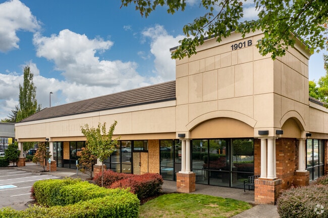
Property Record
1901 Ne 162Nd Ave, Vancouver, WA 98684


NEARBY LISTINGS FOR SALE OR LEASE
-
-
No Photo
-
-
-
-
-
-
View all Vancouver listings for sale on LoopNet.com
Property Detail
1901 Ne 162Nd Ave
164354-000
#106 SEC 24 T2N R2EWM 6.82A FOR ASSESSOR USE ONLY A PTN OF SEQ SEC 24 DAF: BEG AT SW COR SD SEQ TH ALG W LI SD SEQ N 1DG 40MIN 59SEC E 645.02 FT TH S 88DG 38MIN 00SEC E 550.01 FT TH S 1DG 40MIN 59SEC W 645.02 FT TAP ON S LI SD SEC TH ALG SD S LI N 88
Regionalshoppingcenterormallwithanchorstore
Clark
X
Washington
53011C0394D
6.82 AC
2025
Camas/Washougal
2025
Portland
041335
Portland-Vancouver-Hillsboro, OR-WA
68,091 SF
DEMOGRAPHICS near 1901 Ne 162Nd Ave
1 Mile
3 Mile
5 Mile
2024 Total Population
16,123
110,658
218,523
2029 Population
17,304
119,732
236,209
Pop Growth 2024-2029
+ 7.32%
+ 8.20%
+ 8.09%
Average Age
40
40
40
2024 Total Households
5,450
42,010
81,276
HH Growth 2024-2029
+ 7.49%
+ 8.34%
+ 8.22%
Median Household Inc
$98,096
$81,314
$82,994
Avg Household Size
2.90
2.60
2.60
2024 Avg HH Vehicles
2.00
2.00
2.00
Median Home Value
$447,500
$412,596
$423,214
Median Year Built
1996
1994
1994
Nearby Places
Map Layers
Map Styles
 Street
 Aerial
- Restaurants
- Banks
- Shops
- Fitness
- Groceries
PUBLIC TRANSPORTATION
AIRPORT
Portland International
DRIVE
WALK
Distance
Portland International
20 min
10.1 mi
Freight Ports
Port of Vancouver
DRIVE
WALK
Distance
Port of Vancouver
25 min
12.5 mi
Nearby Properties
Address
Land Use
TOTAL SIZE
Lot Size
Zoning
Address
Land Use
TOTAL SIZE
Lot Size
Zoning
309,088 SF
17.57 AC
RC
Address
Land Use
TOTAL SIZE
Lot Size
Zoning
817,650 SF
119.73 AC
LI/BP
Address
Land Use
TOTAL SIZE
Lot Size
Zoning
681,799 SF
36.22 AC
IL
Address
Land Use
TOTAL SIZE
Lot Size
Zoning
399,563 SF
12.98 AC
CC
Address
Land Use
TOTAL SIZE
Lot Size
Zoning
929,350 SF
143.57 AC
LI/BP
Address
Land Use
TOTAL SIZE
Lot Size
Zoning
304,876 SF
11.34 AC
R-18
Address
Land Use
TOTAL SIZE
Lot Size
Zoning
340,500 SF
19.01 AC
R-22
Address
Land Use
TOTAL SIZE
Lot Size
Zoning
264,044 SF
11.16 AC
CC
Address
Land Use
TOTAL SIZE
Lot Size
Zoning
339,894 SF
27.82 AC
R-22
Address
Land Use
TOTAL SIZE
Lot Size
Zoning
237,558 SF
15.48 AC
R-22
Address
Land Use
TOTAL SIZE
Lot Size
Zoning
341,504 SF
19.49 AC
R-22
Address
Land Use
TOTAL SIZE
Lot Size
Zoning
49,124 SF
17.26 AC
R-18
Address
Land Use
TOTAL SIZE
Lot Size
Zoning
233,766 SF
5.34 AC
R-30
Address
Land Use
TOTAL SIZE
Lot Size
Zoning
104,279 SF
6.09 AC
MX
Address
Land Use
TOTAL SIZE
Lot Size
Zoning
204,999 SF
5.71 AC
MX
Address
Land Use
TOTAL SIZE
Lot Size
Zoning
280,065 SF
14.80 AC
R-22
Address
Land Use
TOTAL SIZE
Lot Size
Zoning
247,598 SF
45.75 AC
CG
Address
Land Use
TOTAL SIZE
Lot Size
Zoning
253,976 SF
11.46 AC
MX
Address
Land Use
TOTAL SIZE
Lot Size
Zoning
603,750 SF
49.11 AC
IL
Address
Land Use
TOTAL SIZE
Lot Size
Zoning
285,765 SF
14.41 AC
R-22
Address
Land Use
TOTAL SIZE
Lot Size
Zoning
212,641 SF
8.03 AC
R-22
Address
Land Use
TOTAL SIZE
Lot Size
Zoning
171,584 SF
6.26 AC
MX
Address
Land Use
TOTAL SIZE
Lot Size
Zoning
100,476 SF
5.51 AC
R-18
Address
Land Use
TOTAL SIZE
Lot Size
Zoning
301,864 SF
9.53 AC
R-22
Address
Land Use
TOTAL SIZE
Lot Size
Zoning
188,974 SF
7.19 AC
R-30
Address
Land Use
TOTAL SIZE
Lot Size
Zoning
199,197 SF
10.60 AC
R-22
Address
Land Use
TOTAL SIZE
Lot Size
Zoning
273,844 SF
13.09 AC
R-22
Address
Land Use
TOTAL SIZE
Lot Size
Zoning
244,000 SF
14.38 AC
R-30
Address
Land Use
TOTAL SIZE
Lot Size
Zoning
220,905 SF
9.04 AC
R-22
The World's #1 Commercial Real Estate Marketplace
Connect with us
© 2026 CoStar Group
The information above has been obtained from sources believed reliable. While we do not doubt its accuracy we have not verified it and make no guarantee, warranty or representation about it. It is your responsibility to independently confirm its accuracy and completeness. Any projections, opinions, assumptions, or estimates used are for example only and do not represent the current or future performance of the property. The value of this transaction to you depends on tax and other factors which should be evaluated by your tax, financial, and legal advisors. You and your advisors should conduct a careful, independent investigation of the property to determine to your satisfaction the suitability of the property for your needs.