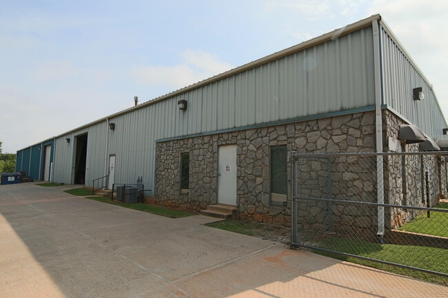
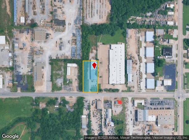
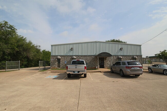
Property Record
1901 Se 29Th St, Oklahoma City, OK 73129
Current Lease Availabilities
NEARBY LISTINGS FOR SALE OR LEASE
Property Detail
1901 Se 29Th St
Oklahoma City, OK
Trosper Addition
143177800
TROSPER ADDITION 031 000 W 1/2 LOT 4
Warehouse
Oklahoma
X
Oklahoma
40109C0315H
4
2023
2.23 AC
2024
Southeast
105300
Oklahoma City
12,000 SF
DEMOGRAPHICS near 1901 Se 29Th St
1 Mile
3 Mile
5 Mile
2024 Total Population
2,515
67,407
204,054
2029 Population
2,571
69,578
211,384
Pop Growth 2024-2029
+ 2.23%
+ 3.22%
+ 3.59%
Average Age
34
35
36
2024 Total Households
842
25,254
79,675
HH Growth 2024-2029
+ 2.38%
+ 3.30%
+ 3.67%
Median Household Inc
$49,213
$41,626
$44,438
Avg Household Size
2.90
2.60
2.40
2024 Avg HH Vehicles
2.00
2.00
2.00
Median Home Value
$68,877
$79,383
$100,554
Median Year Built
1956
1967
1967
Nearby Places
Map Layers
Map Styles
 Street
 Aerial
- Restaurants
- Banks
- Shops
- Fitness
- Groceries
PUBLIC TRANSPORTATION
COMMUTER RAIL
Oklahoma City (Heartland Flyer - Amtrak)
DRIVE
WALK
Distance
Oklahoma City (Heartland Flyer - Amtrak)
6 min
3.7 mi
AIRPORT
Will Rogers World
DRIVE
WALK
Distance
Will Rogers World
21 min
11.6 mi
Freight Ports
Tulsa Port Of Catoosa
DRIVE
WALK
Distance
Tulsa Port Of Catoosa
136 min
124.1 mi
Nearby Properties
Address
Land Use
TOTAL SIZE
Lot Size
Zoning
Address
Land Use
TOTAL SIZE
Lot Size
Zoning
52,331 SF
2.72 AC
DBD
Address
Land Use
TOTAL SIZE
Lot Size
Zoning
303,589 SF
7.17 AC
PUD
Address
Land Use
TOTAL SIZE
Lot Size
Zoning
382,618 SF
5.13 AC
BC
Address
Land Use
TOTAL SIZE
Lot Size
Zoning
38,866 SF
2.89 AC
DBD
Address
Land Use
TOTAL SIZE
Lot Size
Zoning
307,772 SF
1.32 AC
DBD
Address
Land Use
TOTAL SIZE
Lot Size
Zoning
281,052 SF
1.89 AC
DBD
Address
Land Use
TOTAL SIZE
Lot Size
Zoning
42,450 SF
0.32 AC
BC
Address
Land Use
TOTAL SIZE
Lot Size
Zoning
302,236 SF
2.62 AC
SPUD
Address
Land Use
TOTAL SIZE
Lot Size
Zoning
279,464 SF
1.49 AC
DBD
Address
Land Use
TOTAL SIZE
Lot Size
Zoning
188,121 SF
0.83 AC
BC
Address
Land Use
TOTAL SIZE
Lot Size
Zoning
344,045 SF
0.55 AC
DBD
Address
Land Use
TOTAL SIZE
Lot Size
Zoning
502,508 SF
2.27 AC
DBD
Address
Land Use
TOTAL SIZE
Lot Size
Zoning
184,398 SF
8.09 AC
PUD
Address
Land Use
TOTAL SIZE
Lot Size
Zoning
621,489 SF
3.10 AC
DBD
Address
Land Use
TOTAL SIZE
Lot Size
Zoning
312,675 SF
25.01 AC
Address
Land Use
TOTAL SIZE
Lot Size
Zoning
150,272 SF
1.54 AC
DBD
Address
Land Use
TOTAL SIZE
Lot Size
Zoning
0.42 AC
BC
Address
Land Use
TOTAL SIZE
Lot Size
Zoning
123,956 SF
0.73 AC
DBD
Address
Land Use
TOTAL SIZE
Lot Size
Zoning
152,302 SF
14 AC
SPUD
Address
Land Use
TOTAL SIZE
Lot Size
Zoning
460,398 SF
0.69 AC
DBD
Address
Land Use
TOTAL SIZE
Lot Size
Zoning
496,495 SF
2.02 AC
DBD
Address
Land Use
TOTAL SIZE
Lot Size
Zoning
104,100 SF
2.41 AC
PUD
Address
Land Use
TOTAL SIZE
Lot Size
Zoning
85,949 SF
0.50 AC
BC
Address
Land Use
TOTAL SIZE
Lot Size
Zoning
110,937 SF
0.55 AC
BC
Address
Land Use
TOTAL SIZE
Lot Size
Zoning
109,781 SF
0.91 AC
DBD
Address
Land Use
TOTAL SIZE
Lot Size
Zoning
392,100 SF
7.87 AC
I-2
Address
Land Use
TOTAL SIZE
Lot Size
Zoning
296,700 SF
9.17 AC
I-2
Address
Land Use
TOTAL SIZE
Lot Size
Zoning
197,130 SF
0.64 AC
BC
Address
Land Use
TOTAL SIZE
Lot Size
Zoning
501,811 SF
29.33 AC
I-2
Address
Land Use
TOTAL SIZE
Lot Size
Zoning
65,009 SF
8.72 AC
SPUD
The World's #1 Commercial Real Estate Marketplace
Connect with us
© 2026 CoStar Group
The information above has been obtained from sources believed reliable. While we do not doubt its accuracy we have not verified it and make no guarantee, warranty or representation about it. It is your responsibility to independently confirm its accuracy and completeness. Any projections, opinions, assumptions, or estimates used are for example only and do not represent the current or future performance of the property. The value of this transaction to you depends on tax and other factors which should be evaluated by your tax, financial, and legal advisors. You and your advisors should conduct a careful, independent investigation of the property to determine to your satisfaction the suitability of the property for your needs.