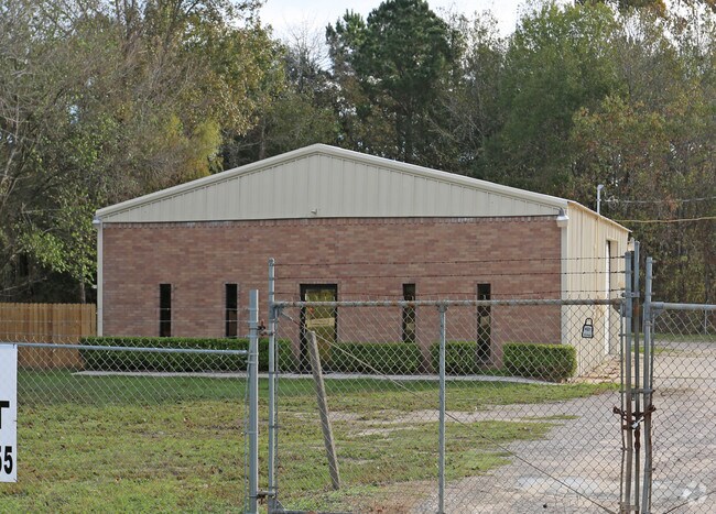
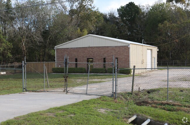
Property Record
19017 Fm 1314 Rd, Conroe, TX 77302

Property Detail
19017 Fm 1314 Rd
9735-00-00800
S973500 - WOODRIDGE ESTATES, LOT 8, 9, ACRES 0.92
Commercialnec
Montgomery
1
Texas
B and X Area of moderate flood hazard, usually the area between the limits of the 100-year and 500-year floods.
8,9
2024
0.92 AC
2025
The Woodlands/Conroe
692202
Houston
2,640 SF
Houston-Pasadena-The Woodlands, TX
NEARBY LISTINGS FOR SALE OR LEASE
DEMOGRAPHICS near 19017 Fm 1314 Rd
1 mile
3 mile
5 mile
2025 Total Population
772
14,378
55,275
2030 Population
931
17,423
65,745
Pop Growth 2025-2030
+ 20.60%
+ 21.18%
+ 18.94%
Average Age
37
36
35
2025 Total Households
249
4,495
17,174
HH Growth 2025-2030
+ 20.88%
+ 21.51%
+ 19.48%
Median Household Inc
$66,000
$89,255
$91,936
Avg Household Size
3.10
3.10
3.10
2025 Avg HH Vehicles
2.00
2.00
2.00
Median Home Value
$367,499
$299,999
$325,442
Median Year Built
2010
2010
2010
Nearby Places
Map Layers
Map Styles
 Street
 Aerial
Layers
 Traffic
 Biking
Places
Listings with unknown addresses are not visible on the map
- Restaurants
- Banks
- Shops
- Fitness
- Groceries
PUBLIC TRANSPORTATION
AIRPORT
George Bush Intcntl/Houston
Drive
Walk
Distance
George Bush Intcntl/Houston
34 min
27.0 mi
Nearby Properties
Address
Land Use
TOTAL SIZE
Lot Size
Zoning
Address
Land Use
TOTAL SIZE
Lot Size
Zoning
1,500,000 SF
86.90 AC
5
Address
Land Use
TOTAL SIZE
Lot Size
Zoning
1,014,160 SF
132.38 AC
Address
Land Use
TOTAL SIZE
Lot Size
Zoning
148,358 SF
16.01 AC
Address
Land Use
TOTAL SIZE
Lot Size
Zoning
130,578 SF
11.57 AC
5
Address
Land Use
TOTAL SIZE
Lot Size
Zoning
37,135 SF
366.48 AC
5
Address
Land Use
TOTAL SIZE
Lot Size
Zoning
95,185 SF
10.48 AC
1
Address
Land Use
TOTAL SIZE
Lot Size
Zoning
52,796 SF
6.58 AC
Address
Land Use
TOTAL SIZE
Lot Size
Zoning
96,946 SF
12 AC
1
Address
Land Use
TOTAL SIZE
Lot Size
Zoning
86,584 SF
5.58 AC
Address
Land Use
TOTAL SIZE
Lot Size
Zoning
45,120 SF
9.73 AC
Address
Land Use
TOTAL SIZE
Lot Size
Zoning
49,320 SF
3 AC
5
Address
Land Use
TOTAL SIZE
Lot Size
Zoning
22,776 SF
49.77 AC
Address
Land Use
TOTAL SIZE
Lot Size
Zoning
55,225 SF
5 AC
Address
Land Use
TOTAL SIZE
Lot Size
Zoning
17,752 SF
5.25 AC
Address
Land Use
TOTAL SIZE
Lot Size
Zoning
32,730 SF
4.41 AC
Address
Land Use
TOTAL SIZE
Lot Size
Zoning
33,660 SF
1.90 AC
5
Address
Land Use
TOTAL SIZE
Lot Size
Zoning
8,320 SF
5.46 AC
1
Address
Land Use
TOTAL SIZE
Lot Size
Zoning
26,558 SF
12 AC
1
Address
Land Use
TOTAL SIZE
Lot Size
Zoning
31,250 SF
8.34 AC
Address
Land Use
TOTAL SIZE
Lot Size
Zoning
11,200 SF
1.29 AC
Address
Land Use
TOTAL SIZE
Lot Size
Zoning
9,100 SF
1.87 AC
5
Address
Land Use
TOTAL SIZE
Lot Size
Zoning
29,314 SF
1.34 AC
1
Address
Land Use
TOTAL SIZE
Lot Size
Zoning
24,800 SF
6.89 AC
Address
Land Use
TOTAL SIZE
Lot Size
Zoning
19,200 SF
2.57 AC
Address
Land Use
TOTAL SIZE
Lot Size
Zoning
7,728 SF
2.56 AC
5
Address
Land Use
TOTAL SIZE
Lot Size
Zoning
9,146 SF
1.64 AC
1
Address
Land Use
TOTAL SIZE
Lot Size
Zoning
5,820 SF
2.39 AC
1
Address
Land Use
TOTAL SIZE
Lot Size
Zoning
6,100 SF
2.84 AC
Address
Land Use
TOTAL SIZE
Lot Size
Zoning
1,440 SF
12.81 AC
1
Address
Land Use
TOTAL SIZE
Lot Size
Zoning
12,880 SF
5.86 AC
1
The World's #1 Commercial Real Estate Marketplace
Connect with us
© 2026 CoStar Group
The information above has been obtained from sources believed reliable. While we do not doubt its accuracy we have not verified it and make no guarantee, warranty or representation about it. It is your responsibility to independently confirm its accuracy and completeness. Any projections, opinions, assumptions, or estimates used are for example only and do not represent the current or future performance of the property. The value of this transaction to you depends on tax and other factors which should be evaluated by your tax, financial, and legal advisors. You and your advisors should conduct a careful, independent investigation of the property to determine to your satisfaction the suitability of the property for your needs.