Property Record
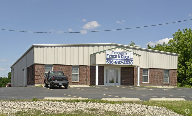
1902 Highway 61, Wentzville, MO 63385


NEARBY LISTINGS FOR SALE OR LEASE
Property Detail
1902 Highway 61
St. Louis, MO-IL
Peanick Parc
2-0143-9524-00-0003.0000000
PEANICK PARC LOT 3
Commercialnec
St. Charles
X
Missouri
29183C0205G
3
2024
1 AC
2025
St Charles County
312192
St. Louis
6,000 SF
DEMOGRAPHICS near 1902 Highway 61
1 Mile
3 Mile
5 Mile
2024 Total Population
4,456
28,885
59,472
2029 Population
4,729
30,721
63,620
Pop Growth 2024-2029
+ 6.13%
+ 6.36%
+ 6.97%
Average Age
37
37
37
2024 Total Households
1,572
10,182
20,725
HH Growth 2024-2029
+ 6.23%
+ 6.46%
+ 7.07%
Median Household Inc
$95,151
$93,704
$98,394
Avg Household Size
2.80
2.80
2.80
2024 Avg HH Vehicles
2.00
2.00
2.00
Median Home Value
$304,804
$282,439
$297,555
Median Year Built
2009
2005
2006
Nearby Places
Map Layers
Map Styles
 Street
 Aerial
- Restaurants
- Banks
- Shops
- Fitness
- Groceries
PUBLIC TRANSPORTATION
AIRPORT
St Louis Lambert International
DRIVE
WALK
Distance
St Louis Lambert International
45 min
33.6 mi
SALE & LEASE HISTORY
LISTING DATE
SALE/LEASE

Feb 07, 2017
For Lease
Feb 07, 2017
For Sale
Nearby Properties
Address
Land Use
TOTAL SIZE
Lot Size
Zoning
Address
Land Use
TOTAL SIZE
Lot Size
Zoning
1,150,000 SF
76.64 AC
Address
Land Use
TOTAL SIZE
Lot Size
Zoning
380,762 SF
24.76 AC
Address
Land Use
TOTAL SIZE
Lot Size
Zoning
420,000 SF
20.75 AC
Address
Land Use
TOTAL SIZE
Lot Size
Zoning
210,333 SF
25.16 AC
Address
Land Use
TOTAL SIZE
Lot Size
Zoning
18,284 SF
15.50 AC
Address
Land Use
TOTAL SIZE
Lot Size
Zoning
235,850 SF
12.97 AC
Address
Land Use
TOTAL SIZE
Lot Size
Zoning
165,953 SF
14 AC
Address
Land Use
TOTAL SIZE
Lot Size
Zoning
215,329 SF
19.29 AC
Address
Land Use
TOTAL SIZE
Lot Size
Zoning
68,644 SF
4.68 AC
Address
Land Use
TOTAL SIZE
Lot Size
Zoning
293,124 SF
22.81 AC
Address
Land Use
TOTAL SIZE
Lot Size
Zoning
285,050 SF
20.84 AC
Address
Land Use
TOTAL SIZE
Lot Size
Zoning
150,141 SF
54.62 AC
AC4
Address
Land Use
TOTAL SIZE
Lot Size
Zoning
140,375 SF
13.17 AC
Address
Land Use
TOTAL SIZE
Lot Size
Zoning
69,965 SF
8.09 AC
Address
Land Use
TOTAL SIZE
Lot Size
Zoning
136,594 SF
14.44 AC
Address
Land Use
TOTAL SIZE
Lot Size
Zoning
126,308 SF
11.63 AC
Address
Land Use
TOTAL SIZE
Lot Size
Zoning
18.75 AC
Address
Land Use
TOTAL SIZE
Lot Size
Zoning
52,222 SF
1.68 AC
Address
Land Use
TOTAL SIZE
Lot Size
Zoning
54,059 SF
2.06 AC
Address
Land Use
TOTAL SIZE
Lot Size
Zoning
83,191 SF
9.56 AC
Address
Land Use
TOTAL SIZE
Lot Size
Zoning
73.30 AC
AB7
Address
Land Use
TOTAL SIZE
Lot Size
Zoning
16,319 SF
7.01 AC
AB7
Address
Land Use
TOTAL SIZE
Lot Size
Zoning
106,800 SF
11.57 AC
Address
Land Use
TOTAL SIZE
Lot Size
Zoning
74,509 SF
7.98 AC
Address
Land Use
TOTAL SIZE
Lot Size
Zoning
70,978 SF
1.98 AC
Address
Land Use
TOTAL SIZE
Lot Size
Zoning
21.22 AC
Address
Land Use
TOTAL SIZE
Lot Size
Zoning
88,693 SF
6.54 AC
Address
Land Use
TOTAL SIZE
Lot Size
Zoning
56,694 SF
17.21 AC
Address
Land Use
TOTAL SIZE
Lot Size
Zoning
12,280 SF
16.61 AC
Address
Land Use
TOTAL SIZE
Lot Size
Zoning
80,000 SF
4.99 AC
The World's #1 Commercial Real Estate Marketplace
Connect with us
© 2026 CoStar Group
The information above has been obtained from sources believed reliable. While we do not doubt its accuracy we have not verified it and make no guarantee, warranty or representation about it. It is your responsibility to independently confirm its accuracy and completeness. Any projections, opinions, assumptions, or estimates used are for example only and do not represent the current or future performance of the property. The value of this transaction to you depends on tax and other factors which should be evaluated by your tax, financial, and legal advisors. You and your advisors should conduct a careful, independent investigation of the property to determine to your satisfaction the suitability of the property for your needs.