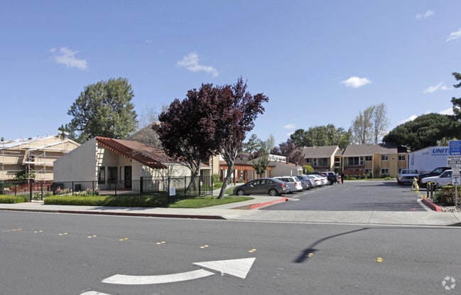
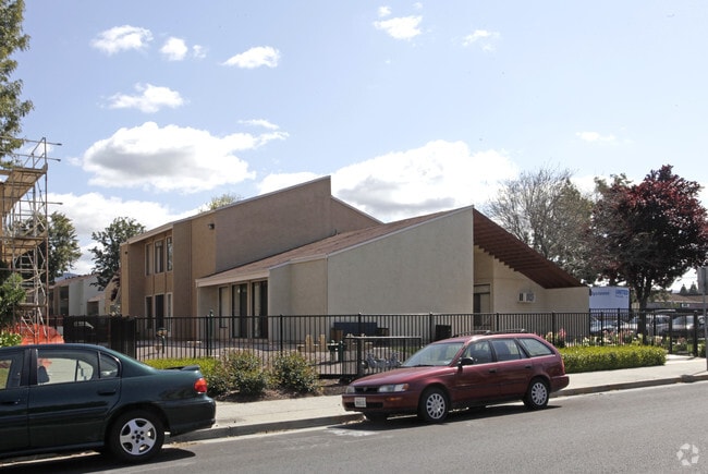
Property Record
1902 Lakewood Dr, San Jose, CA 95132


NEARBY LISTINGS FOR SALE OR LEASE
Property Detail
1902 Lakewood Dr
092-01-016
Milpitas Rho
Multifamilydwelling
Santa Clara
X
California
06085C0069H
6.91 AC
2024
Northwood
2025
South Bay/San Jose
504410
San Jose-Sunnyvale-Santa Clara, CA
146,150 SF
DEMOGRAPHICS near 1902 Lakewood Dr
1 Mile
3 Mile
5 Mile
2024 Total Population
26,390
165,806
378,153
2029 Population
25,583
159,374
363,311
Pop Growth 2024-2029
(3.06%)
(3.88%)
(3.92%)
Average Age
38
39
38
2024 Total Households
8,474
52,410
121,110
HH Growth 2024-2029
(3.07%)
(4.05%)
(3.99%)
Median Household Inc
$166,175
$154,997
$135,360
Avg Household Size
3.00
3.00
2.90
2024 Avg HH Vehicles
2.00
2.00
2.00
Median Home Value
$1,089,882
$1,064,828
$1,028,130
Median Year Built
1987
1984
1982
Nearby Places
Map Layers
Map Styles
 Street
 Aerial
- Restaurants
- Banks
- Shops
- Fitness
- Groceries
PUBLIC TRANSPORTATION
TRANSIT/SUBWAY
Cropley Station (Alum Rock - Santa Teresa Line - Santa Clara VTA Light Rail)
DRIVE
WALK
Distance
Cropley Station (Alum Rock - Santa Teresa Line - Santa Clara VTA Light Rail)
0 min
3 min
0.2 mi
Cropley Station (Mountain View - Alum Rock - VTA)
DRIVE
WALK
Distance
Cropley Station (Mountain View - Alum Rock - VTA)
0 min
5 min
0.3 mi
Montague Station (Alum Rock - Santa Teresa Line - VTA, Mountain View - Alum Rock - VTA)
DRIVE
WALK
Distance
Montague Station (Alum Rock - Santa Teresa Line - VTA, Mountain View - Alum Rock - VTA)
1 min
16 min
0.8 mi
Milpitas (Berryessa/North San Jose to Daly City - Bay Area Rapid Transit (BART), Berryessa/North San Jose to Richmond - Bay Area Rapid Transit (BART), Daly City to Berryessa/North San Jose - Bay Area Rapid Transit (BART), Richmond to Berryessa/North San Jose - Bay Area Rapid Transit (BART))
DRIVE
WALK
Distance
Milpitas (Berryessa/North San Jose to Daly City - Bay Area Rapid Transit (BART), Berryessa/North San Jose to Richmond - Bay Area Rapid Transit (BART), Daly City to Berryessa/North San Jose - Bay Area Rapid Transit (BART), Richmond to Berryessa/North San Jose - Bay Area Rapid Transit (BART))
2 min
17 min
0.9 mi
Hostetter Station (Alum Rock - Santa Teresa Line - Santa Clara VTA Light Rail)
DRIVE
WALK
Distance
Hostetter Station (Alum Rock - Santa Teresa Line - Santa Clara VTA Light Rail)
1 min
20 min
0.9 mi
COMMUTER RAIL
College Park (Caltrain - Caltrain (Caltrain))
DRIVE
WALK
Distance
College Park (Caltrain - Caltrain (Caltrain))
10 min
6.7 mi
Santa Clara Caltrain Station Northbound (Limited - Caltrain (Caltrain), Local Weekday - Caltrain (Caltrain), Local Weekend - Caltrain (Caltrain))
DRIVE
WALK
Distance
Santa Clara Caltrain Station Northbound (Limited - Caltrain (Caltrain), Local Weekday - Caltrain (Caltrain), Local Weekend - Caltrain (Caltrain))
12 min
7.7 mi
AIRPORT
Norman Y Mineta San Jose International
DRIVE
WALK
Distance
Norman Y Mineta San Jose International
11 min
5.9 mi
Metro Oakland International
DRIVE
WALK
Distance
Metro Oakland International
41 min
32.4 mi
Freight Ports
Port of Redwood City
DRIVE
WALK
Distance
Port of Redwood City
31 min
22.7 mi
Nearby Properties
Address
Land Use
TOTAL SIZE
Lot Size
Zoning
Address
Land Use
TOTAL SIZE
Lot Size
Zoning
7.49 AC
M2
Address
Land Use
TOTAL SIZE
Lot Size
Zoning
194,597 SF
20.10 AC
I
Address
Land Use
TOTAL SIZE
Lot Size
Zoning
74,528 SF
9.26 AC
TEC
Address
Land Use
TOTAL SIZE
Lot Size
Zoning
1,282,514 SF
99.02 AC
C2-S
Address
Land Use
TOTAL SIZE
Lot Size
Zoning
242,320 SF
8.01 AC
TEC
Address
Land Use
TOTAL SIZE
Lot Size
Zoning
556,649 SF
8.09 AC
IP
Address
Land Use
TOTAL SIZE
Lot Size
Zoning
503,840 SF
5.02 AC
MXD2
Address
Land Use
TOTAL SIZE
Lot Size
Zoning
350,507 SF
6.17 AC
APD
Address
Land Use
TOTAL SIZE
Lot Size
Zoning
328,189 SF
4.01 AC
R3
Address
Land Use
TOTAL SIZE
Lot Size
Zoning
3.72 AC
M2S
Address
Land Use
TOTAL SIZE
Lot Size
Zoning
5.21 AC
APD
Address
Land Use
TOTAL SIZE
Lot Size
Zoning
1,659,060 SF
6.42 AC
APD
Address
Land Use
TOTAL SIZE
Lot Size
Zoning
310,021 SF
5.45 AC
APD
Address
Land Use
TOTAL SIZE
Lot Size
Zoning
505,150 SF
35.68 AC
CIC
Address
Land Use
TOTAL SIZE
Lot Size
Zoning
324,610 SF
3.27 AC
APD
Address
Land Use
TOTAL SIZE
Lot Size
Zoning
270,200 SF
17.48 AC
IP
Address
Land Use
TOTAL SIZE
Lot Size
Zoning
339,693 SF
5.39 AC
APD
Address
Land Use
TOTAL SIZE
Lot Size
Zoning
39.81 AC
IP
Address
Land Use
TOTAL SIZE
Lot Size
Zoning
362,780 SF
7.58 AC
APD
Address
Land Use
TOTAL SIZE
Lot Size
Zoning
316,904 SF
5.08 AC
APD
Address
Land Use
TOTAL SIZE
Lot Size
Zoning
4.56 AC
M2
Address
Land Use
TOTAL SIZE
Lot Size
Zoning
366,149 SF
2.98 AC
R3
Address
Land Use
TOTAL SIZE
Lot Size
Zoning
3.74 AC
APD
Address
Land Use
TOTAL SIZE
Lot Size
Zoning
66,350 SF
19.51 AC
IP
Address
Land Use
TOTAL SIZE
Lot Size
Zoning
143,242 SF
28.95 AC
C
Address
Land Use
TOTAL SIZE
Lot Size
Zoning
2.55 AC
MXD2
Address
Land Use
TOTAL SIZE
Lot Size
Zoning
136,602 SF
9 AC
IP
Address
Land Use
TOTAL SIZE
Lot Size
Zoning
300,964 SF
3.92 AC
A(PD)
Address
Land Use
TOTAL SIZE
Lot Size
Zoning
6.04 AC
R5-S
Address
Land Use
TOTAL SIZE
Lot Size
Zoning
239,340 SF
2.32 AC
M2
The World's #1 Commercial Real Estate Marketplace
Connect with us
© 2026 CoStar Group
The information above has been obtained from sources believed reliable. While we do not doubt its accuracy we have not verified it and make no guarantee, warranty or representation about it. It is your responsibility to independently confirm its accuracy and completeness. Any projections, opinions, assumptions, or estimates used are for example only and do not represent the current or future performance of the property. The value of this transaction to you depends on tax and other factors which should be evaluated by your tax, financial, and legal advisors. You and your advisors should conduct a careful, independent investigation of the property to determine to your satisfaction the suitability of the property for your needs.