Property Record
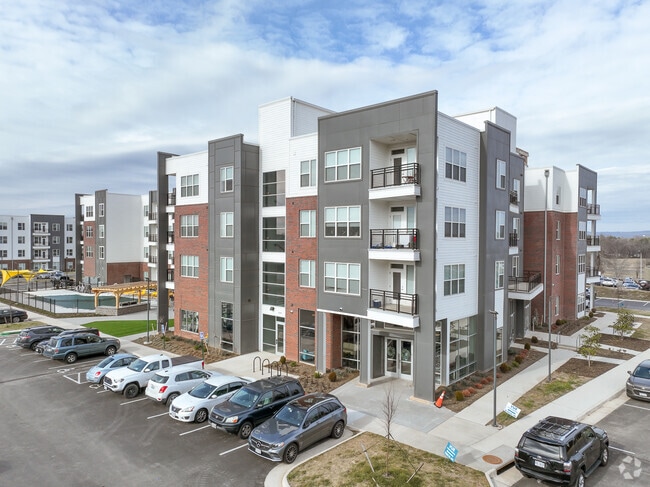
1902 Research Center Dr, Blacksburg, VA 24060


NEARBY LISTINGS FOR SALE OR LEASE
-
-
View all Blacksburg listings for sale on LoopNet.com
Property Detail
1902 Research Center Dr
Blacksburg-Christiansburg-Radford, VA
Shufflebarger Subd
006527
SHUFFLEBARGER SUBD LOT 13 REVISED
Commercialnec
Montgomery
X
Virginia
51121C0133C
13
2025
7.38 AC
2025
University/Airport
020701
Other Market Areas
DEMOGRAPHICS near 1902 Research Center Dr
1 Mile
3 Mile
5 Mile
2024 Total Population
5,024
30,534
58,236
2029 Population
5,057
30,295
57,660
Pop Growth 2024-2029
+ 0.66%
(0.78%)
(0.99%)
Average Age
36
34
35
2024 Total Households
2,380
13,724
24,980
HH Growth 2024-2029
+ 0.63%
(0.82%)
(1.02%)
Median Household Inc
$38,159
$42,814
$51,342
Avg Household Size
2.00
2.10
2.30
2024 Avg HH Vehicles
2.00
2.00
2.00
Median Home Value
$421,000
$377,954
$314,855
Median Year Built
1988
1984
1988
Nearby Places
Map Layers
Map Styles
 Street
 Aerial
- Restaurants
- Banks
- Shops
- Fitness
- Groceries
PUBLIC TRANSPORTATION
AIRPORT
Roanoke/Blacksburg Regional (Woodrum Field)
DRIVE
WALK
Distance
Roanoke/Blacksburg Regional (Woodrum Field)
54 min
38.0 mi
Freight Ports
Virginia Port Authority - Richmond
DRIVE
WALK
Distance
Virginia Port Authority - Richmond
256 min
221.8 mi
Nearby Properties
Address
Land Use
TOTAL SIZE
Lot Size
Zoning
Address
Land Use
TOTAL SIZE
Lot Size
Zoning
Address
Land Use
TOTAL SIZE
Lot Size
Zoning
41.51 AC
PR
Address
Land Use
TOTAL SIZE
Lot Size
Zoning
120,948 SF
15.28 AC
RM-48
Address
Land Use
TOTAL SIZE
Lot Size
Zoning
224,316 SF
6.10 AC
RM48
Address
Land Use
TOTAL SIZE
Lot Size
Zoning
31,178 SF
7.33 AC
RM48
Address
Land Use
TOTAL SIZE
Lot Size
Zoning
3.23 AC
DC
Address
Land Use
TOTAL SIZE
Lot Size
Zoning
47,153 SF
30.90 AC
R&D
Address
Land Use
TOTAL SIZE
Lot Size
Zoning
50,000 SF
25.93 AC
R&D
Address
Land Use
TOTAL SIZE
Lot Size
Zoning
230,692 SF
12.90 AC
PR
Address
Land Use
TOTAL SIZE
Lot Size
Zoning
96,768 SF
20.18 AC
RM1
Address
Land Use
TOTAL SIZE
Lot Size
Zoning
4,332 SF
24.35 AC
RM-48
Address
Land Use
TOTAL SIZE
Lot Size
Zoning
212,497 SF
10.75 AC
PR
Address
Land Use
TOTAL SIZE
Lot Size
Zoning
125,184 SF
9.12 AC
RM-48
Address
Land Use
TOTAL SIZE
Lot Size
Zoning
189,259 SF
31.06 AC
R&D
Address
Land Use
TOTAL SIZE
Lot Size
Zoning
197,024 SF
9.86 AC
PR
Address
Land Use
TOTAL SIZE
Lot Size
Zoning
183,569 SF
8.38 AC
PR
Address
Land Use
TOTAL SIZE
Lot Size
Zoning
33,716 SF
15.72 AC
R&D
Address
Land Use
TOTAL SIZE
Lot Size
Zoning
140,302 SF
1.09 AC
DC
Address
Land Use
TOTAL SIZE
Lot Size
Zoning
7,820 SF
58.14 AC
R&D
Address
Land Use
TOTAL SIZE
Lot Size
Zoning
5.58 AC
MXD
Address
Land Use
TOTAL SIZE
Lot Size
Zoning
150,108 SF
8.19 AC
PR
Address
Land Use
TOTAL SIZE
Lot Size
Zoning
151,388 SF
18.29 AC
B3
Address
Land Use
TOTAL SIZE
Lot Size
Zoning
127,968 SF
5.63 AC
RM-48
Address
Land Use
TOTAL SIZE
Lot Size
Zoning
148,695 SF
7.97 AC
PR
Address
Land Use
TOTAL SIZE
Lot Size
Zoning
147,862 SF
7.73 AC
PR
Address
Land Use
TOTAL SIZE
Lot Size
Zoning
3.47 AC
MXD
Address
Land Use
TOTAL SIZE
Lot Size
Zoning
538,247 SF
54.60 AC
B3
Address
Land Use
TOTAL SIZE
Lot Size
Zoning
6.48 AC
GC
Address
Land Use
TOTAL SIZE
Lot Size
Zoning
100,620 SF
5.10 AC
RM-48
The World's #1 Commercial Real Estate Marketplace
Connect with us
© 2025 CoStar Group
The information above has been obtained from sources believed reliable. While we do not doubt its accuracy we have not verified it and make no guarantee, warranty or representation about it. It is your responsibility to independently confirm its accuracy and completeness. Any projections, opinions, assumptions, or estimates used are for example only and do not represent the current or future performance of the property. The value of this transaction to you depends on tax and other factors which should be evaluated by your tax, financial, and legal advisors. You and your advisors should conduct a careful, independent investigation of the property to determine to your satisfaction the suitability of the property for your needs.