Property Record
19020 N Dale Mabry Hwy, Lutz, FL 33548


NEARBY LISTINGS FOR SALE OR LEASE
Property Detail
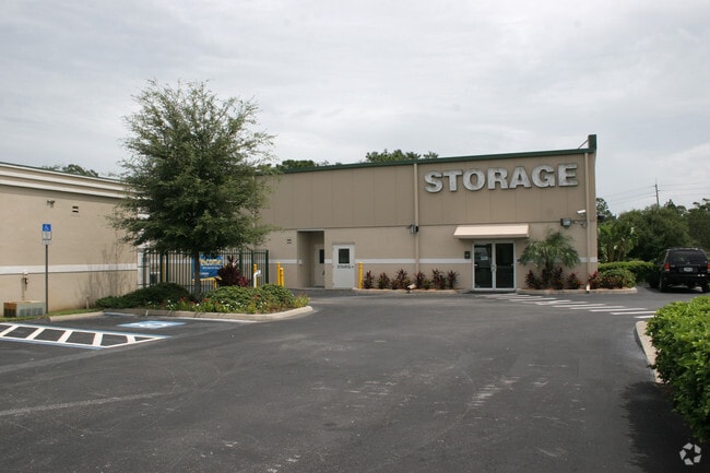
19020 N Dale Mabry Hwy
Tampa-St. Petersburg-Clearwater, FL
Unplatted
U-10-27-18-ZZZ-000000-50550.0
Hillsborough
Publicstorage
Florida
X
3.87 AC
12101C0415F
Northwest Tampa
71,496 SF
Tampa/St Petersburg
DEMOGRAPHICS near 19020 N Dale Mabry Hwy
1 Mile
3 Mile
5 Mile
2024 Total Population
4,154
36,266
126,780
2029 Population
4,527
40,907
144,035
Pop Growth 2024-2029
+ 8.98%
+ 12.80%
+ 13.61%
Average Age
40
41
41
2024 Total Households
1,348
13,362
47,974
HH Growth 2024-2029
+ 9.27%
+ 13.34%
+ 13.72%
Median Household Inc
$153,479
$114,908
$96,622
Avg Household Size
3.00
2.70
2.60
2024 Avg HH Vehicles
2.00
2.00
2.00
Median Home Value
$438,788
$421,456
$374,796
Median Year Built
1999
1997
1994
Nearby Places
Map Layers
Map Styles
 Street
 Aerial
- Restaurants
- Banks
- Shops
- Fitness
- Groceries
PUBLIC TRANSPORTATION
AIRPORT
Tampa International
DRIVE
WALK
Distance
Tampa International
28 min
19.4 mi
St Pete-Clearwater International
DRIVE
WALK
Distance
St Pete-Clearwater International
41 min
30.3 mi
Freight Ports
Port of Tampa Bay
DRIVE
WALK
Distance
Port of Tampa Bay
35 min
20.7 mi
Nearby Properties
Address
Land Use
TOTAL SIZE
Lot Size
Zoning
Address
Land Use
TOTAL SIZE
Lot Size
Zoning
452,046 SF
40.02 AC
PD
Address
Land Use
TOTAL SIZE
Lot Size
Zoning
444,470 SF
147.09 AC
AR
Address
Land Use
TOTAL SIZE
Lot Size
Zoning
383,193 SF
13.07 AC
PD
Address
Land Use
TOTAL SIZE
Lot Size
Zoning
291,175 SF
19.43 AC
MPUD
Address
Land Use
TOTAL SIZE
Lot Size
Zoning
207,337 SF
11.54 AC
PD
Address
Land Use
TOTAL SIZE
Lot Size
Zoning
249,297 SF
68.37 AC
PD
Address
Land Use
TOTAL SIZE
Lot Size
Zoning
367,737 SF
64.17 AC
MPUD
Address
Land Use
TOTAL SIZE
Lot Size
Zoning
142,116 SF
20.82 AC
PD
Address
Land Use
TOTAL SIZE
Lot Size
Zoning
2,850 SF
68.38 AC
PD
Address
Land Use
TOTAL SIZE
Lot Size
Zoning
108,748 SF
35.99 AC
PD
Address
Land Use
TOTAL SIZE
Lot Size
Zoning
97,537 SF
17.31 AC
AR
Address
Land Use
TOTAL SIZE
Lot Size
Zoning
113,231 SF
57.48 AC
PD
Address
Land Use
TOTAL SIZE
Lot Size
Zoning
92,467 SF
26.90 AC
MPUD
Address
Land Use
TOTAL SIZE
Lot Size
Zoning
62,050 SF
11.17 AC
PD
Address
Land Use
TOTAL SIZE
Lot Size
Zoning
74,366 SF
22.46 AC
PD
Address
Land Use
TOTAL SIZE
Lot Size
Zoning
99,356 SF
1.54 AC
PD
Address
Land Use
TOTAL SIZE
Lot Size
Zoning
91,118 SF
11.70 AC
PD
Address
Land Use
TOTAL SIZE
Lot Size
Zoning
71,363 SF
6.20 AC
PD
Address
Land Use
TOTAL SIZE
Lot Size
Zoning
80,719 SF
8.14 AC
PD
Address
Land Use
TOTAL SIZE
Lot Size
Zoning
195,182 SF
22.91 AC
MPUD
Address
Land Use
TOTAL SIZE
Lot Size
Zoning
133,367 SF
11.98 AC
CG
Address
Land Use
TOTAL SIZE
Lot Size
Zoning
75,076 SF
14.03 AC
PD
Address
Land Use
TOTAL SIZE
Lot Size
Zoning
91,241 SF
8.38 AC
ASC-1
Address
Land Use
TOTAL SIZE
Lot Size
Zoning
98,701 SF
2.09 AC
MPUD
Address
Land Use
TOTAL SIZE
Lot Size
Zoning
65,365 SF
8.68 AC
PD
Address
Land Use
TOTAL SIZE
Lot Size
Zoning
75,630 SF
8.17 AC
PD
Address
Land Use
TOTAL SIZE
Lot Size
Zoning
120,547 SF
40.64 AC
C2
Address
Land Use
TOTAL SIZE
Lot Size
Zoning
85,626 SF
14.47 AC
PD
Address
Land Use
TOTAL SIZE
Lot Size
Zoning
5,118 SF
483.73 AC
AR
Address
Land Use
TOTAL SIZE
Lot Size
Zoning
56,921 SF
199.77 AC
PD
The World's #1 Commercial Real Estate Marketplace
Connect with us
© 2026 CoStar Group
The information above has been obtained from sources believed reliable. While we do not doubt its accuracy we have not verified it and make no guarantee, warranty or representation about it. It is your responsibility to independently confirm its accuracy and completeness. Any projections, opinions, assumptions, or estimates used are for example only and do not represent the current or future performance of the property. The value of this transaction to you depends on tax and other factors which should be evaluated by your tax, financial, and legal advisors. You and your advisors should conduct a careful, independent investigation of the property to determine to your satisfaction the suitability of the property for your needs.