Property Record
19025 Eureka Rd, Southgate, MI 48195


Property Detail
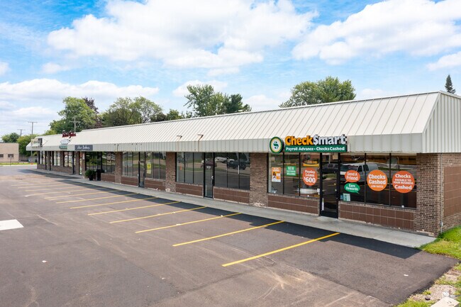
19025 Eureka Rd
53-022-01-0071-302
35D71A2 71B 72 73 N 171.83FT OF LOT 71 ALSO LOTS 72 AND 73 SUPERVISORS ECORSE PLAT NO. 1 T3S R10E L66 P89 WCR
Stripcommercialcenter
WAYNE
C-2 GEN BU
Michigan
B and X Area of moderate flood hazard, usually the area between the limits of the 100-year and 500-year floods.
71-73
2025
1.25 AC
2025
Downriver South
581200
Detroit
13,572 SF
Detroit-Warren-Dearborn, MI
NEARBY LISTINGS FOR SALE OR LEASE
DEMOGRAPHICS near 19025 Eureka Rd
1 mile
3 mile
5 mile
2025 Total Population
6,088
80,330
217,630
2030 Population
5,977
78,788
213,492
Pop Growth 2025-2030
(1.82%)
(1.92%)
(1.90%)
Average Age
46
42
42
2025 Total Households
2,768
34,194
90,468
HH Growth 2025-2030
(1.99%)
(1.96%)
(1.94%)
Median Household Inc
$60,131
$66,940
$68,702
Avg Household Size
2.10
2.30
2.40
2025 Avg HH Vehicles
2.00
2.00
2.00
Median Home Value
$194,548
$175,607
$174,570
Median Year Built
1973
1961
1959
Nearby Places
Map Layers
Map Styles
 Street
 Aerial
Layers
 Traffic
 Biking
Places
Listings with unknown addresses are not visible on the map
- Restaurants
- Banks
- Shops
- Fitness
- Groceries
PUBLIC TRANSPORTATION
AIRPORT
Detroit Metro Wayne County
Drive
Walk
Distance
Detroit Metro Wayne County
20 min
10.0 mi
Windsor International
Drive
Walk
Distance
Windsor International
40 min
23.3 mi
SALE & LEASE HISTORY
LISTING DATE
SALE/LEASE

Sep 25, 2016
For Lease
Nearby Properties
Address
Land Use
TOTAL SIZE
Lot Size
Zoning
Address
Land Use
TOTAL SIZE
Lot Size
Zoning
553,004 SF
61.46 AC
B-2
Address
Land Use
TOTAL SIZE
Lot Size
Zoning
1,981,391 SF
166.35 AC
I-2
Address
Land Use
TOTAL SIZE
Lot Size
Zoning
1,606,527 SF
126.47 AC
I-2
Address
Land Use
TOTAL SIZE
Lot Size
Zoning
217,726 SF
27.60 AC
B-2
Address
Land Use
TOTAL SIZE
Lot Size
Zoning
479,851 SF
16.90 AC
RM MULTI F
Address
Land Use
TOTAL SIZE
Lot Size
Zoning
131,205 SF
13.95 AC
B-2
Address
Land Use
TOTAL SIZE
Lot Size
Zoning
729,040 SF
45.85 AC
I-2
Address
Land Use
TOTAL SIZE
Lot Size
Zoning
125,898 SF
10.62 AC
B-2
Address
Land Use
TOTAL SIZE
Lot Size
Zoning
125,898 SF
10.62 AC
B-2
Address
Land Use
TOTAL SIZE
Lot Size
Zoning
3,261 SF
23.39 AC
RM MULTI F
Address
Land Use
TOTAL SIZE
Lot Size
Zoning
247,238 SF
21.39 AC
I-1
Address
Land Use
TOTAL SIZE
Lot Size
Zoning
200,484 SF
48.86 AC
B-3
Address
Land Use
TOTAL SIZE
Lot Size
Zoning
214,489 SF
17.64 AC
RM-1
Address
Land Use
TOTAL SIZE
Lot Size
Zoning
287,791 SF
17.98 AC
RM MULTI F
Address
Land Use
TOTAL SIZE
Lot Size
Zoning
163,944 SF
17.51 AC
RM MULTI F
Address
Land Use
TOTAL SIZE
Lot Size
Zoning
236,908 SF
29.21 AC
B-2
Address
Land Use
TOTAL SIZE
Lot Size
Zoning
262,170 SF
15.27 AC
RM MULTI F
Address
Land Use
TOTAL SIZE
Lot Size
Zoning
356,200 SF
21.66 AC
I-2
Address
Land Use
TOTAL SIZE
Lot Size
Zoning
220,869 SF
25.31 AC
C-2 GEN BU
Address
Land Use
TOTAL SIZE
Lot Size
Zoning
912 SF
2.80 AC
RM MULTI F
Address
Land Use
TOTAL SIZE
Lot Size
Zoning
229,395 SF
15.46 AC
RM-1
Address
Land Use
TOTAL SIZE
Lot Size
Zoning
10.66 AC
RM MULTI F
Address
Land Use
TOTAL SIZE
Lot Size
Zoning
32,767 SF
17.81 AC
RM-1
Address
Land Use
TOTAL SIZE
Lot Size
Zoning
144,724 SF
12.13 AC
B-2
Address
Land Use
TOTAL SIZE
Lot Size
Zoning
252,833 SF
34.40 AC
RM1-MUL
Address
Land Use
TOTAL SIZE
Lot Size
Zoning
240,852 SF
15.44 AC
RM MULTI F
Address
Land Use
TOTAL SIZE
Lot Size
Zoning
172,500 SF
6.52 AC
RM-1
Address
Land Use
TOTAL SIZE
Lot Size
Zoning
217,548 SF
6.82 AC
RM MULTI F
Address
Land Use
TOTAL SIZE
Lot Size
Zoning
83,540 SF
2.90 AC
RM-2
Address
Land Use
TOTAL SIZE
Lot Size
Zoning
82,615 SF
15 AC
B-3
The World's #1 Commercial Real Estate Marketplace
Connect with us
© 2026 CoStar Group
The information above has been obtained from sources believed reliable. While we do not doubt its accuracy we have not verified it and make no guarantee, warranty or representation about it. It is your responsibility to independently confirm its accuracy and completeness. Any projections, opinions, assumptions, or estimates used are for example only and do not represent the current or future performance of the property. The value of this transaction to you depends on tax and other factors which should be evaluated by your tax, financial, and legal advisors. You and your advisors should conduct a careful, independent investigation of the property to determine to your satisfaction the suitability of the property for your needs.