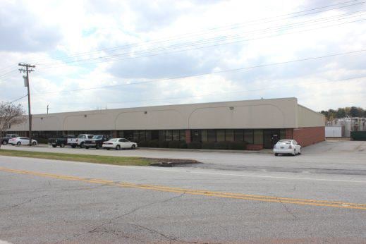
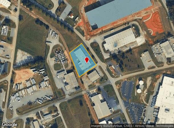
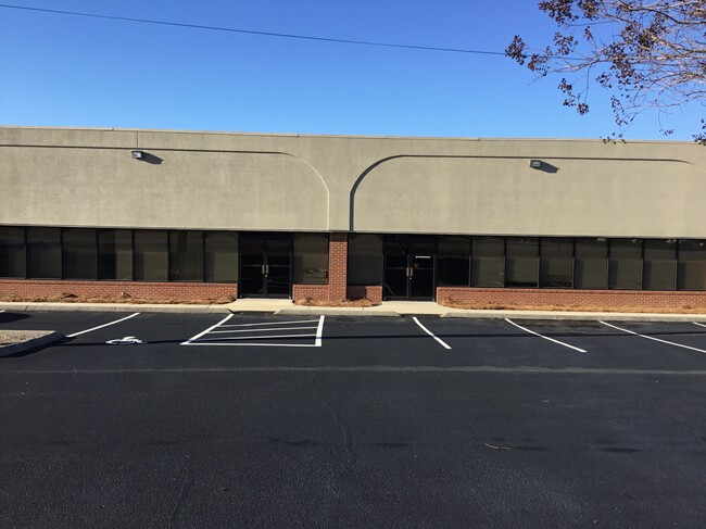
Property Record
2003 Perimeter Rd, Greenville, SC 29605

Current Lease Availabilities
NEARBY LISTINGS FOR SALE OR LEASE
Property Detail
2003 Perimeter Rd
Greenville-Anderson-Mauldin, SC
Harrison L And Clara Lorraine Coleman
0400.01-01-112.00
PERIMETER RD
Publicstorage
Greenville
X
South Carolina
45045C0457E
112.00
2024
1.47 AC
2024
I-85 South/Donaldson
003401
Greenville/Spartanburg
DEMOGRAPHICS near 2003 Perimeter Rd
1 Mile
3 Mile
5 Mile
2024 Total Population
150
19,097
70,016
2029 Population
165
21,236
77,898
Pop Growth 2024-2029
+ 10.00%
+ 11.20%
+ 11.26%
Average Age
37
38
39
2024 Total Households
62
7,120
27,223
HH Growth 2024-2029
+ 9.68%
+ 11.19%
+ 11.33%
Median Household Inc
$46,250
$53,462
$61,034
Avg Household Size
2.40
2.60
2.50
2024 Avg HH Vehicles
2.00
2.00
2.00
Median Home Value
$150,000
$150,028
$196,584
Median Year Built
1985
1991
1992
Nearby Places
- Restaurants
- Banks
- Shops
- Fitness
- Groceries
PUBLIC TRANSPORTATION
COMMUTER RAIL
DRIVE
WALK
Distance
23 min
9.9 mi
AIRPORT
Greenville Spartanburg International
DRIVE
WALK
Distance
Greenville Spartanburg International
29 min
17.3 mi
Nearby Properties
Address
Land Use
TOTAL SIZE
Lot Size
Zoning
Address
Land Use
TOTAL SIZE
Lot Size
Zoning
78.04 AC
C2
Address
Land Use
TOTAL SIZE
Lot Size
Zoning
977.33 AC
I1
Address
Land Use
TOTAL SIZE
Lot Size
Zoning
46.07 AC
I2
Address
Land Use
TOTAL SIZE
Lot Size
Zoning
29.91 AC
Address
Land Use
TOTAL SIZE
Lot Size
Zoning
32.34 AC
Address
Land Use
TOTAL SIZE
Lot Size
Zoning
58.95 AC
Address
Land Use
TOTAL SIZE
Lot Size
Zoning
41.48 AC
I2
Address
Land Use
TOTAL SIZE
Lot Size
Zoning
12.87 AC
I2
Address
Land Use
TOTAL SIZE
Lot Size
Zoning
14.13 AC
Address
Land Use
TOTAL SIZE
Lot Size
Zoning
387.84 AC
S1
Address
Land Use
TOTAL SIZE
Lot Size
Zoning
31.52 AC
I2
Address
Land Use
TOTAL SIZE
Lot Size
Zoning
8.97 AC
Address
Land Use
TOTAL SIZE
Lot Size
Zoning
13.90 AC
I1
Address
Land Use
TOTAL SIZE
Lot Size
Zoning
33.60 AC
I1
Address
Land Use
TOTAL SIZE
Lot Size
Zoning
13.52 AC
I2
Address
Land Use
TOTAL SIZE
Lot Size
Zoning
28.29 AC
I2
Address
Land Use
TOTAL SIZE
Lot Size
Zoning
12.41 AC
RS
Address
Land Use
TOTAL SIZE
Lot Size
Zoning
385.69 AC
R10
Address
Land Use
TOTAL SIZE
Lot Size
Zoning
Address
Land Use
TOTAL SIZE
Lot Size
Zoning
13.03 AC
S1
Address
Land Use
TOTAL SIZE
Lot Size
Zoning
12.85 AC
I1
Address
Land Use
TOTAL SIZE
Lot Size
Zoning
50 AC
I2
Address
Land Use
TOTAL SIZE
Lot Size
Zoning
13.36 AC
I1
Address
Land Use
TOTAL SIZE
Lot Size
Zoning
11 AC
I1
Address
Land Use
TOTAL SIZE
Lot Size
Zoning
128.50 AC
I1
Address
Land Use
TOTAL SIZE
Lot Size
Zoning
45.10 AC
I1
Address
Land Use
TOTAL SIZE
Lot Size
Zoning
23.10 AC
S1
Address
Land Use
TOTAL SIZE
Lot Size
Zoning
12.84 AC
S1
Address
Land Use
TOTAL SIZE
Lot Size
Zoning
91.92 AC
I1
Address
Land Use
TOTAL SIZE
Lot Size
Zoning
8.14 AC
I1
The World's #1 Commercial Real Estate Marketplace
Connect with us
© 2025 CoStar Group
The information above has been obtained from sources believed reliable. While we do not doubt its accuracy we have not verified it and make no guarantee, warranty or representation about it. It is your responsibility to independently confirm its accuracy and completeness. Any projections, opinions, assumptions, or estimates used are for example only and do not represent the current or future performance of the property. The value of this transaction to you depends on tax and other factors which should be evaluated by your tax, financial, and legal advisors. You and your advisors should conduct a careful, independent investigation of the property to determine to your satisfaction the suitability of the property for your needs.