Property Record
1903 Platt Springs Rd, West Columbia, SC 29169


NEARBY LISTINGS FOR SALE OR LEASE
Property Detail
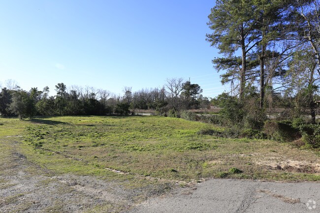
1903 Platt Springs Rd
Columbia, SC
Prepared For Sehanna S Ramdhani
005741-02-001
NONE 30X170X190X155X230
Residentialacreage
Lexington
X
South Carolina
45063C0277J
0.99 AC
2025
Cayce/West Columbia
2024
Columbia
020601
DEMOGRAPHICS near 1903 Platt Springs Rd
1 Mile
3 Mile
5 Mile
2024 Total Population
6,316
46,871
121,368
2029 Population
6,933
50,645
128,558
Pop Growth 2024-2029
+ 9.77%
+ 8.05%
+ 5.92%
Average Age
41
38
37
2024 Total Households
2,871
20,293
53,335
HH Growth 2024-2029
+ 9.93%
+ 8.55%
+ 6.14%
Median Household Inc
$42,350
$49,640
$49,248
Avg Household Size
2.10
2.10
2.00
2024 Avg HH Vehicles
2.00
2.00
2.00
Median Home Value
$142,347
$152,972
$168,983
Median Year Built
1967
1974
1976
Nearby Places
Map Layers
Map Styles
 Street
 Aerial
- Restaurants
- Banks
- Shops
- Fitness
- Groceries
PUBLIC TRANSPORTATION
COMMUTER RAIL
Columbia Amtrak Station (Silver Star - Amtrak)
DRIVE
WALK
Distance
Columbia Amtrak Station (Silver Star - Amtrak)
6 min
3.6 mi
AIRPORT
Columbia Metro
DRIVE
WALK
Distance
Columbia Metro
16 min
5.9 mi
Freight Ports
North Charleston Terminal
DRIVE
WALK
Distance
North Charleston Terminal
115 min
101.9 mi
SALE & LEASE HISTORY
LISTING DATE
SALE/LEASE

May 04, 2017
For Sale
Feb 23, 2018
For Sale
Aug 16, 2017
For Sale
Nearby Properties
Address
Land Use
TOTAL SIZE
Lot Size
Zoning
Address
Land Use
TOTAL SIZE
Lot Size
Zoning
375,417 SF
3.92 AC
INS-GEN
Address
Land Use
TOTAL SIZE
Lot Size
Zoning
119,738 SF
10.30 AC
EC
Address
Land Use
TOTAL SIZE
Lot Size
Zoning
311,168 SF
3.98 AC
MC
Address
Land Use
TOTAL SIZE
Lot Size
Zoning
490,633 SF
13.20 AC
RM-2
Address
Land Use
TOTAL SIZE
Lot Size
Zoning
163,868 SF
4.35 AC
CAC
Address
Land Use
TOTAL SIZE
Lot Size
Zoning
352,672 SF
5.16 AC
MC
Address
Land Use
TOTAL SIZE
Lot Size
Zoning
155,883 SF
2.74 AC
MC
Address
Land Use
TOTAL SIZE
Lot Size
Zoning
22,802 SF
2.64 AC
MC
Address
Land Use
TOTAL SIZE
Lot Size
Zoning
121,560 SF
8.46 AC
RM-2
Address
Land Use
TOTAL SIZE
Lot Size
Zoning
196,800 SF
5.83 AC
HI
Address
Land Use
TOTAL SIZE
Lot Size
Zoning
12.50 AC
PD
Address
Land Use
TOTAL SIZE
Lot Size
Zoning
99,720 SF
3.81 AC
MC
Address
Land Use
TOTAL SIZE
Lot Size
Zoning
103,476 SF
2.04 AC
MC
Address
Land Use
TOTAL SIZE
Lot Size
Zoning
247,360 SF
6.61 AC
EC
Address
Land Use
TOTAL SIZE
Lot Size
Zoning
171,284 SF
10.50 AC
RG-2
Address
Land Use
TOTAL SIZE
Lot Size
Zoning
189,102 SF
3.86 AC
C-1
Address
Land Use
TOTAL SIZE
Lot Size
Zoning
158,976 SF
11.28 AC
RM-2
Address
Land Use
TOTAL SIZE
Lot Size
Zoning
152,064 SF
9.58 AC
RM-2
Address
Land Use
TOTAL SIZE
Lot Size
Zoning
686,209 SF
1.73 AC
RM-2
Address
Land Use
TOTAL SIZE
Lot Size
Zoning
237 AC
HI
Address
Land Use
TOTAL SIZE
Lot Size
Zoning
0.46 AC
C-1
Address
Land Use
TOTAL SIZE
Lot Size
Zoning
131,628 SF
4.39 AC
GC
Address
Land Use
TOTAL SIZE
Lot Size
Zoning
100,548 SF
1.76 AC
PD
Address
Land Use
TOTAL SIZE
Lot Size
Zoning
80,000 SF
4.76 AC
EC
Address
Land Use
TOTAL SIZE
Lot Size
Zoning
58,179 SF
2.63 AC
RAC
Address
Land Use
TOTAL SIZE
Lot Size
Zoning
172,634 SF
6.27 AC
RAC
Address
Land Use
TOTAL SIZE
Lot Size
Zoning
100 SF
9.14 AC
C-1
Address
Land Use
TOTAL SIZE
Lot Size
Zoning
97,199 SF
1.33 AC
C-1
Address
Land Use
TOTAL SIZE
Lot Size
Zoning
123,381 SF
1.59 AC
PD
Address
Land Use
TOTAL SIZE
Lot Size
Zoning
8,002 SF
2.43 AC
PD
The World's #1 Commercial Real Estate Marketplace
Connect with us
© 2026 CoStar Group
The information above has been obtained from sources believed reliable. While we do not doubt its accuracy we have not verified it and make no guarantee, warranty or representation about it. It is your responsibility to independently confirm its accuracy and completeness. Any projections, opinions, assumptions, or estimates used are for example only and do not represent the current or future performance of the property. The value of this transaction to you depends on tax and other factors which should be evaluated by your tax, financial, and legal advisors. You and your advisors should conduct a careful, independent investigation of the property to determine to your satisfaction the suitability of the property for your needs.