Property Record
1828 E John St, Matthews, NC 28105

This Property Is For Sale
NEARBY LISTINGS FOR SALE OR LEASE
Property Detail
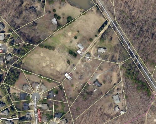
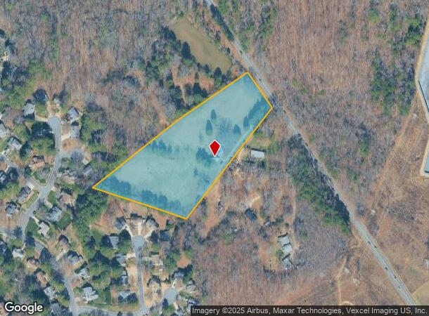
1828 E John St
Charlotte-Concord-Gastonia, NC-SC
Property/William C Cannon & Do
227-501-65
Mecklenburg
Sfr
North Carolina
X
5.36 AC
3710448900K
Matthews
1,574 SF
Charlotte
DEMOGRAPHICS near 1828 E John St
1 Mile
3 Mile
5 Mile
2024 Total Population
4,931
55,657
151,095
2029 Population
5,215
60,181
162,883
Pop Growth 2024-2029
+ 5.76%
+ 8.13%
+ 7.80%
Average Age
40
41
40
2024 Total Households
1,830
20,882
57,318
HH Growth 2024-2029
+ 5.85%
+ 8.39%
+ 7.79%
Median Household Inc
$104,957
$98,426
$95,443
Avg Household Size
2.70
2.60
2.60
2024 Avg HH Vehicles
2.00
2.00
2.00
Median Home Value
$344,825
$359,358
$368,661
Median Year Built
1992
1996
1995
Nearby Places
Map Layers
Map Styles
 Street
 Aerial
- Restaurants
- Banks
- Shops
- Fitness
- Groceries
PUBLIC TRANSPORTATION
AIRPORT
Charlotte/Douglas International
DRIVE
WALK
Distance
Charlotte/Douglas International
28 min
24.9 mi
Nearby Properties
Address
Land Use
TOTAL SIZE
Lot Size
Zoning
Address
Land Use
TOTAL SIZE
Lot Size
Zoning
1,064,632 SF
73.76 AC
Address
Land Use
TOTAL SIZE
Lot Size
Zoning
466,084 SF
42.13 AC
C
Address
Land Use
TOTAL SIZE
Lot Size
Zoning
395,963 SF
43.37 AC
R15
Address
Land Use
TOTAL SIZE
Lot Size
Zoning
12.30 AC
SF-1 INDIA
Address
Land Use
TOTAL SIZE
Lot Size
Zoning
750,813 SF
56.11 AC
C
Address
Land Use
TOTAL SIZE
Lot Size
Zoning
262,337 SF
7.35 AC
Address
Land Use
TOTAL SIZE
Lot Size
Zoning
282,922 SF
47.76 AC
R4
Address
Land Use
TOTAL SIZE
Lot Size
Zoning
269,164 SF
18.57 AC
Address
Land Use
TOTAL SIZE
Lot Size
Zoning
258,053 SF
14.99 AC
Address
Land Use
TOTAL SIZE
Lot Size
Zoning
18.05 AC
CBD INDIAN
Address
Land Use
TOTAL SIZE
Lot Size
Zoning
28.27 AC
Address
Land Use
TOTAL SIZE
Lot Size
Zoning
281,872 SF
37.85 AC
R12CD
Address
Land Use
TOTAL SIZE
Lot Size
Zoning
294,525 SF
24.80 AC
C
Address
Land Use
TOTAL SIZE
Lot Size
Zoning
288,504 SF
30.19 AC
RI
Address
Land Use
TOTAL SIZE
Lot Size
Zoning
274,215 SF
17.50 AC
O9CD
Address
Land Use
TOTAL SIZE
Lot Size
Zoning
232,858 SF
21.74 AC
R15MF
Address
Land Use
TOTAL SIZE
Lot Size
Zoning
8,446 SF
16.89 AC
MFR INDIAN
Address
Land Use
TOTAL SIZE
Lot Size
Zoning
256,498 SF
23.52 AC
C
Address
Land Use
TOTAL SIZE
Lot Size
Zoning
241,703 SF
17.43 AC
R12MFCD
Address
Land Use
TOTAL SIZE
Lot Size
Zoning
254,369 SF
43.75 AC
B1SCD
Address
Land Use
TOTAL SIZE
Lot Size
Zoning
104,880 SF
10.01 AC
R-12
Address
Land Use
TOTAL SIZE
Lot Size
Zoning
174,834 SF
2.51 AC
Address
Land Use
TOTAL SIZE
Lot Size
Zoning
231,072 SF
17.52 AC
R15MFCD
Address
Land Use
TOTAL SIZE
Lot Size
Zoning
227,750 SF
25.53 AC
C
Address
Land Use
TOTAL SIZE
Lot Size
Zoning
211,146 SF
18.83 AC
R15MFCD
Address
Land Use
TOTAL SIZE
Lot Size
Zoning
2,062 SF
105.82 AC
B-1SCD
Address
Land Use
TOTAL SIZE
Lot Size
Zoning
227,278 SF
27.50 AC
Address
Land Use
TOTAL SIZE
Lot Size
Zoning
158,321 SF
9.20 AC
Address
Land Use
TOTAL SIZE
Lot Size
Zoning
151,264 SF
48.74 AC
R15MF
Address
Land Use
TOTAL SIZE
Lot Size
Zoning
92,310 SF
6.03 AC
B-3(CD)
The World's #1 Commercial Real Estate Marketplace
Connect with us
© 2025 CoStar Group
The information above has been obtained from sources believed reliable. While we do not doubt its accuracy we have not verified it and make no guarantee, warranty or representation about it. It is your responsibility to independently confirm its accuracy and completeness. Any projections, opinions, assumptions, or estimates used are for example only and do not represent the current or future performance of the property. The value of this transaction to you depends on tax and other factors which should be evaluated by your tax, financial, and legal advisors. You and your advisors should conduct a careful, independent investigation of the property to determine to your satisfaction the suitability of the property for your needs.