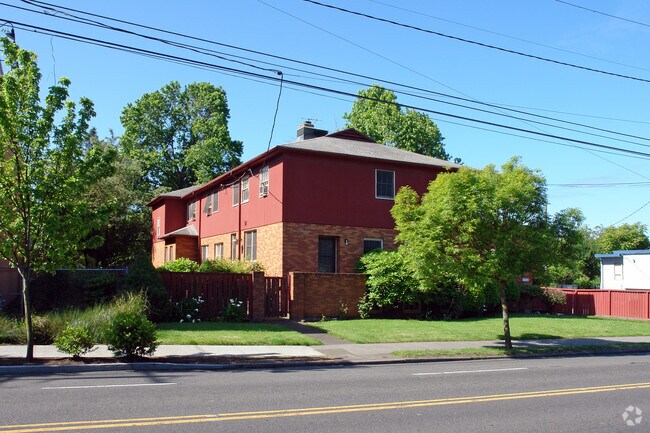
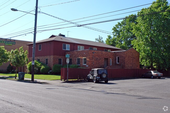
Property Record
1904 Se Division St, Portland, OR 97202

Property Detail
1904 Se Division St
R328026
SECTION 11 1S 1E, TL 1900 0.39 ACRES
Commercialnec
Multnomah
CM2
Oregon
B and X Area of moderate flood hazard, usually the area between the limits of the 100-year and 500-year floods.
0.39 AC
0
SE Close-In
2025
Portland
001000
Portland-Vancouver-Hillsboro, OR-WA
5,876 SF
NEARBY LISTINGS FOR SALE OR LEASE
DEMOGRAPHICS near 1904 Se Division St
1 mile
3 mile
5 mile
2025 Total Population
25,286
225,164
479,151
2030 Population
25,017
223,951
475,340
Pop Growth 2025-2030
(1.06%)
(0.54%)
(0.80%)
Average Age
39
41
41
2025 Total Households
12,422
113,293
218,284
HH Growth 2025-2030
(1.34%)
(0.57%)
(0.88%)
Median Household Inc
$94,836
$88,595
$92,340
Avg Household Size
2.00
1.90
2.10
2025 Avg HH Vehicles
1.00
1.00
1.00
Median Home Value
$730,276
$720,013
$664,746
Median Year Built
1948
1963
1961
Nearby Places
Map Layers
Map Styles
 Street
 Aerial
Transit
 Traffic
 Biking
Places
Listings with unknown addresses are not visible on the map
- Restaurants
- Banks
- Shops
- Fitness
- Groceries
PUBLIC TRANSPORTATION
TRANSIT/SUBWAY
Clinton St/Se 12Th Ave Max Station (MAX Orange Line - TriMet)
Drive
Walk
Distance
Clinton St/Se 12Th Ave Max Station (MAX Orange Line - TriMet)
2 min
10 min
0.5 mi
Se 17Th Ave & Rhine St Max Station (MAX Orange Line - TriMet)
Drive
Walk
Distance
Se 17Th Ave & Rhine St Max Station (MAX Orange Line - TriMet)
3 min
15 min
0.8 mi
Omsi/Se Water Max Station (MAX Orange Line - TriMet)
Drive
Walk
Distance
Omsi/Se Water Max Station (MAX Orange Line - TriMet)
3 min
17 min
0.9 mi
Se Grand & Mill (Portland Streetcar - B Loop - Portland Streetcar)
Drive
Walk
Distance
Se Grand & Mill (Portland Streetcar - B Loop - Portland Streetcar)
2 min
18 min
0.9 mi
Se M L King & Mill (Portland Streetcar - A Loop - Portland Streetcar)
Drive
Walk
Distance
Se M L King & Mill (Portland Streetcar - A Loop - Portland Streetcar)
3 min
19 min
1.0 mi
COMMUTER RAIL
Portland (Amtrak Cascades - Amtrak, Coast Starlight - Amtrak, Empire Builder - Amtrak)
Drive
Walk
Distance
Portland (Amtrak Cascades - Amtrak, Coast Starlight - Amtrak, Empire Builder - Amtrak)
9 min
2.9 mi
AIRPORT
Portland International
Drive
Walk
Distance
Portland International
23 min
8.7 mi
Freight Ports
Port of Portland
Drive
Walk
Distance
Port of Portland
12 min
5.9 mi
Nearby Properties
Address
Land Use
TOTAL SIZE
Lot Size
Zoning
Address
Land Use
TOTAL SIZE
Lot Size
Zoning
395,815 SF
2.66 AC
IRD
Address
Land Use
TOTAL SIZE
Lot Size
Zoning
27.58 AC
EX
Address
Land Use
TOTAL SIZE
Lot Size
Zoning
627,500 SF
16.60 AC
CX
Address
Land Use
TOTAL SIZE
Lot Size
Zoning
822,867 SF
103.39 AC
CI1
Address
Land Use
TOTAL SIZE
Lot Size
Zoning
560,000 SF
0.15 AC
CX
Address
Land Use
TOTAL SIZE
Lot Size
Zoning
20.71 AC
OS
Address
Land Use
TOTAL SIZE
Lot Size
Zoning
409,260 SF
7.41 AC
EX
Address
Land Use
TOTAL SIZE
Lot Size
Zoning
1.09 AC
EX
Address
Land Use
TOTAL SIZE
Lot Size
Zoning
2.24 AC
CX
Address
Land Use
TOTAL SIZE
Lot Size
Zoning
304,836 SF
10.85 AC
CX
Address
Land Use
TOTAL SIZE
Lot Size
Zoning
417,324 SF
0.68 AC
CX
Address
Land Use
TOTAL SIZE
Lot Size
Zoning
598,328 SF
12.32 AC
CX
Address
Land Use
TOTAL SIZE
Lot Size
Zoning
257,700 SF
2.89 AC
EX
Address
Land Use
TOTAL SIZE
Lot Size
Zoning
178,785 SF
10.20 AC
R5
Address
Land Use
TOTAL SIZE
Lot Size
Zoning
128,500 SF
6.95 AC
OS
Address
Land Use
TOTAL SIZE
Lot Size
Zoning
460,000 SF
0.92 AC
CX
Address
Land Use
TOTAL SIZE
Lot Size
Zoning
689,840 SF
0.92 AC
CX
Address
Land Use
TOTAL SIZE
Lot Size
Zoning
125,217 SF
0.23 AC
CX
Address
Land Use
TOTAL SIZE
Lot Size
Zoning
7.78 AC
EX
Address
Land Use
TOTAL SIZE
Lot Size
Zoning
426,742 SF
0.53 AC
RXD
Address
Land Use
TOTAL SIZE
Lot Size
Zoning
243,371 SF
0.67 AC
CI2
Address
Land Use
TOTAL SIZE
Lot Size
Zoning
584,483 SF
0.90 AC
CX
Address
Land Use
TOTAL SIZE
Lot Size
Zoning
280,069 SF
18.31 AC
IR
Address
Land Use
TOTAL SIZE
Lot Size
Zoning
247,520 SF
7.74 AC
CX
Address
Land Use
TOTAL SIZE
Lot Size
Zoning
306,000 SF
1.21 AC
NULL
Address
Land Use
TOTAL SIZE
Lot Size
Zoning
251,293 SF
14.15 AC
IR
Address
Land Use
TOTAL SIZE
Lot Size
Zoning
596,161 SF
0.92 AC
CX
Address
Land Use
TOTAL SIZE
Lot Size
Zoning
456,760 SF
0.53 AC
EX
Address
Land Use
TOTAL SIZE
Lot Size
Zoning
193,898 SF
2.50 AC
IRD
Address
Land Use
TOTAL SIZE
Lot Size
Zoning
387,000 SF
0.88 AC
CXD
The World's #1 Commercial Real Estate Marketplace
Connect with us
© 2026 CoStar Group
The information above has been obtained from sources believed reliable. While we do not doubt its accuracy we have not verified it and make no guarantee, warranty or representation about it. It is your responsibility to independently confirm its accuracy and completeness. Any projections, opinions, assumptions, or estimates used are for example only and do not represent the current or future performance of the property. The value of this transaction to you depends on tax and other factors which should be evaluated by your tax, financial, and legal advisors. You and your advisors should conduct a careful, independent investigation of the property to determine to your satisfaction the suitability of the property for your needs.