Property Record
1905 E Langsford Rd, Lees Summit, MO 64063


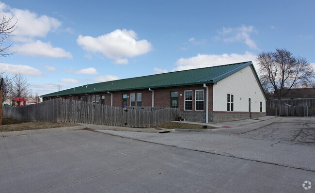

Property Detail
1905 E Langsford Rd
Kansas City, MO-KS
GREYSTONE PARK 5TH PLAT LOTS 2A & 3A---LOT 3A
60-330-17-30-00-0-00-000
Jackson
Privateschool
Missouri
B and X Area of moderate flood hazard, usually the area between the limits of the 100-year and 500-year floods.
2a,3a
2024
1.37 AC
2025
Southeast Jackson County
013904
Kansas City
12,208 SF
NEARBY LISTINGS FOR SALE OR LEASE
DEMOGRAPHICS near 1905 E Langsford Rd
1 mile
3 mile
5 mile
2025 Total Population
13,062
44,064
75,655
2030 Population
13,036
44,207
76,544
Pop Growth 2025-2030
(0.20%)
+ 0.32%
+ 1.18%
Average Age
38
39
40
2025 Total Households
4,672
16,981
29,699
HH Growth 2025-2030
(0.26%)
+ 0.32%
+ 1.29%
Median Household Inc
$111,250
$92,540
$95,147
Avg Household Size
2.80
2.60
2.50
2025 Avg HH Vehicles
2.00
2.00
2.00
Median Home Value
$271,825
$275,647
$294,546
Median Year Built
1987
1987
1988
Nearby Places
Map Layers
Map Styles
 Street
 Aerial
Transit
 Traffic
 Biking
Places
Listings with unknown addresses are not visible on the map
- Restaurants
- Banks
- Shops
- Fitness
- Groceries
PUBLIC TRANSPORTATION
COMMUTER RAIL
Drive
Walk
Distance
7 min
2.4 mi
AIRPORT
Kansas City International
Drive
Walk
Distance
Kansas City International
59 min
43.3 mi
Nearby Properties
Address
Land Use
TOTAL SIZE
Lot Size
Zoning
Address
Land Use
TOTAL SIZE
Lot Size
Zoning
474,121 SF
40.14 AC
Address
Land Use
TOTAL SIZE
Lot Size
Zoning
264,963 SF
Address
Land Use
TOTAL SIZE
Lot Size
Zoning
246,379 SF
51.99 AC
Address
Land Use
TOTAL SIZE
Lot Size
Zoning
438,125 SF
Address
Land Use
TOTAL SIZE
Lot Size
Zoning
107,210 SF
17.13 AC
Address
Land Use
TOTAL SIZE
Lot Size
Zoning
67,891 SF
464.50 AC
Address
Land Use
TOTAL SIZE
Lot Size
Zoning
195,589 SF
47.72 AC
Address
Land Use
TOTAL SIZE
Lot Size
Zoning
209,098 SF
Address
Land Use
TOTAL SIZE
Lot Size
Zoning
52,030 SF
11.81 AC
Address
Land Use
TOTAL SIZE
Lot Size
Zoning
100,573 SF
2.89 AC
Address
Land Use
TOTAL SIZE
Lot Size
Zoning
104,368 SF
13.90 AC
Address
Land Use
TOTAL SIZE
Lot Size
Zoning
248,600 SF
Address
Land Use
TOTAL SIZE
Lot Size
Zoning
383,280 SF
0.91 AC
Address
Land Use
TOTAL SIZE
Lot Size
Zoning
140,377 SF
27 AC
Address
Land Use
TOTAL SIZE
Lot Size
Zoning
563,000 SF
40.34 AC
Address
Land Use
TOTAL SIZE
Lot Size
Zoning
104,704 SF
11.28 AC
Address
Land Use
TOTAL SIZE
Lot Size
Zoning
192,014 SF
20.95 AC
Address
Land Use
TOTAL SIZE
Lot Size
Zoning
251,085 SF
Address
Land Use
TOTAL SIZE
Lot Size
Zoning
140,194 SF
29.50 AC
Address
Land Use
TOTAL SIZE
Lot Size
Zoning
99,891 SF
9.71 AC
Address
Land Use
TOTAL SIZE
Lot Size
Zoning
65,290 SF
15.70 AC
Address
Land Use
TOTAL SIZE
Lot Size
Zoning
48,764 SF
8.25 AC
Address
Land Use
TOTAL SIZE
Lot Size
Zoning
12,788 SF
16.29 AC
Address
Land Use
TOTAL SIZE
Lot Size
Zoning
22,500 SF
Address
Land Use
TOTAL SIZE
Lot Size
Zoning
33,136 SF
3.99 AC
Address
Land Use
TOTAL SIZE
Lot Size
Zoning
150,619 SF
19.95 AC
Address
Land Use
TOTAL SIZE
Lot Size
Zoning
67,800 SF
2.53 AC
Address
Land Use
TOTAL SIZE
Lot Size
Zoning
43,075 SF
10.04 AC
Address
Land Use
TOTAL SIZE
Lot Size
Zoning
37,489 SF
9.22 AC
Address
Land Use
TOTAL SIZE
Lot Size
Zoning
77,116 SF
36.96 AC
The World's #1 Commercial Real Estate Marketplace
Connect with us
© 2026 CoStar Group
The information above has been obtained from sources believed reliable. While we do not doubt its accuracy we have not verified it and make no guarantee, warranty or representation about it. It is your responsibility to independently confirm its accuracy and completeness. Any projections, opinions, assumptions, or estimates used are for example only and do not represent the current or future performance of the property. The value of this transaction to you depends on tax and other factors which should be evaluated by your tax, financial, and legal advisors. You and your advisors should conduct a careful, independent investigation of the property to determine to your satisfaction the suitability of the property for your needs.