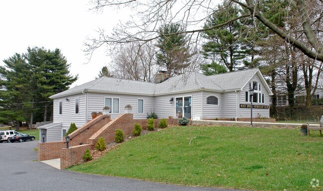
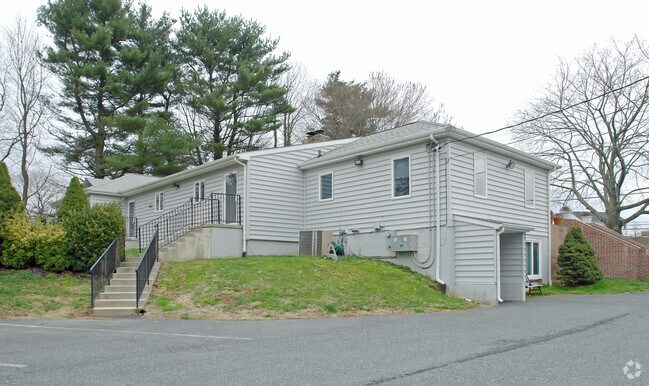
Property Record
1905 Rock Spring Rd, Forest Hill, MD 21050
NEARBY LISTINGS FOR SALE OR LEASE
Property Detail
1905 Rock Spring Rd
03-039404
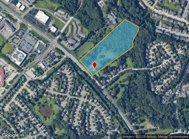
8.64 ACRES 1905 ROCKSPRING ROAD N W OF BEL AIR
Commercialnec
Harford
AE
Maryland
24025C0134E
8.64 AC
2025
Outlying Harford County
2025
Baltimore
303203
Baltimore-Columbia-Towson, MD
2,933 SF
DEMOGRAPHICS near 1905 Rock Spring Rd
1 Mile
3 Mile
5 Mile
2024 Total Population
8,998
39,829
82,232
2029 Population
9,266
40,811
84,320
Pop Growth 2024-2029
+ 2.98%
+ 2.47%
+ 2.54%
Average Age
43
41
42
2024 Total Households
3,436
14,699
30,552
HH Growth 2024-2029
+ 2.97%
+ 2.52%
+ 2.63%
Median Household Inc
$100,958
$106,560
$108,789
Avg Household Size
2.50
2.60
2.60
2024 Avg HH Vehicles
2.00
2.00
2.00
Median Home Value
$360,714
$373,806
$381,252
Median Year Built
1994
1989
1986
Nearby Places
Map Layers
Map Styles
 Street
 Aerial
- Restaurants
- Banks
- Shops
- Fitness
- Groceries
PUBLIC TRANSPORTATION
AIRPORT
Baltimore/Washington International Thurgood Marshall
DRIVE
WALK
Distance
Baltimore/Washington International Thurgood Marshall
58 min
39.6 mi
Freight Ports
Port of Baltimore
DRIVE
WALK
Distance
Port of Baltimore
48 min
33.0 mi
Nearby Properties
Address
Land Use
TOTAL SIZE
Lot Size
Zoning
Address
Land Use
TOTAL SIZE
Lot Size
Zoning
51,475 SF
7.85 AC
C1
Address
Land Use
TOTAL SIZE
Lot Size
Zoning
12.38 AC
R2
Address
Land Use
TOTAL SIZE
Lot Size
Zoning
6,084 SF
6.03 AC
B2
Address
Land Use
TOTAL SIZE
Lot Size
Zoning
101,236 SF
23.52 AC
R1
Address
Land Use
TOTAL SIZE
Lot Size
Zoning
113,276 SF
2.19 AC
B2A
Address
Land Use
TOTAL SIZE
Lot Size
Zoning
78,264 SF
16.71 AC
AG
Address
Land Use
TOTAL SIZE
Lot Size
Zoning
52,245 SF
2.43 AC
R3/B1
Address
Land Use
TOTAL SIZE
Lot Size
Zoning
74,842 SF
0.77 AC
B2 B3
Address
Land Use
TOTAL SIZE
Lot Size
Zoning
10.73 AC
B2
Address
Land Use
TOTAL SIZE
Lot Size
Zoning
229,355 SF
59.83 AC
R2
Address
Land Use
TOTAL SIZE
Lot Size
Zoning
46,247 SF
10.45 AC
R2 B2
Address
Land Use
TOTAL SIZE
Lot Size
Zoning
35.99 AC
R2
Address
Land Use
TOTAL SIZE
Lot Size
Zoning
78,394 SF
24.56 AC
CI
Address
Land Use
TOTAL SIZE
Lot Size
Zoning
7,104 SF
10.95 AC
R2 R3
Address
Land Use
TOTAL SIZE
Lot Size
Zoning
77,649 SF
10.42 AC
GI
Address
Land Use
TOTAL SIZE
Lot Size
Zoning
63,392 SF
8.44 AC
VR
Address
Land Use
TOTAL SIZE
Lot Size
Zoning
9,464 SF
3.51 AC
R3
Address
Land Use
TOTAL SIZE
Lot Size
Zoning
97,060 SF
8.39 AC
B2
Address
Land Use
TOTAL SIZE
Lot Size
Zoning
51,868 SF
6.25 AC
R3
Address
Land Use
TOTAL SIZE
Lot Size
Zoning
149,009 SF
0.69 AC
B3
Address
Land Use
TOTAL SIZE
Lot Size
Zoning
17,901 SF
6.74 AC
R3
Address
Land Use
TOTAL SIZE
Lot Size
Zoning
14,948 SF
0.75 AC
B2
Address
Land Use
TOTAL SIZE
Lot Size
Zoning
19,224 SF
6.43 AC
R2
Address
Land Use
TOTAL SIZE
Lot Size
Zoning
53,964 SF
1.31 AC
R1
Address
Land Use
TOTAL SIZE
Lot Size
Zoning
84,100 SF
2.58 AC
B3
Address
Land Use
TOTAL SIZE
Lot Size
Zoning
5,690 SF
10.86 AC
R2
Address
Land Use
TOTAL SIZE
Lot Size
Zoning
45,890 SF
20.67 AC
R2
Address
Land Use
TOTAL SIZE
Lot Size
Zoning
49,265 SF
4.30 AC
B3
Address
Land Use
TOTAL SIZE
Lot Size
Zoning
31,222 SF
1.60 AC
B3 RO
Address
Land Use
TOTAL SIZE
Lot Size
Zoning
49,560 SF
1.15 AC
B2AB3
The World's #1 Commercial Real Estate Marketplace
Connect with us
© 2026 CoStar Group
The information above has been obtained from sources believed reliable. While we do not doubt its accuracy we have not verified it and make no guarantee, warranty or representation about it. It is your responsibility to independently confirm its accuracy and completeness. Any projections, opinions, assumptions, or estimates used are for example only and do not represent the current or future performance of the property. The value of this transaction to you depends on tax and other factors which should be evaluated by your tax, financial, and legal advisors. You and your advisors should conduct a careful, independent investigation of the property to determine to your satisfaction the suitability of the property for your needs.