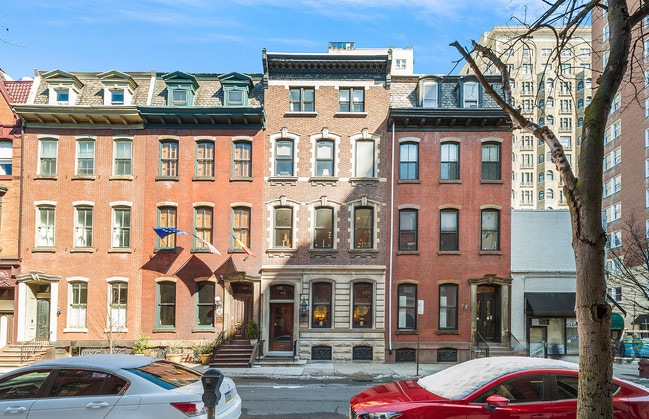
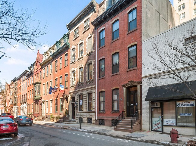
Property Record
1905 Spruce St, Philadelphia, PA 19103

Current Lease Availabilities
NEARBY LISTINGS FOR SALE OR LEASE
Property Detail
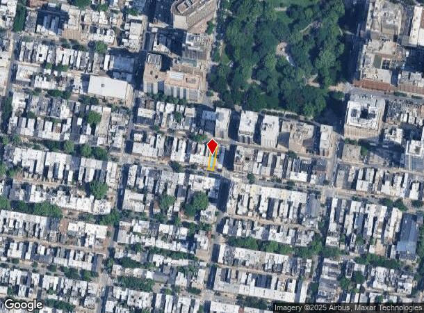
1905 Spruce St
Philadelphia-Camden-Wilmington, PA-NJ-DE-MD
Philadelphia
082135201
Pennsylvania
Townhouserowhouse
0.05 AC
X
Market Street West
42045C0150F
Philadelphia
5,040 SF
DEMOGRAPHICS near 1905 Spruce St
1 Mile
3 Mile
5 Mile
2024 Total Population
97,741
511,350
971,130
2029 Population
95,277
500,664
953,203
Pop Growth 2024-2029
(2.52%)
(2.09%)
(1.85%)
Average Age
38
36
37
2024 Total Households
53,938
228,102
404,528
HH Growth 2024-2029
(2.98%)
(2.43%)
(2.13%)
Median Household Inc
$92,649
$65,056
$51,324
Avg Household Size
1.70
2.00
2.20
2024 Avg HH Vehicles
1.00
1.00
1.00
Median Home Value
$504,792
$338,053
$230,547
Median Year Built
1960
1949
1948
Nearby Places
Map Layers
Map Styles
 Street
 Aerial
- Restaurants
- Banks
- Shops
- Fitness
- Groceries
PUBLIC TRANSPORTATION
COMMUTER RAIL
Suburban Station (R1 - Southeastern Pennsylvania Transportation Authority Regional Rail (SEPTA Regional Rail), R2 - Southeastern Pennsylvania Transportation Authority Regional Rail (SEPTA Regional Rail), R3 - Southeastern Pennsylvania Transportation Authority Regional Rail (SEPTA Regional Rail), R5 - Southeastern Pennsylvania Transportation Authority Regional Rail (SEPTA Regional Rail), R6 - Southeastern Pennsylvania Transportation Authority Regional Rail (SEPTA Regional Rail), R7 - Southeastern Pennsylvania Transportation Authority Regional Rail (SEPTA Regional Rail), R8 - Southeastern Pennsylvania Transportation Authority Regional Rail (SEPTA Regional Rail))
DRIVE
WALK
Distance
Suburban Station (R1 - Southeastern Pennsylvania Transportation Authority Regional Rail (SEPTA Regional Rail), R2 - Southeastern Pennsylvania Transportation Authority Regional Rail (SEPTA Regional Rail), R3 - Southeastern Pennsylvania Transportation Authority Regional Rail (SEPTA Regional Rail), R5 - Southeastern Pennsylvania Transportation Authority Regional Rail (SEPTA Regional Rail), R6 - Southeastern Pennsylvania Transportation Authority Regional Rail (SEPTA Regional Rail), R7 - Southeastern Pennsylvania Transportation Authority Regional Rail (SEPTA Regional Rail), R8 - Southeastern Pennsylvania Transportation Authority Regional Rail (SEPTA Regional Rail))
4 min
15 min
0.8 mi
Philadelphia 30th Street (Atlantic City Line - NJ Transit Commuter Rail (NJ Transit))
DRIVE
WALK
Distance
Philadelphia 30th Street (Atlantic City Line - NJ Transit Commuter Rail (NJ Transit))
4 min
20 min
1.0 mi
AIRPORT
Philadelphia International
DRIVE
WALK
Distance
Philadelphia International
21 min
9.6 mi
Trenton Mercer
DRIVE
WALK
Distance
Trenton Mercer
53 min
34.7 mi
Freight Ports
South Jersey Port
DRIVE
WALK
Distance
South Jersey Port
12 min
5.0 mi
Nearby Properties
Address
Land Use
TOTAL SIZE
Lot Size
Zoning
Address
Land Use
TOTAL SIZE
Lot Size
Zoning
11,513 SF
19.92 AC
SPSTA
Address
Land Use
TOTAL SIZE
Lot Size
Zoning
159,630 SF
9.15 AC
SPENT
Address
Land Use
TOTAL SIZE
Lot Size
Zoning
1,449,928 SF
1.22 AC
CMX5
Address
Land Use
TOTAL SIZE
Lot Size
Zoning
1,076,400 SF
5 AC
CMX4
Address
Land Use
TOTAL SIZE
Lot Size
Zoning
1,200,021 SF
0.69 AC
CMX5
Address
Land Use
TOTAL SIZE
Lot Size
Zoning
26,690 SF
500 AC
SPINS
Address
Land Use
TOTAL SIZE
Lot Size
Zoning
1,103,300 SF
1.18 AC
CMX5
Address
Land Use
TOTAL SIZE
Lot Size
Zoning
1,464,000 SF
0.76 AC
CMX5
Address
Land Use
TOTAL SIZE
Lot Size
Zoning
319,590 SF
0.87 AC
I2
Address
Land Use
TOTAL SIZE
Lot Size
Zoning
760,635 SF
0.77 AC
CMX5
Address
Land Use
TOTAL SIZE
Lot Size
Zoning
1,179,072 SF
8.90 AC
RM4
Address
Land Use
TOTAL SIZE
Lot Size
Zoning
1,296,804 SF
2.71 AC
I2
Address
Land Use
TOTAL SIZE
Lot Size
Zoning
782,208 SF
0.68 AC
CMX5
Address
Land Use
TOTAL SIZE
Lot Size
Zoning
2,215,276 SF
2.46 AC
CMX5
Address
Land Use
TOTAL SIZE
Lot Size
Zoning
880,950 SF
27.71 AC
SPENT
Address
Land Use
TOTAL SIZE
Lot Size
Zoning
624,696 SF
5.79 AC
CMX4
Address
Land Use
TOTAL SIZE
Lot Size
Zoning
1,200,000 SF
1.78 AC
CMX5
Address
Land Use
TOTAL SIZE
Lot Size
Zoning
1,075,580 SF
2.65 AC
CMX5
Address
Land Use
TOTAL SIZE
Lot Size
Zoning
1.17 AC
Address
Land Use
TOTAL SIZE
Lot Size
Zoning
468,307 SF
2.45 AC
CMX4
Address
Land Use
TOTAL SIZE
Lot Size
Zoning
500,165 SF
2.16 AC
SPPOA
Address
Land Use
TOTAL SIZE
Lot Size
Zoning
1,152,520 SF
1.49 AC
CMX5
Address
Land Use
TOTAL SIZE
Lot Size
Zoning
696,920 SF
10.55 AC
SPINS
Address
Land Use
TOTAL SIZE
Lot Size
Zoning
1,143,040 SF
0.81 AC
CMX5
Address
Land Use
TOTAL SIZE
Lot Size
Zoning
738,750 SF
1.19 AC
CMX5
Address
Land Use
TOTAL SIZE
Lot Size
Zoning
700,000 SF
7.88 AC
CMX5
Address
Land Use
TOTAL SIZE
Lot Size
Zoning
1,102,992 SF
2.14 AC
CMX5
Address
Land Use
TOTAL SIZE
Lot Size
Zoning
1.88 AC
SPINS
Address
Land Use
TOTAL SIZE
Lot Size
Zoning
738,207 SF
0.89 AC
CMX5
Address
Land Use
TOTAL SIZE
Lot Size
Zoning
665,742 SF
0.98 AC
CMX4
The World's #1 Commercial Real Estate Marketplace
Connect with us
© 2025 CoStar Group
The information above has been obtained from sources believed reliable. While we do not doubt its accuracy we have not verified it and make no guarantee, warranty or representation about it. It is your responsibility to independently confirm its accuracy and completeness. Any projections, opinions, assumptions, or estimates used are for example only and do not represent the current or future performance of the property. The value of this transaction to you depends on tax and other factors which should be evaluated by your tax, financial, and legal advisors. You and your advisors should conduct a careful, independent investigation of the property to determine to your satisfaction the suitability of the property for your needs.